Alfonso, Cavite
Alfonso, officially the Municipality of Alfonso, (Tagalog: Bayan ng Alfonso), is a 1st class municipality in the province of Cavite, Philippines. According to the 2015 census, it has a population of 51,839 people.[3]
Alfonso | |
|---|---|
| Municipality of Alfonso | |
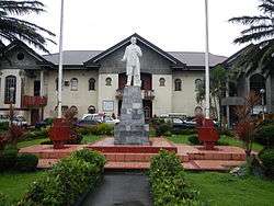
 Downtown area | |
 Seal | |
| Nickname(s): Agro-Industrial Center of Upland Cavite | |
 Map of Cavite with Alfonso highlighted | |
OpenStreetMap 
| |
.svg.png) Alfonso Location within the Philippines | |
| Coordinates: 14°08′16″N 120°51′19″E | |
| Country | |
| Region | Calabarzon (Region IV-A) |
| Province | Cavite |
| District | 8th District |
| Founded | May 16, 1859 |
| Named for | King Alfonso XII of Spain |
| Barangays | 32 (see Barangays) |
| Government | |
| • Type | Sangguniang Bayan |
| • Mayor | Randy A. Salamat (PDPLBN) |
| • Vice Mayor | Madona Mojica-Pel (PDPLBN) |
| • Congressman | Abraham N. Tolentino (PDPLBN) |
| • Electorate | 36,070 voters (2019) |
| Area | |
| • Total | 66.58 km2 (25.71 sq mi) |
| Elevation | 424.6 m (1,393.0 ft) |
| Population (2015 census)[3] | |
| • Total | 51,839 |
| • Density | 780/km2 (2,000/sq mi) |
| • Households | 11,762 |
| Economy | |
| • Income class | 1st municipal income class |
| • Poverty incidence | 4.77% (2015)[4] |
| • Revenue (₱) | 146,232,896.85 (2016) |
| Time zone | UTC+8 (PST) |
| ZIP code | 4123 |
| PSGC | |
| IDD : area code | +63 (0)46 |
| Climate type | tropical monsoon climate |
| Native languages | Tagalog |
| Website | www |
History
Alfonso was totally forested until the 17th century when a few pocket settlements sprouted. The town was originally part of Barrio Lumampong in the town of Indang. In the course of time, the pocket settlements grew into sitios and later on into barrios. The town became a separate district municipality from Indang on 16 March 1859 through the efforts of the community leaders Bonifacio Aveo and Felix del Mundo. The new town was called Alas-as for a period of seventeen years. The name refers to the name of a tree used for the construction of houses and bears sweet fruit. It was, eventually, named after King Alfonso XII of Spain, son of Isabella II. Alfonso was initially composed of the barrios of Taywanak, Pajo, Esperanza, Marahan, Matagbak, Sinaliw and Kaytitinga. Don Narciso Mojica was the capitan municipal of Alfonso at the outbreak of the Philippine Revolution. A few days after the Cry of Balintawak, on 31 August 1896, General Mariano Trias ordered the liquidation of all Spaniards in the municipality. In the bloody battle that followed, the leaders of the revolutionists were General Hipolito Rint, Captain Eriberto Cetro (Kapitan Berto) and Predencio Rolle (Tandang Doro).[5]
Geography
Alfonso is an upland town situated at the south-western portion of the Cavite province. It is 74 kilometers from Manila via Tagaytay City. Magallanes bounds it on the west, Batangas province on the south, Mendez and Tagaytay City on the east, General Aguinaldo on the north-west and Maragondon and Indang on the north-east.
Barangays
Alfonso is politically subdivided into 32 barangays.[6]
- Amuyong
- Bilog
- Buck Estate
- Esperanza Ibaba
- Esperanza Ilaya
- Kaysuyo (Kaytitinga IV)
- Kaytitinga I
- Kaytitinga II
- Kaytitinga III
- Luksuhin Ibaba
- Luksuhin Ilaya
- Mangas I
- Mangas II
- Marahan I
- Marahan II
- Matagbak I
- Matagbak II
- Pajo Malupit
- Palumlum
- Poblacion I
- Poblacion II
- Poblacion III
- Poblacion IV
- Poblacion V
- Sicat
- Sinaliw Malaki
- Sinaliw Munti
- Santa Theresa (Pulyok and Kaytayo)
- Sulsugin
- Taywanak Ibaba
- Taywanak Ilaya
- Upli
Climate
| Climate data for Alfonso, Cavite | |||||||||||||
|---|---|---|---|---|---|---|---|---|---|---|---|---|---|
| Month | Jan | Feb | Mar | Apr | May | Jun | Jul | Aug | Sep | Oct | Nov | Dec | Year |
| Average high °C (°F) | 26 (79) |
27 (81) |
29 (84) |
30 (86) |
29 (84) |
28 (82) |
26 (79) |
26 (79) |
26 (79) |
27 (81) |
27 (81) |
26 (79) |
27 (81) |
| Average low °C (°F) | 17 (63) |
17 (63) |
18 (64) |
20 (68) |
21 (70) |
22 (72) |
22 (72) |
22 (72) |
21 (70) |
20 (68) |
19 (66) |
18 (64) |
20 (68) |
| Average precipitation mm (inches) | 11 (0.4) |
13 (0.5) |
14 (0.6) |
32 (1.3) |
101 (4.0) |
142 (5.6) |
208 (8.2) |
187 (7.4) |
175 (6.9) |
131 (5.2) |
68 (2.7) |
39 (1.5) |
1,121 (44.3) |
| Average rainy days | 5.2 | 5.0 | 7.4 | 11.5 | 19.8 | 23.5 | 27.0 | 25.9 | 25.2 | 23.2 | 15.5 | 8.3 | 197.5 |
| Source: Meteoblue [7] | |||||||||||||
Demographics
| Population census of Alfonso | ||
|---|---|---|
| Year | Pop. | ±% p.a. |
| 1903 | 5,780 | — |
| 1918 | 7,580 | +1.82% |
| 1939 | 9,797 | +1.23% |
| 1948 | 11,714 | +2.01% |
| 1960 | 17,477 | +3.39% |
| 1970 | 17,703 | +0.13% |
| 1975 | 20,623 | +3.11% |
| 1980 | 21,980 | +1.28% |
| 1990 | 28,944 | +2.79% |
| 1995 | 34,613 | +3.41% |
| 2000 | 39,674 | +2.97% |
| 2007 | 47,973 | +2.65% |
| 2010 | 48,567 | +0.45% |
| 2015 | 51,839 | +1.25% |
| Source: Philippine Statistics Authority[3][8][9][10] | ||
In the 2015 census, the population of Alfonso, Cavite, was 51,839 people,[3] with a density of 780 inhabitants per square kilometre or 2,000 inhabitants per square mile.
Local government
The following are the duly elected officials of Alfonso, Cavite for the term 2016-2019
| Position | Official |
|---|---|
| Mayor | Virgilio P. Varias |
| Vice Mayor | Randy A. Salamat |
| Sangguniang Bayan Members |
|---|
| Agnes Vidallon-Panganiban |
| Madona Mojica-Pel |
| Meynardo C. Manalo |
| Mariette J. Rom |
| Elpidio H. Credo |
| Mariano R. Jeciel |
| Carolina R. Rivera |
| Jorge Michael R. Penano |
| ABC President |
|---|
| Erliza Vislenio-Vidallon |
| SK Federation President |
| Kystel Faye Alcazar |
References
- "Municipality". Quezon City, Philippines: Department of the Interior and Local Government. Retrieved 31 May 2013.
- "Province: Cavite". PSGC Interactive. Quezon City, Philippines: Philippine Statistics Authority. Retrieved 12 November 2016.
- Census of Population (2015). "Region IV-A (Calabarzon)". Total Population by Province, City, Municipality and Barangay. PSA. Retrieved 20 June 2016.
- "PSA releases the 2015 Municipal and City Level Poverty Estimates". Quezon City, Philippines. Retrieved 1 January 2020.
- The Philippine Index, Millennium Edition, Vol. 1 No. 1
- "Municipality of Alfonso". The Official Website of the Provincial Government of Cavite. Retrieved 5 April 2017.
- "Alfonso: Average Temperatures and Rainfall". Meteoblue. Retrieved 12 May 2020.
- Census of Population and Housing (2010). "Region IV-A (Calabarzon)". Total Population by Province, City, Municipality and Barangay. NSO. Retrieved 29 June 2016.
- Censuses of Population (1903–2007). "Region IV-A (Calabarzon)". Table 1. Population Enumerated in Various Censuses by Province/Highly Urbanized City: 1903 to 2007. NSO.
- "Province of Cavite". Municipality Population Data. Local Water Utilities Administration Research Division. Retrieved 17 December 2016.
External links
| Wikimedia Commons has media related to Alfonso, Cavite. |
- Alfonso Profile at PhilAtlas.com
- Profile: Alfonso, Cavite - Official Website of the Province of Cavite
- Profile: Alfonso, Cavite - DILG Calabarzon Region
- Philippine Standard Geographic Code
- Philippine Census Information
Places adjacent to Alfonso, Cavite | ||||||||||
|---|---|---|---|---|---|---|---|---|---|---|
| ||||||||||
Trece Martires (de facto capital), Imus (de jure capital) | |
| Municipalities | |
| Component cities | |
| Authority control |
|
|---|