Plaridel, Quezon
Plaridel, officially the Municipality of Plaridel, (Tagalog: Bayan ng Plaridel), is a 5th class municipality in the province of Quezon, Philippines. According to the 2015 census, it has a population of 10,935 people.[3]
Plaridel | |
|---|---|
| Municipality of Plaridel | |
 Holy Rosary Parish | |
 Seal | |
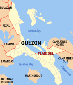 Map of Quezon with Plaridel highlighted | |

| |
.svg.png) Plaridel Location within the Philippines | |
| Coordinates: 13°57′04″N 122°01′13″E | |
| Country | |
| Region | Calabarzon (Region IV-A) |
| Province | Quezon |
| District | 4th District |
| Founded | June 16, 1962 |
| Barangays | 9 (see Barangays) |
| Government | |
| • Type | Sangguniang Bayan |
| • Mayor | Bernardo V. Tumagay |
| • Vice Mayor | Jose D. Saavedra |
| • Congressman | Angelita D. Tan |
| • Electorate | 8,569 voters (2019) |
| Area | |
| • Total | 35.05 km2 (13.53 sq mi) |
| Elevation | 6.5 m (21.3 ft) |
| Population (2015 census)[3] | |
| • Total | 10,935 |
| • Density | 310/km2 (810/sq mi) |
| • Households | 2,249 |
| Economy | |
| • Income class | 5th municipal income class |
| • Poverty incidence | 14.14% (2015)[4] |
| • Revenue (₱) | 44,730,145.90 (2016) |
| Time zone | UTC+8 (PST) |
| ZIP code | 4306 |
| PSGC | |
| IDD : area code | +63 (0)42 |
| Climate type | tropical rainforest climate |
| Native languages | Tagalog |
The municipality was created in 1962 by virtue of Republic Act No. 3493 where its territories carved out from Atimonan.[5]
Geography
The smallest municipality in the province of Quezon, Plaridel has an area of 33 square kilometers comprising nine barangays - four of which are poblaciones - and its population is around 11,000. It lies between the towns of Atimonan and Gumaca, hugging the coastline of the Province alongside Maharlika Highway. Its inhabitants are occupied primarily with fishing. Those engaged in Agriculture plant mostly coconut and rice. A visitor this town must taste and savor its local version of Suman.
Barangays
Plaridel is politically subdivided into 9 barangays.
- Concepcion
- Duhat
- Ilaya
- Ilosong
- Tanauan
- Central (Poblacion)
- Paang Bundok (Poblacion)
- Paaralan or Pampaaralan (Poblacion)
- M. L. Tumagay (Poblacion)
Barangays Duhat, Ilaya, and Ilosong are south of the Poblacion, and are accessed by a paved road which connects with the National Maharlika Highway at Barangay Pampaaralan (also called Paaralan). This road is also the main access to Barangay Kulawit, part of the Municipality of Atimonan to the west.
Demographics
| Population census of Plaridel | ||
|---|---|---|
| Year | Pop. | ±% p.a. |
| 1970 | 5,665 | — |
| 1975 | 6,051 | +1.33% |
| 1980 | 6,386 | +1.08% |
| 1990 | 7,473 | +1.58% |
| 1995 | 8,666 | +2.81% |
| 2000 | 9,501 | +1.99% |
| 2007 | 10,069 | +0.80% |
| 2010 | 10,238 | +0.61% |
| 2015 | 10,935 | +1.26% |
| Source: Philippine Statistics Authority[3][6][7][8] | ||
Climate
| Climate data for Plaridel, Quezon | |||||||||||||
|---|---|---|---|---|---|---|---|---|---|---|---|---|---|
| Month | Jan | Feb | Mar | Apr | May | Jun | Jul | Aug | Sep | Oct | Nov | Dec | Year |
| Average high °C (°F) | 26 (79) |
27 (81) |
29 (84) |
31 (88) |
31 (88) |
30 (86) |
29 (84) |
29 (84) |
29 (84) |
29 (84) |
28 (82) |
26 (79) |
29 (84) |
| Average low °C (°F) | 22 (72) |
22 (72) |
22 (72) |
23 (73) |
24 (75) |
24 (75) |
24 (75) |
24 (75) |
24 (75) |
24 (75) |
23 (73) |
23 (73) |
23 (74) |
| Average precipitation mm (inches) | 83 (3.3) |
55 (2.2) |
44 (1.7) |
37 (1.5) |
90 (3.5) |
123 (4.8) |
145 (5.7) |
125 (4.9) |
135 (5.3) |
166 (6.5) |
163 (6.4) |
152 (6.0) |
1,318 (51.8) |
| Average rainy days | 15.1 | 10.8 | 11.9 | 11.4 | 19.9 | 23.7 | 26.3 | 23.9 | 23.9 | 22.1 | 20.2 | 18.6 | 227.8 |
| Source: Meteoblue [9] | |||||||||||||
Religion
- Roman Catholic
- Iglesia Ni Cristo
- Seventh Day Adventist
- Bible Baptist
Local government
Elected officials 2013-2016:
- Mayor: Bernardo V. Tumagay
- Vice Mayor: Robert I. Magbuhos
- Councilors:
- Wilfredo M. Magbuhos Jr.
- Rico N. Alvarez
- Rolando V. Borja
- Ronald M. Papag
- Ernesto B. Deseo
- Serafin V. Valonzo
- Carlos L. Campomanes
- Francisco Joel S. Abuel Jr.
References
- "Municipality". Quezon City, Philippines: Department of the Interior and Local Government. Retrieved 31 May 2013.
- "Province: Quezon". PSGC Interactive. Quezon City, Philippines: Philippine Statistics Authority. Retrieved 12 November 2016.
- Census of Population (2015). "Region IV-A (Calabarzon)". Total Population by Province, City, Municipality and Barangay. PSA. Retrieved 20 June 2016.
- "PSA releases the 2015 Municipal and City Level Poverty Estimates". Quezon City, Philippines. Retrieved 1 January 2020.
- "Republic Act No. 3493 - An Act Creating the Municipality of Plaridel in the Province of Quezon". Chan Robles Virtual Law Library. 16 June 1962. Retrieved 2 March 2016.
- Census of Population and Housing (2010). "Region IV-A (Calabarzon)". Total Population by Province, City, Municipality and Barangay. NSO. Retrieved 29 June 2016.
- Censuses of Population (1903–2007). "Region IV-A (Calabarzon)". Table 1. Population Enumerated in Various Censuses by Province/Highly Urbanized City: 1903 to 2007. NSO.
- "Province of Quezon". Municipality Population Data. Local Water Utilities Administration Research Division. Retrieved 17 December 2016.
- "Plaridel: Average Temperatures and Rainfall". Meteoblue. Retrieved 27 January 2020.
External links
- Plaridel Profile at PhilAtlas.com
- An Act Creating the Municipality of Plaridel in the Province of Quezon
- Philippine Standard Geographic Code
- Philippine Census Information
- Local Governance Performance Management System
- erintanada.com
Places adjacent to Plaridel, Quezon | |
|---|---|
Lucena (capital) | |
| Municipalities |
|
| Component city | |
| Highly urbanized city |
|