Quezon, Quezon
Quezon, officially the Municipality of Quezon, (Tagalog: Bayan ng Quezon), is a 5th class municipality in the province of Quezon, Philippines. According to the 2015 census, it has a population of 15,228 people.[4]
Quezon | |
|---|---|
| Municipality of Quezon | |
 Seal | |
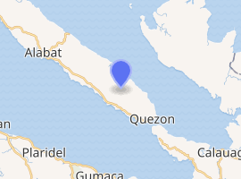
 Map of Quezon with Quezon highlighted | |
| |
.svg.png) Quezon Location within the Philippines | |
| Coordinates: 14°03′N 122°08′E | |
| Country | |
| Region | Calabarzon (Region IV-A) |
| Province | Quezon |
| District | 4th District |
| Founded | January 1, 1914 [1] |
| Named for | Manuel Luis Quezon |
| Barangays | 24 (see Barangays) |
| Government | |
| • Type | Sangguniang Bayan |
| • Mayor | Ma. Caridad P. Clacio |
| • Vice Mayor | Leo L. Oliveros |
| • Congressman | Angelita D. Tan |
| • Electorate | 10,653 voters (2019) |
| Area | |
| • Total | 71.22 km2 (27.50 sq mi) |
| Elevation | 7.7 m (25.3 ft) |
| Population (2015 census)[4] | |
| • Total | 15,228 |
| • Density | 210/km2 (550/sq mi) |
| • Households | 3,654 |
| Economy | |
| • Income class | 5th municipal income class |
| • Poverty incidence | 26.16% (2015)[5] |
| • Revenue (₱) | 55,537,446.81 (2016) |
| Time zone | UTC+8 (PST) |
| ZIP code | 4332 |
| PSGC | |
| IDD : area code | +63 (0)42 |
| Climate type | tropical rainforest climate |
| Native languages | Inagta Alabat language Tagalog |
The municipality was named after Manuel L. Quezon, the second President of the Philippines, first President of the Philippine Commonwealth, and the former governor. It is home to the recently started Yubakan Festival and a few speakers of the critically endangered Inagta Alabat language, one of the most endangered languages in the world as listed by UNESCO.
Barangays
Quezon is politically subdivided into 24 barangays, 6 urban and 18 rural.
- Apad
- Argosino
- Barangay I (Poblacion)
- Barangay II (Poblacion)
- Barangay III (Poblacion)
- Barangay IV (Poblacion)
- Barangay V (Poblacion)
- Barangay VI (Poblacion)
- Cagbalogo
- Caridad
- Cometa
- Del Pilar
- Guinhawa
- Gumubat
- Magsino
- Mascariña
- Montaña
- Sabang
- Silangan
- Tagkawa
- Villa Belen
- Villa Francia
- Villa Gomez
- Villa Mercedes
Demographics
| Population census of Quezon | ||
|---|---|---|
| Year | Pop. | ±% p.a. |
| 1918 | 2,627 | — |
| 1939 | 4,450 | +2.54% |
| 1948 | 5,346 | +2.06% |
| 1960 | 8,095 | +3.52% |
| 1970 | 10,604 | +2.73% |
| 1975 | 10,465 | −0.26% |
| 1980 | 10,734 | +0.51% |
| 1990 | 11,345 | +0.56% |
| 1995 | 13,200 | +2.88% |
| 2000 | 14,594 | +2.18% |
| 2007 | 15,011 | +0.39% |
| 2010 | 15,142 | +0.32% |
| 2015 | 15,228 | +0.11% |
| Source: Philippine Statistics Authority[4][6][7][8] | ||
Climate
| Climate data for Quezon, Quezon | |||||||||||||
|---|---|---|---|---|---|---|---|---|---|---|---|---|---|
| Month | Jan | Feb | Mar | Apr | May | Jun | Jul | Aug | Sep | Oct | Nov | Dec | Year |
| Average high °C (°F) | 26 (79) |
27 (81) |
29 (84) |
31 (88) |
31 (88) |
30 (86) |
29 (84) |
29 (84) |
29 (84) |
29 (84) |
28 (82) |
27 (81) |
29 (84) |
| Average low °C (°F) | 22 (72) |
22 (72) |
22 (72) |
23 (73) |
24 (75) |
24 (75) |
24 (75) |
24 (75) |
24 (75) |
24 (75) |
24 (75) |
23 (73) |
23 (74) |
| Average precipitation mm (inches) | 51 (2.0) |
35 (1.4) |
37 (1.5) |
39 (1.5) |
91 (3.6) |
131 (5.2) |
168 (6.6) |
132 (5.2) |
162 (6.4) |
184 (7.2) |
166 (6.5) |
101 (4.0) |
1,297 (51.1) |
| Average rainy days | 13.4 | 10.5 | 11.8 | 12.0 | 19.8 | 24.1 | 26.7 | 25.1 | 25.3 | 23.9 | 21.2 | 17.6 | 231.4 |
| Source: Meteoblue [9] | |||||||||||||
References
- https://quod.lib.umich.edu/p/philamer/ACD6603.1913.001?rgn=main;view=fulltext
- "Municipality". Quezon City, Philippines: Department of the Interior and Local Government. Retrieved 31 May 2013.
- "Province: Quezon". PSGC Interactive. Quezon City, Philippines: Philippine Statistics Authority. Retrieved 12 November 2016.
- Census of Population (2015). "Region IV-A (Calabarzon)". Total Population by Province, City, Municipality and Barangay. PSA. Retrieved 20 June 2016.
- "PSA releases the 2015 Municipal and City Level Poverty Estimates". Quezon City, Philippines. Retrieved 1 January 2020.
- Census of Population and Housing (2010). "Region IV-A (Calabarzon)". Total Population by Province, City, Municipality and Barangay. NSO. Retrieved 29 June 2016.
- Censuses of Population (1903–2007). "Region IV-A (Calabarzon)". Table 1. Population Enumerated in Various Censuses by Province/Highly Urbanized City: 1903 to 2007. NSO.
- "Province of Quezon". Municipality Population Data. Local Water Utilities Administration Research Division. Retrieved 17 December 2016.
- "Quezon: Average Temperatures and Rainfall". Meteoblue. Retrieved 27 January 2020.
External links
- Quezon Profile at PhilAtlas.com
- Philippine Standard Geographic Code
- Philippine Census Information
- Local Governance Performance Management System
Places adjacent to Quezon, Quezon | |
|---|---|
Lucena (capital) | |
| Municipalities |
|
| Component city | |
| Highly urbanized city |
|
This article is issued from Wikipedia. The text is licensed under Creative Commons - Attribution - Sharealike. Additional terms may apply for the media files.