Louisa, Kentucky
Louisa is a home rule-class city[2] located at the merger of the Levisa and Tug Forks into the Big Sandy River. It is located in Lawrence County, Kentucky, in the United States, and is the seat of its county.[3] The population was 2,467 at the 2010 census[4] and an estimated 2,375 in 2018.[1]
Louisa, Kentucky | |
|---|---|
City | |
 Main Street | |
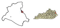 Location in Lawrence County, Kentucky | |
| Coordinates: 38°6′43″N 82°36′21″W | |
| Country | United States |
| State | Kentucky |
| County | Lawrence |
| Established | December 11, 1822 |
| Incorporated | 1869 |
| Government | |
| • Type | Mayor-Council |
| Area | |
| • Total | 2.26 sq mi (5.85 km2) |
| • Land | 2.24 sq mi (5.81 km2) |
| • Water | 0.02 sq mi (0.05 km2) |
| Elevation | 584 ft (178 m) |
| Population (2010) | |
| • Total | 2,467 |
| • Estimate (2018)[1] | 2,375 |
| • Density | 1,059/sq mi (409.0/km2) |
| Time zone | UTC-5 (Eastern (EST)) |
| • Summer (DST) | UTC-4 (EDT) |
| ZIP codes | 41201, 41230 |
| Area code(s) | 606 |
| FIPS code | 21-47854 |
| GNIS feature ID | 0497204 |
| Website | www |
History
The origin of the city's name is unclear. Theories include that it was named for Louisa County, Virginia, or a corruption of the name of the Levisa, or that it was named after Louisa Swetnam, one of the first white children born in the area. The Levisa Fork was originally written and spoken as the "Louisa Fork", which is the likely origin of the name. It is also possible that the town name was connected to the Spanish Era in Kentucky. Spain made land grants in what is now Kentucky. Explorer Dr. Thomas Walker named the river after a family member. Others claim that the Levisa Fork is named for Levite connections to the Cherokee and other native tribes prior to later European contact. An 1856 map still shows the river under the name "Louisa". Virginia and Carolina and other English colonial-linked settlement attempts began as early as 1790 but did not take hold until 1818. Louisa became the county seat in 1822 and a city in 1823.
During the Civil War, Union troops under future president James A. Garfield occupied the city from December 1861 until the end of the war, despite several Confederate takeover attempts.

The Chattaroi Railroad (now a part of CSX) connected to Louisa in 1881. The city is also served by US 23. The first needle dam constructed in the United States was completed just north of town in 1896.[5]
The city was home to Fred M. Vinson, the 13th Chief Justice of the United States, and to the York Brothers, a popular country music act of the 1940s and 1950s.[6]
Geography
Louisa is located in eastern Lawrence County at 38°6′43″N 82°36′21″W (38.112054, -82.605796).[7] Its eastern border is the Levisa Fork, and its northern border is the Big Sandy River, which also serves as the Kentucky–West Virginia border.
U.S. Route 23 passes through the western side of the city, leading north 30 miles (48 km) down the valley of the Big Sandy River to Ashland on the Ohio River and southwest 28 miles (45 km) to Staffordsville. Kentucky Route 3 passes through the center of Louisa on Madison Street; KY 3 leads northwest 7 miles (11 km) to Fallsburg and southeast up the valley of the Tug Fork and Rockcastle Creek 25 miles (40 km) to Inez. Kentucky Route 32 leads southwest from Louisa 18 miles (29 km) to Blaine. West Virginia Route 37 leads east across the Tug Fork to Fort Gay, West Virginia.
According to the United States Census Bureau, Louisa has a total area of 2.3 square miles (5.9 km2), of which 0.02 square miles (0.05 km2), or 0.81%, are water.[8]
Climate
The climate in this area is characterized by relatively high temperatures and evenly distributed precipitation throughout the year. According to the Köppen Climate Classification system, Louisa has a Humid subtropical climate, abbreviated "Cfa" on climate maps.[9]
Point of interest
The bridge from Louisa, in eastern Lawrence County, to Fort Gay, West Virginia, is something of a geographic and architectural oddity. The quarter-mile concrete span spans two forks of the Big Sandy River, connects two states and has a right turn at its halfway point, which connects traffic to the Point Section neighborhood of Louisa.
Culture
Every second weekend in September, Louisa hosts the regional Septemberfest that features several local and national acts performing for three days, as well as the huge arts and crafts section on the northwestern side of town and the many food vendors featuring Southeastern cuisine.
Demographics
| Historical population | |||
|---|---|---|---|
| Census | Pop. | %± | |
| 1830 | 87 | — | |
| 1860 | 258 | — | |
| 1870 | 425 | 64.7% | |
| 1880 | 496 | 16.7% | |
| 1890 | 834 | 68.1% | |
| 1900 | 1,099 | 31.8% | |
| 1910 | 1,356 | 23.4% | |
| 1920 | 2,011 | 48.3% | |
| 1930 | 1,931 | −4.0% | |
| 1940 | 2,023 | 4.8% | |
| 1950 | 2,015 | −0.4% | |
| 1960 | 2,071 | 2.8% | |
| 1970 | 1,781 | −14.0% | |
| 1980 | 1,832 | 2.9% | |
| 1990 | 1,990 | 8.6% | |
| 2000 | 2,018 | 1.4% | |
| 2010 | 2,467 | 22.2% | |
| Est. 2018 | 2,375 | [1] | −3.7% |
| U.S. Decennial Census[10] | |||
As of the census[11] of 2000, there were 2,018 people, 927 households, and 548 families residing in the city. The population density was 1,496.2 people per square mile (577.2/km²). There were 1,065 housing units at an average density of 789.6 per square mile (304.6/km²). The racial makeup of the city was 98.61% White, 0.50% African American, 0.05% Native American, 0.10% Asian, 0.05% from other races, and 0.69% from two or more races. Hispanic or Latino of any race were 0.20% of the population.
There were 927 households out of which 26.5% had children under the age of 18 living with them, 41.3% were married couples living together, 15.2% had a female householder with no husband present, and 40.8% were non-families. 38.1% of all households were made up of individuals and 18.4% had someone living alone who was 65 years of age or older. The average household size was 2.16 and the average family size was 2.84.
In the city, the population was spread out with 22.1% under the age of 18, 10.0% from 18 to 24, 25.9% from 25 to 44, 23.9% from 45 to 64, and 18.1% who were 65 years of age or older. The median age was 39 years. For every 100 females, there were 79.5 males. For every 100 females age 18 and over, there were 74.1 males.
The median income for a household in the city was $16,690, and the median income for a family was $24,474. Males had a median income of $30,000 versus $21,250 for females. The per capita income for the city was $16,746. About 27.5% of families and 32.8% of the population were below the poverty line, including 46.9% of those under age 18 and 17.4% of those age 65 or over.
Education
Secondary schools
Primary schools
Public library
Louisa has a lending library, the Lawrence County Public Library.[12]
Notable people
- Tyler Childers, folk/country/Americana singer
- Chandler Shepherd (born 1992), baseball pitcher
- Frederick M. Vinson, Chief Justice of the United States, 1946-1953
References
- "Population and Housing Unit Estimates". Retrieved December 15, 2019.
- "Summary and Reference Guide to House Bill 331 City Classification Reform" (PDF). Kentucky League of Cities. Retrieved December 30, 2014.
- "Find a County". National Association of Counties. Retrieved 2011-06-07.
- "Total Population: 2010 Census DEC Summary File 1 (P1), Louisa city, Kentucky". data.census.gov. U.S. Census Bureau. Retrieved February 7, 2020.
- Thomas, B.F. & Watt, D.A. The Improvement of Rivers: A Treatise on the Methods Employed For Improving Streams for Open Navigation, and for Navigation by Means of Locks and Dams, p. 563. 1913.
- Bopping.org. "York Brothers".
- "US Gazetteer files: 2010, 2000, and 1990". United States Census Bureau. 2011-02-12. Retrieved 2011-04-23.
- "U.S. Gazetteer Files: 2019: Places: Kentucky". U.S. Census Bureau Geography Division. Retrieved February 7, 2020.
- Climate Summary for Louisa, Kentucky
- "Census of Population and Housing". Census.gov. Retrieved June 4, 2015.
- "U.S. Census website". United States Census Bureau. Retrieved 2008-01-31.
- "Kentucky Public Library Directory". Kentucky Department for Libraries and Archives. Archived from the original on 11 January 2019. Retrieved 5 June 2019.
External links
Municipalities and communities of Lawrence County, Kentucky, United States | ||
|---|---|---|
| Cities | 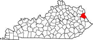 Location of Lawrence County, Kentucky | |
| Unincorporated communities | ||

| Authority control |
|
|---|