Hickman County, Kentucky
Hickman County is a county located in the U.S. state of Kentucky. As of the 2010 census, the population was 4,902,[1] making it the third-least populous county in Kentucky. Its county seat is Clinton.[2] The county was formed in 1821.[3] It is the least densely populated county in the state and is a prohibition or dry county.
Hickman County | |
|---|---|
 Hickman County Courthouse in Clinton | |
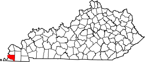 Location within the U.S. state of Kentucky | |
 Kentucky's location within the U.S. | |
| Coordinates: 36°41′N 88°59′W | |
| Country | |
| State | |
| Founded | 1821 |
| Named for | Paschal Hickman |
| Seat | Clinton |
| Largest city | Clinton |
| Area | |
| • Total | 253 sq mi (660 km2) |
| • Land | 242 sq mi (630 km2) |
| • Water | 11 sq mi (30 km2) 4.3%% |
| Population | |
| • Estimate (2018) | 4,421 |
| • Density | 20/sq mi (8/km2) |
| Time zone | UTC−6 (Central) |
| • Summer (DST) | UTC−5 (CDT) |
| Congressional district | 1st |
| Website | hickmancounty |
History
Founded in 1821, Hickman County was the seventy-first in order of formation. It was named for Captain Paschal Hickman of the 1st Rifle Regiment, Kentucky Militia.[4][5] A resident of Franklin County, Kentucky, Hickman was wounded and captured at the Battle of Frenchtown in January 1813 and was killed by Indians in the Massacre of the River Raisin.
Columbus, Kentucky, in the northwest of the county and located on the Mississippi River, was the original county seat. A log structure built in 1823 served as the courthouse. In 1830, the county seat was moved to the more centrally located Clinton.
In 1861, early in the American Civil War, the Confederate Army established Fort de Russey on the strategically located bluffs at Columbus across the river from Belmont, Missouri. Confederate General Leonidas Polk knew it was important to control the river, and wanted to extend a massive chain across the Mississippi to block Union forces from going downstream. (This was never achieved.) The fort was garrisoned with several thousand troops and a six-gun battery was installed; a smaller force was based at a Confederate camp in Belmont.
Union Gen. Ulysses S. Grant moved troops from his base at Cairo, Illinois, and attacked Belmont in November 1861, his first battle of the war. He was ultimately defeated by Confederate troops sent from Columbus across the river to reinforce the Confederate defense; they were led by Polk.[6][7] The former site of the Confederate fortifications near Columbus, Kentucky is now the Columbus-Belmont State Park, commemorating all the actions of the day that led to Union defeat here.[8]
Geography

According to the U.S. Census Bureau, the county has a total area of 253 square miles (660 km2), of which 242 square miles (630 km2) is land and 11 square miles (28 km2) (4.3%) is water.[9] The elevation in the county ranges from 276 feet (84 m) to 510 feet (160 m) above sea level. The county's western border is formed by the Mississippi River, nearly a mile wide here, with the state of Missouri on the other side. Some portions of the county are landlocked to Missouri west of the Mississippi.
Adjacent counties
- Carlisle County (north)
- Graves County (east)
- Weakley County, Tennessee (southeast)
- Obion County, Tennessee (south)
- Fulton County (south)
- Mississippi County, Missouri (west)
Demographics
| Historical population | |||
|---|---|---|---|
| Census | Pop. | %± | |
| 1830 | 5,198 | — | |
| 1840 | 8,968 | 72.5% | |
| 1850 | 4,791 | −46.6% | |
| 1860 | 7,008 | 46.3% | |
| 1870 | 8,453 | 20.6% | |
| 1880 | 10,651 | 26.0% | |
| 1890 | 11,637 | 9.3% | |
| 1900 | 11,745 | 0.9% | |
| 1910 | 11,750 | 0.0% | |
| 1920 | 10,244 | −12.8% | |
| 1930 | 8,725 | −14.8% | |
| 1940 | 9,142 | 4.8% | |
| 1950 | 7,778 | −14.9% | |
| 1960 | 6,747 | −13.3% | |
| 1970 | 6,264 | −7.2% | |
| 1980 | 6,065 | −3.2% | |
| 1990 | 5,566 | −8.2% | |
| 2000 | 5,262 | −5.5% | |
| 2010 | 4,902 | −6.8% | |
| Est. 2018 | 4,421 | [10] | −9.8% |
| U.S. Decennial Census[11] 1790-1960[12] 1900-1990[13] 1990-2000[14] 2010-2013[1] | |||
As of the census[15] of 2000, there were 5,262 people, 2,188 households, and 1,542 families residing in the county. The population density was 22 per square mile (8.5/km2). There were 2,436 housing units at an average density of 10 per square mile (3.9/km2). The racial makeup of the county was 88.35% White, 9.90% Black or African American, 0.29% Native American, 0.06% Asian, 0.17% from other races, and 1.24% from two or more races. 1.03% of the population were Hispanic or Latino of any race.
There were 2,188 households out of which 28.20% had children under the age of 18 living with them, 56.50% were married couples living together, 10.80% had a female householder with no husband present, and 29.50% were non-families. 27.60% of all households were made up of individuals and 13.00% had someone living alone who was 65 years of age or older. The average household size was 2.34 and the average family size was 2.82.
In the county, the population was spread out with 22.10% under the age of 18, 6.90% from 18 to 24, 26.70% from 25 to 44, 25.90% from 45 to 64, and 18.50% who were 65 years of age or older. The median age was 41 years. For every 100 females there were 91.30 males. For every 100 females age 18 and over, there were 88.90 males.
The median income for a household in the county was $31,615, and the median income for a family was $37,049. Males had a median income of $28,438 versus $18,506 for females. The per capita income for the county was $17,279. About 14.20% of families and 17.40% of the population were below the poverty line, including 27.70% of those under age 18 and 13.80% of those age 65 or over.
Notable people
- Robert Burns Smith, third Governor of Montana[16]
Politics
| Year | Republican | Democratic | Third parties |
|---|---|---|---|
| 2016 | 76.8% 1,657 | 20.8% 449 | 2.4% 51 |
| 2012 | 66.9% 1,431 | 32.1% 686 | 1.0% 22 |
| 2008 | 62.5% 1,406 | 36.1% 812 | 1.4% 32 |
| 2004 | 59.6% 1,395 | 39.5% 926 | 0.9% 21 |
| 2000 | 54.2% 1,151 | 44.3% 940 | 1.6% 33 |
| 1996 | 32.0% 695 | 56.1% 1,220 | 11.9% 258 |
| 1992 | 35.0% 861 | 52.8% 1,296 | 12.2% 300 |
| 1988 | 49.3% 1,142 | 50.0% 1,158 | 0.7% 15 |
| 1984 | 56.6% 1,380 | 43.0% 1,049 | 0.3% 8 |
| 1980 | 42.8% 1,143 | 54.6% 1,456 | 2.6% 69 |
| 1976 | 21.5% 585 | 74.9% 2,035 | 3.5% 96 |
| 1972 | 56.7% 1,430 | 38.7% 976 | 4.7% 118 |
| 1968 | 23.2% 623 | 32.8% 880 | 44.0% 1,183 |
| 1964 | 22.1% 613 | 77.5% 2,149 | 0.4% 12 |
| 1960 | 30.8% 968 | 69.2% 2,176 | 0.0% 0 |
| 1956 | 24.8% 785 | 74.8% 2,367 | 0.4% 11 |
| 1952 | 30.4% 871 | 69.4% 1,988 | 0.2% 6 |
| 1948 | 12.3% 326 | 80.6% 2,143 | 7.2% 190 |
| 1944 | 22.6% 588 | 77.1% 2,005 | 0.4% 9 |
| 1940 | 15.1% 490 | 84.7% 2,758 | 0.2% 7 |
| 1936 | 13.0% 385 | 86.3% 2,548 | 0.6% 19 |
| 1932 | 11.8% 446 | 87.8% 3,327 | 0.4% 16 |
| 1928 | 26.1% 767 | 73.7% 2,163 | 0.2% 6 |
| 1924 | 21.3% 618 | 78.1% 2,270 | 0.6% 17 |
| 1920 | 22.0% 866 | 77.4% 3,045 | 0.6% 23 |
| 1916 | 21.1% 539 | 77.4% 1,982 | 1.5% 39 |
| 1912 | 17.7% 365 | 74.5% 1,540 | 7.8% 162 |
See also
References
- "State & County QuickFacts". United States Census Bureau. Archived from the original on June 7, 2011. Retrieved March 8, 2014.
- "Find a County". National Association of Counties. Archived from the original on 2011-05-31. Retrieved 2011-06-07.
- "Hickman County". The Kentucky Encyclopedia. 2000. Retrieved August 22, 2014.
- Gannett, Henry (1905). The Origin of Certain Place Names in the United States. Govt. Print. Off. pp. 156.
- The Register of the Kentucky State Historical Society, Volume 1. Kentucky State Historical Society. 1903. pp. 35.
- Hughes, Nathaniel Cheairs, The Battle of Belmont: Grant Strikes South (Univ of North Carolina Press, 1991), p. 184.
- McGhee, James E. "The Neophyte General: U.S. Grant and the Belmont Campaign" Archived 2016-03-04 at the Wayback Machine, Civil War in St. Louis
- The Kentucky Encyclopedia.
- "2010 Census Gazetteer Files". United States Census Bureau. August 22, 2012. Archived from the original on August 12, 2014. Retrieved August 16, 2014.
- "Population and Housing Unit Estimates". Retrieved July 29, 2019.
- "U.S. Decennial Census". United States Census Bureau. Retrieved August 16, 2014.
- "Historical Census Browser". University of Virginia Library. Retrieved August 16, 2014.
- "Population of Counties by Decennial Census: 1900 to 1990". United States Census Bureau. Retrieved August 16, 2014.
- "Census 2000 PHC-T-4. Ranking Tables for Counties: 1990 and 2000" (PDF). United States Census Bureau. Retrieved August 16, 2014.
- "U.S. Census website". United States Census Bureau. Retrieved 2008-01-31.
- "Montana Governor Robert Burns Smith". National Governors Association. Retrieved October 10, 2012.
- Leip, David. "Dave Leip's Atlas of U.S. Presidential Elections". uselectionatlas.org. Retrieved 2018-07-02.
Municipalities and communities of Hickman County, Kentucky, United States | ||
|---|---|---|
| Cities | Location of Hickman County, Kentucky | |
| Unincorporated communities | ||

| Authority control |
|
|---|