List of Nova Scotia provincial highways
This is a list of numbered highways in the province of Nova Scotia.
| Nova Scotia provincial highway system | |
|---|---|
 .png)  Standard highway markers for Nova Scotia | |
| Highway names | |
| Arterial (100-series) highways | Nova Scotia Highway 1XX (Hwy 1XX) |
| Trunk Highways | Nova Scotia Trunk XX (Trunk XX) |
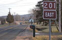
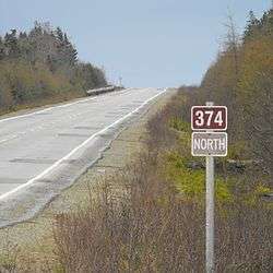
| Collector Highways | Nova Scotia Route XXX (Route XXX) |
| System links | |
| Provincial highways in Nova Scotia 100-series | |
Arterial (100-series) highways
A 100-series highway is a designation applied to a highway that can be a controlled-access expressway, Super-2, or fully divided freeway. The designation can also be applied in some cases to sections of uncontrolled access roads which are deemed strategically important and which will be upgraded in the future to controlled-access.
Trunk Highways
Nova Scotia's original arterial highway number system had route number signs in the same shape as the U.S. Highway route number signs. These signs are now used for Trunk routes. Former, "missing", Trunk routes were largely downgraded to Collector Routes in 1970.[1][2][3][4]
| Number | Length (km) | Length (mi) | Southern or western terminus | Northern or eastern terminus | Local names | Formed | Removed | Notes |
|---|---|---|---|---|---|---|---|---|
| 327.5 | 203.5 | Yarmouth | Trunk 1 in Bedford | — | — | Passes through Lower Sackville, Windsor, the Annapolis Valley, and Digby. | ||
| 266.0 | 165.3 | Halifax | Hwy 104 in Onslow | — | — | Passes through Bedford, Lower Sackville, Truro, Parrsboro, and Amherst. | ||
| 23 | 14 | Trunk 2 in Southampton | Trunk 2 in Upper Nappan | — | — | Former section of Trunk 2; replaced by Route 302.[5] | ||
| 291.3 | 181.0 | Trunk 1 in Yarmouth | Halifax | — | — | Passes through Liverpool, Bridgewater, and Lunenburg. | ||
| 15 | 9 | Trunk 3 in Bridgewater | Trunk 3 in Mahone Bay | — | — | Replaced by Route 325.[4] | ||
| 414.6 | 257.6 | Hwy 104 near Thomson Station | Trunk 28 in Glace Bay | — | — | Passes through Truro, New Glasgow, Antigonish, and Sydney. | ||
| 165 | 103 | Trunk 4 / Trunk 19 in Port Hastings | Sydney | — | — | Replaced by Hwy 105, with some bypassed sections re-designated as Route 205 and Route 305 or as unnumbered, local roads. | ||
| 136.4 | 84.8 | Hwy 104 in Amherst | Hwy 106 in Pictou | — | — | |||
| 278.2 | 172.9 | Trunk 2 Bedford | Trunk 4 in Antigonish | — | — | Passes through Dartmouth, Musquodoboit Harbour, and Sheet Harbour. | ||
| 112.9 | 70.2 | Trunk 3 in Liverpool | Trunk 1 in Annapolis Royal | Kejimkujik Scenic Drive | — | — | Connects to Kejimkujik National Park. | |
| 59 | 37 | Apple River | Trunk 2 in Parrsboro | — | — | Replaced by Route 209. | ||
| 88.2 | 54.8 | Route 325 in Bridgewater | Trunk 1 in Middleton | — | — | |||
| 49 | 30 | Trunk 4 in Truro | Trunk 6 in Tatamagouche | — | — | Replaced by Route 311. | ||
| 65.6 | 40.8 | Trunk 3 in Chester Basin | Trunk 1 in Kentville | — | — | |||
| 120.7 | 75.0 | Trunk 3 near Chester | Trunk 2 in Milford Station | — | — | Passes through Windsor. | ||
| 120.0 | 74.6 | Trunk 4 in Newport Corner | Trunk 2 in Shubenacadie | — | — | Replaced by Route 215. | ||
| 79.2 | 49.2 | Trunk 4 in Monastery | Canso | — | — | |||
| 64 | 40 | Trunk 1 in Digby | Westport, Brier Island | — | — | Replaced by Route 217. | ||
| 11 | 7 | Trunk 7 in Dartmouth | Trunk 2 in Waverley | — | — | Replaced by Route 318. | ||
| 106.6 | 66.2 | Hwy 104 / Hwy 105 / Trunk 4 in Port Hastings | Cabot Trail at Margaree Forks | Ceilidh Trail | — | — | ||
| 85 | 53 | Trunk 5 in Port Hastings | Trunk 5 in Baddeck | — | 1940s | Trunk 5 and Trunk 19 designations were switched between Port Hastings and Baddeck.[2][4] | ||
| 56 | 35 | Trunk 7 at Melrose | Trunk 4 in Antigonish | — | 1940s | Replaced by Trunk 7; proposed section of Trunk 7 between Melrose and Trunk 16 was not constructed.[1][2][4] | ||
| 2 | 1 | Trunk 4 at Grande Anse | Louisdale | — | — | Replaced by Route 320; Route 320 was subsequently relocated with the completion of Hwy 104. | ||
| 35.6 | 22.1 | Trunk 4 in Sydney | Louisbourg | Mira Road | — | — | ||
| 38 | 24 | Trunk 4 in Oxford | Trunk 6 in Port Philip | — | — | Replaced by Route 321. | ||
| 72 | 45 | Trunk 5 at Aberdeen | Trunk 5 at Leitches Creek Station | — | — | Replaced by Route 223. | ||
| — | — | Trunk 2 in Athol | Springhill | — | 1938 | Section between Springhill and Little Forks was replaced by Trunk 2, the remainder was decommissioned as is known as Little Forks Road; bypassed section of Trunk 2 was replaced by Route 302. | ||
| 35.6 | 22.1 | Trunk 4 in Sydney | Trunk 4 in Glace Bay | — | — | |||
| Trunk 30 | 298 | 185 | Hwy 105 at South Haven | Hwy 105 at Buckwheat Corner | Cabot Trail | — | — | Trunk 30 is unsigned; Passes through Cape Breton Highlands National Park. |
| 17 | 11 | Trunk 3 in Barrington Passage | Lower Clarks Harbour, Cape Sable Island | — | — | Replaced by Route 330. | ||
| 56 | 35 | Trunk 3 in Mill Village | Trunk 3 in Bridgewater | — | — | Replaced by Route 331. | ||
| Trunk 32 | 4.6 | 2.9 | Route 306 in Halifax | Main Avenue in Halifax | • Dunbrack Street • North West Arm Drive (former) |
— | — | Trunk 32 is unsigned. |
| 36 | 22 | Trunk 3 in Upper LaHave | Trunk 3 in Lunenburg | — | — | Replaced by Route 332. | ||
| Trunk 33 | 4.7 | 2.9 | Hwy 101 / Trunk 1 in Lower Sackville | Trunk 7 in Bedford | Bedford Bypass | — | — | Trunk 33 is unsigned. |
| 63 | 39 | Trunk 3 in Upper Tantallon | Trunk 3 in Beechville | — | — | Replaced by Route 333. | ||
| 20 | 12 | Lower Wedgeport | Trunk 3 in Arcadia | — | — | Replaced by Route 334. | ||
| 14 | 9 | Lower West Pubnico | Trunk 3 in Pubnico | — | — | Replaced by Route 335. | ||
| 80 | 50 | Trunk 1 in Hebron | Trunk 1 in Weymouth | — | — | Replaced by Route 340. | ||
| 19 | 12 | Trunk 1 in Kentville | Kingsport | — | — | Replaced by Route 341 (Kentville – Canard), Route 358 (Canard – Canning), and Route 221 (Canning – Kingsport). | ||
| 6 | 4 | Mulgrave | Trunk 4 in Aulds Cove | 1955 | 1970 | Former Trunk 4 to Mulgrave–Port Hawkesbury ferry (ferry replaced by Canso Causeway); replaced by Route 344. | ||
| 63 | 39 | Trunk 4 in Sutherlands River | Trunk 4 / Trunk 7 in Antigonish | — | — | Replaced by Route 245. | ||
| 47 | 29 | Trunk 6 in East Amherst | Trunk 6 in Port Howe | — | — | Replaced by Route 366. | ||
| ||||||||
Collector Highways


Scenic Routes
- Cabot Trail -- Highway 105 - Hunters Mountain - Northeast Margaree - Margaree Forks - Margaree Harbour - Grand-Étang - Chéticamp - Pleasant Bay - Cape North - Neil's Harbour - Ingonish - South Gut St. Anns - St. Ann's - South Haven
- Ceilidh Trail -- Port Hastings - Judique North - Harbourview - Port Hood - Mabou - Inverness
- Bras d'Or Lakes Scenic Drive
- Digby Neck and Islands -- Digby - Sandy Cove - Tiverton - Long Island - Freeport - Westport
- Evangeline Trail -- Lower Sackville - Windsor - Kentville - Middleton - Bridgetown - Digby - Yarmouth
- Fleur-de-Lis Trail -- Isle Madame - Arichat - Petit de Grat - St. Peter's - D'Escousse - Louisbourg
- Fundy Shore Ecotour -- Advocate Harbour - Joggins - Joggins - Parrsboro - Springhill, Amherst - Green Oaks - Beaver Brook - Clifton - Old Barns - Maitland - Selma - Noel Shore- Densmore Mills-Minasville - Moose Brook - Tenecape - Walton - Cambridge - Bramber - Cheverie - Kempt Shore - Summerville - Centre Burlington - Brooklyn
- Glooscap Trail -- Truro - Onslow - Glenholme - Bass River - Lower Economy - Five Islands - Parrsboro - Springhill - Amherst - Green Oaks - Beaver Brook - Clifton- Old Barns - Maitland- Selma- Noel Shore - Densmore Mills - Minasville- Moose Brook - Tenecape - Walton - Cambridge- Bramber- Cheverie- Kempt Shore - Summerville- Centre Burlington - Brooklyn
- Kejimkujik Scenic Drive -- Liverpool - Kejimkujik National Park - Annapolis Royal
- Lighthouse Route -- Halifax - Beechville - Goodwood - Hatchet Lake - White's lake - Shad Bay - Bayside - Peggys Cove - Indian Harbour - Hackett's Cove - Glen Margaret - Seabright - French Village - Glen Haven - Tantallon - Upper Tantallon - Hubbards- Fox Point - Mill Cove- Northwest Cove - Aspotogan - Bayswater - East River- - East River - Chester - Lunenburg - Bridgewater - Oak Hill - Pleasantville - Upper LaHave - Rose Bay - Riverport - East LaHave - Crescent Beach - Petite Riviere - Broad Cove - Cherry Hill - Vogler's Cove - Mill Village - Liverpool - Shelburne - Barrington Passage - Wedgeport - Arcadia - Yarmouth
- Marconi Trail -- Louisbourg - Main-a-Dieu - Bateston - Catalone - Marion Bridge - Donkin - Glace Bay
- Marine Drive -- Dartmouth - Eastern Passage - Cole Harbour - Upper Lawrencetown - West Lawrencetown - Seaforth - West Chezzetcook - Porters Lake - Musquodoboit Harbour - Jeddore - Sheet Harbour - Isaac's Harbour - Country Harbour Ferry - Port Bickerton - Harpellville - Indian Harbour Lake - Jordanville - Stillwater - Mulgrave - Sand Point - Boylston- Auld's Cove .
- Sunrise Trail -- Amherst - Tidnish Bridge - Tidnish - Lorneville - Port Howe - Pugwash - Wallace - Malagash - Tatamagouche - River John - Caribou - Northumberland Ferries - Pictou - Westville - New Glasgow - Antigonish - Doctors Brook - Lower Barney's River - Morristown - Cape George - Georgeville - Malignant Cove - Tracadie - Havre Boucher - Auld's Cove - Canso Causeway
Local roads
There is also an extensive system of unnumbered local roads in Nova Scotia, many of which are similar in construction, surface and dimension to the numbered collector highways. Examples of such un-numbered roads are:
- Ballpark Road
- Bethel Drive
- Mineville Road
- Mira Road
- Crisp Road: Ingilsville, Williamston, and New Albany
- West Dalhousie Road: Lequille, Lake LaRose, Perotte, West Dalhousie, Hannamville and Durland Lake
- Inglisville Road: West Inglisville,Inglisville, East Inglisville
- Mary Jane Riley Road: Clementsvale, Guinea, Waldeck
- Roxbury Road: Roxbury
- Neaves Road: Neavesville, Walker Lake
References
- Department of Highways, Nova Scotia (1936). Highway Map Nova Scotia (Map). Province of Nova Scotia.
- Department of Highways, Nova Scotia (1938). Highway Map Nova Scotia (Map). Province of Nova Scotia.
- Imperial Oil (1940). Imperial Oil map of Eastern Canada (Map). Imperial Oil Ltd.
- Province of Nova Scotia (1944). Official Road Map (Map). Province of Nova Scotia, Canada's Ocean Playground.
- Surveys and Mapping Branch, Department of Mines and Technical Surveys (1966). "Highways of Canada and Northern United States - Eastern Sheet" (Map). Canada and Northern United States. 1 in = 150 mi. Ottawa: Canadian Government Travel Bureau.
|