Kejimkujik National Park
Kejimkujik National Park (/ˈkɛdʒɪməˌkuːdʒɪk/)[2] is a National Park of Canada, covering 404 km2 (156 sq mi) in the southwest of Nova Scotia peninsula. It consists of two separate land areas: an inland part, which is coincident with the Kejimkujik National Historic Site of Canada, and the Kejimujik National Park Seaside on the Atlantic coast.[3]
| Kejimkujik National Park | |
|---|---|
IUCN category II (national park) | |
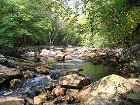 Little River | |
 Location of Kejimkujik National Park in Canada | |
| Location | Nova Scotia, Canada |
| Nearest city | Halifax |
| Coordinates | 44°23′57″N 65°13′06″W |
| Area | 404 km2 (156 sq mi) |
| Established | 1967 |
| Visitors | 60,649[1] (in 2015-16) |
| Governing body | Parks Canada |
| Official name | Kejimkujik National Historic Site of Canada |
| Designated | 1994 |
The Historic site is a cultural landscape 404 square kilometres (156 sq mi) forested upland plain between the South Shore and the Annapolis Valley. In it is found petroglyph sites, habitation sites, fishing and hunting sites, travel routes and burial grounds, which attest to Mi’kmaq occupancy of this area for thousands of years.
The seaside part is a wilderness protection area featuring coastal bogs, beaches, intertidal areas, and abundant flora and fauna.[4]
The Royal Astronomical Society of Canada has designated the park a dark-sky preserve.[5]
The park is named after Kejimikujik Lake, the largest lake in the park.
History
Canoe routes in the park have been used for thousands of years by natives to travel from the Bay of Fundy to the Atlantic shore.[6]
There are four Mi'kmaw petroglyph sites in the park. They are found in slate beds on the eastern side of Kejimikujik Lake. There are no slates beds on the western side. They are highly protected. Only one site can be visited by the public via a guided tour in the summer.[7] The petroglyphs show aspects of Mi'kmaw life after European contact, and are dated to the 1700s and 1800s. Many are symbolic and sometimes ambiguous. Motifs associated with traditional culture include canoes, wigwams, traditional costume, and decorative designs. There are also images of prey animals, but none of plants.[7] European motifs include ships, horses, women in dresses, Christian symbols, and five-pointed stars.
The Tent Dwellers is a book by Albert Paine[8] which chronicles his travels through inland Nova Scotia on a trout fishing trip. Published in 1908, it takes place in what is now Kejimkujik National Park and the Kejimkujik Seaside Tobeatic Game Reserve.
Recreation
The main Jeremy's Bay campground has 355 campsites, many suitable for large RVs, and generates about $1 million per year in fees.[9] A group campground for up to 80 people is at Jim Charles Point, named after the eponymous local First Nations Guide who lived there in the mid 1800s.[10] There are also backcountry primitive campsites accessible by canoe, bicycle or hiking.
There are 15 hiking trails for hiking, skiing, or snowshoeing. Backcountry campsites can also be accessed on foot. Winter camping is possible.[11]
Flora and fauna
Most of the park's forest is second growth, although it does contain significant areas of intact original habitat.[12] The park's shallow lakes, bogs, and marshes are a habitat to a greater variet of amphibians and reptiles than anywhere else in Atlantic Canada.[13] The park is situated in the Southwest Nova Biosphere Reserve in a region characterized as Acadian forest.
Among the 34 species of mammal found in the park, the more common are: shrews, the star-nosed mole, bats, Snowshoe Hare, squirrels (including nocturnal flying squirrels), beaver (protected species in Nova Scotia), mice, voles, porcupine, red fox, and white-tailed deer.[14]
Common birds of the park include the Hermit Thrush, White-breasted Nuthatch, American Woodcock, Northern Parula, Yellow-bellied Sapsucker, Piping Plover (at the seaside), Ruffed Grouse, Common Loon, Barred Owl, and the black duck.[15]
At the Kejimkujik seaside, harbor seals can be seen.[6] The Little Port Joli Basin and Basin Lake are being used for European green crab research. The removal of the green crabs are essential in research into the dwindling fish stocks on the East Coast.
Invasive species include the chain pickerel and the small-mouth bass.[16]
The park is habitat to many endangered or threatened species, including the Blanding's turtle, ribbon snake, piping plover, Canada Warbler, Common Nighthawk, Chimney Swift, Monarch butterfly, and Harlequin Duck.[17]
Loons in the park have the highest levels of methyl mercury in their blood of any loons in North America, the result of bioaccumulation. This is reducing their reproduction rates. Yellow perch, 10–15 cm long, is their main source of food, and these have been found to have more than twice the mercury level than loons from neighbouring New Brunswick.[18] After years of research, the ultimate source of the mercury remains unknown.[19] Mercury is present in many fish across Nova Scotia, and there are province-wide advisories on all species, except rainbow trout.[20]
The federal government Kejimkujik Ecological Research and Monitoring Centre has run dozens of projects in the park.[21]
Geography

The park is located in a flat plain. Its highest point, Mount Tom, is at 180m. Precambrian to Ordovician quartzite and slate form the bedrock, along with Devonian granite. These rocks provide few nutrients to the soils that develop from them. Podzols are found in well-drained areas, which poorly-drained areas are dominated by Gleysols and peat bog.[22]
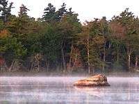
Fifteen per cent of the park is covered by lakes. Evidence of the Last Glacial Period include drumlins, erratics, and eskers.[22] Major rivers include the Mersey, and the Shelburne, major lakes include Kejimikujik, and Luxton.
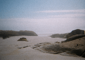
Kejimujik National Park Seaside includes white sandy beaches and coastal wetland areas.
Climate
The park has a humid continental climate (Köppen climate classification Dfb) with four distinct seasons. Being located inland, in the western part of Nova Scotia, the park has warmer temperatures and higher precipitation than eastern sections of Nova Scotia.[23] Winters are cold with a January average of −6.1 °C (21.0 °F). During this time of the year, the maximum temperature often stays below freezing although frequent mild spells push maximum temperatures above freezing frequently (about 12–19 days from December to February) and occasionally above 10 °C (50.0 °F) when the wind is from the southwest.[23] On average, there are 8 days where the temperature falls below −20 °C (−4.0 °F).[24] Winters are characterized by stretches of unsettled weather, resulting in high precipitation and cloud cover.[23] Snowfall is high, averaging 244 centimetres (96.1 in) a year.
Summers are warm with a July average of 18.4 °C (65.1 °F) and precipitation is lower (though significant) than the winter months. Temperatures in the park rarely exceed 30 °C (86.0 °F), occurring on 2 days per year owing to the moderating influence of the ocean.[23] Spring and fall are transitional seasons that feature mild temperature although they are unpredictable. The park receives 1,399 millimetres (55 in) of precipitation per year, which is fairly evenly distributed throughout the year.
| Climate data for Kejimkujik National Park, 1981–2010 normals, extremes 1966–2017 | |||||||||||||
|---|---|---|---|---|---|---|---|---|---|---|---|---|---|
| Month | Jan | Feb | Mar | Apr | May | Jun | Jul | Aug | Sep | Oct | Nov | Dec | Year |
| Average high °C (°F) | −0.4 (31.3) |
0.7 (33.3) |
4.7 (40.5) |
10.2 (50.4) |
17.1 (62.8) |
22.5 (72.5) |
25.6 (78.1) |
25.0 (77.0) |
20.8 (69.4) |
14.0 (57.2) |
8.3 (46.9) |
2.8 (37.0) |
12.6 (54.7) |
| Daily mean °C (°F) | −5.0 (23.0) |
−4.2 (24.4) |
−0.1 (31.8) |
5.0 (41.0) |
11.1 (52.0) |
16.4 (61.5) |
19.7 (67.5) |
19.1 (66.4) |
15.1 (59.2) |
8.9 (48.0) |
4.2 (39.6) |
−1.2 (29.8) |
7.4 (45.3) |
| Average low °C (°F) | −9.5 (14.9) |
−9.0 (15.8) |
−4.9 (23.2) |
−0.2 (31.6) |
5.1 (41.2) |
10.2 (50.4) |
13.9 (57.0) |
13.0 (55.4) |
9.5 (49.1) |
3.7 (38.7) |
0.1 (32.2) |
−5.0 (23.0) |
2.2 (36.0) |
| Average rainfall mm (inches) | 76.0 (2.99) |
55.0 (2.17) |
89.7 (3.53) |
103.3 (4.07) |
99.8 (3.93) |
96.2 (3.79) |
103.6 (4.08) |
87.0 (3.43) |
93.0 (3.66) |
109.9 (4.33) |
136.3 (5.37) |
105.5 (4.15) |
1,155.4 (45.49) |
| Average snowfall cm (inches) | 71.7 (28.2) |
53.4 (21.0) |
39.1 (15.4) |
12.9 (5.1) |
0.7 (0.3) |
0.0 (0.0) |
0.0 (0.0) |
0.0 (0.0) |
0.0 (0.0) |
2.3 (0.9) |
12.3 (4.8) |
51.2 (20.2) |
243.7 (95.9) |
| Average rainy days (≥ 0.2 mm) | 6.5 | 5.1 | 8.8 | 10.7 | 12.5 | 11.5 | 10.5 | 9.9 | 9.7 | 12.4 | 12.5 | 8.5 | 118.5 |
| Average snowy days (≥ 0.2 cm) | 10.6 | 8.4 | 5.8 | 2.1 | 0.13 | 0.0 | 0.0 | 0.0 | 0.0 | 0.13 | 2.0 | 8.3 | 37.4 |
| Source: Environment Canada[25] | |||||||||||||
See also
- List of National Parks of Canada
- List of parks in Nova Scotia
References
- "Parks Canada Attendance 2017-18" (PDF). Parks Canada. Government of Canada. Retrieved 21 March 2019.
- Parks Canada (2017-07-26). Parks Can Can Canada 2017. Retrieved 2019-05-19.
- Kejimkujik. Canadian Register of Historic Places. Retrieved 10 March 2013.
- "Kejimkujik National Park and National Historic Site". Parks Canada. Retrieved 21 March 2019.
- "N.S. national park named night sky preserve". CBC. Retrieved 22 March 2019.
- "Kejimkujik National Park and National Historic Site". Retrieved 22 March 2019.
- Cave, Beverley. "The Petroglyphs of Kejimkujik National Park Nova Scotia: A fresh perspective on their physical and cultural contexts" (PDF). Memorial University of Newfoundland. Retrieved 22 March 2019.
- "The Tent Dwellers by Albert Bigelow Paine". Project Gutenberg. Retrieved 21 March 2019.
- McPhee, John. "Main Kejimkujik campground to close for season". Truro News. Retrieved 22 March 2019.
- Crowell, Bill (April 2008). The artist & the colonel: The story of Mabel Killam Day and Frank Parker Day. Glen Margaret Publishing. p. 142. ISBN 978-1-897462-03-4.
- "Kejimkujik National Park". Retrieved 22 March 2019.
- "New England-Acadian forests". WWF. Retrieved 22 March 2019.
- Finkelstein, Maxwell. "Kejimkujik National Park and National Historic Site". The Canadian Encyclopedia. Retrieved 22 March 2019.
- Wood, Thomas. "The Recent Mammals of Kejimkujik National Park" (PDF). Canadian WiIldlife Service. Retrieved 22 March 2019.
- "10 COMMON BIRD-SIGHTINGS IN KEJIMKUJIK NATIONAL PARK, NOVA SCOTIA". Canadian Living. Retrieved 22 March 2019.
- Cowley, Jim. "Dreaded invasive fish makes its way into Kejimkujik Park". CBC. Retrieved 22 March 2019.
- "rotecting species". Retrieved 22 March 2019.
- "Fishing for Answers" (PDF). Government of Canada. Retrieved 22 March 2019.
- "Kejimkujik National Park mercury source still a mystery". CBC News. 20 August 2014. Retrieved 21 August 2014.
- "Fish consumption advisory". Government of Nova Scotia. Retrieved 22 March 2019.
- "Research at Kejimkujik". Government of Canada. Retrieved 22 March 2019.
- "Kejimkujik National Park and National Historic Site Geology". Parks Canada. Retrieved 21 March 2019.
- "Nova Scotia's Climate" (PDF). Natural History of Nova Scotia, Volume 1. Nova Scotia Museum of Natural History. Archived from the original (PDF) on November 13, 2013. Retrieved May 10, 2013.
- "Kejimkujik Park, Nova Scotia". Canadian Climate Normals 1971–2000 (in English and French). Environment Canada. Retrieved May 10, 2013.
- "Daily Data Report for February 2017". Canadian Climate Data. Environment Canada. Climate ID: 8202592. Retrieved 26 February 2017.
External links
| Wikimedia Commons has media related to Kejimkujik National Park. |
| National Parks |
|
|---|---|
| Marine Conservation Areas | |
| National Landmarks | |
| |
| Provinces | |
|---|---|
| Territories | |
| Other countries | |
| |
| Authority control |
|
|---|