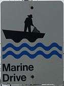
Marine Drive (Nova Scotia)
The Marine Drive is a designated scenic route along Nova Scotia's Eastern Shore. It closely follows the coast of the Atlantic Ocean and the Strait of Canso from the Canso Causeway to the junction of Route 322 and Highway 111 in Dartmouth.[2]
| |
|---|---|
| Route information | |
| Length | 414 km[1] (257 mi) 16 km (10 mi) spur to Canso |
| Component highways | |
| Major junctions | |
| West end | Dartmouth |
| East end | |
| Location | |
| Counties | Halifax Regional Municipality, Guysborough County |
| Highway system | |
| Provincial highways in Nova Scotia 100-series | |
List of Highways
Jeddore Oyster Ponds
List of Communities
West Chezzetcook
Ecum Secum
- Upper Lawrencetown
- West Lawrencetown
- East Lawrencetown
- Three Fathom Harbour
- Seaforth
- Grand Desert
- West Chezzetcook
— Trunk 7
- Porters Lake
- Head of Chezzetcook
- Gaetz Brook
- Musquodoboit Harbour
- Smiths Settlement
- Jeddore
- Salmon River Bridge
- Oyster Pond
- Lake Charlotte
- Beech Hill
- Ship Harbour
- East Ship Harbour
- Murphy Cove
- Pleasant Harbour
- Tangier
- Popes Harbour
- Spry Harbour
- Spry Bay
- Mushaboom
- Sheet Harbour
- Watt Section
- Beaver Harbour
- Port Dufferin
- West Quoddy
- East Quoddy
- Harrigan Cove
- Moosehead
- Moser River
- Necum Teuch
- Ecum Secum
- Marie Joseph
- Liscomb Mills
- Spanish Ship Bay
- Liscomb
- Goldenville
- Sherbrooke
- Stillwater
- Jordanville
- Indian Harbour Lake
- Port Hilford
- Harpellville
- Port Bickerton
- Isaac's Harbour North
- Goldboro
- Drum Head
- Seal Harbour
- Coddle's Harbour
- New Harbour West
- New Harbour East
- Tor Bay
- Larry's River
- Charlos Cove
- Cole Harbour
- Port Felix
- Whitehead
— Trunk 16
- Canso
- Hazel Hill
- Fox Island Main
- Half Island Cove
- Philips Harbour
- Queensport
- Halfway Cove
- Guysborough
- Boylston
- Manchester
- Port Shoreham
- Manassette Lake
- St. Francis Harbour
- Hadleyville
- Sand Point
- Middle Melford
- Steep Creek
- Pirate Harbour
- Mulgrave
- Auld's Cove
Parks
- Port Shoreham Beach Provincial Park
- Boylston Provincial Park
- Tor Bay Provincial Park
- Salsman Provincial Park
- Sherbrooke Provincial Park
- Marie Joseph Provincial Park
- Taylor Head Provincial Park
- Spry Bay Provincial Park
- Clam Harbour Beach Provincial Park
- Martinique Beach Provincial Park
- Porters Lake Provincial Park
- Lawrencetown Beach Provincial Park
- Rainbow Haven Beach Provincial Park
- McNabs and Lawlor's Island Provincial Park
- Bissett Road Trail
- Cole Harbour -Lawrencetown Coastal Heritage Park System
- Moser River Interpretive Trail
- Musquodoboit Trail System
- Moser River Seaside Park
- Tangier Grand Lake Wilderness Area
- West River Sheet Harbour Picnic Park
- McCormick's Beach
Museums
- Sherbrooke Village Miners Museum
- Fisherman’s Life Museum
- Musquodoboit Harbour Railway Museum
- Cole Harbour Heritage Farm Museum
- Old Hall Wilderness Heritage Centre
- The Old Courthouse Museum
- MacPhee House Museum
References
- Google (April 24, 2020). "Marine Drive" (Map). Google Maps. Google. Retrieved April 24, 2020.
- Scenic Roadways Locator Map (PDF) (Map). 1:1,100,000. Province of Nova Scotia. 2019.
This article is issued from Wikipedia. The text is licensed under Creative Commons - Attribution - Sharealike. Additional terms may apply for the media files.