List of Massachusetts state parks
This list of Massachusetts State Parks contains the state parks and recreation areas in the Commonwealth of Massachusetts managed by the Massachusetts Department of Conservation and Recreation as of 2015.[1]
The Bureau of State Parks and Recreation division of Department of Conservation and Recreation (Massachusetts) (DCR) is responsible for the maintenance and management of over 450,000 acres (1,820 sq km) of privately and state-owned forests and parks, nearly 10% of the Commonwealth's total land mass. Within the lands managed by the Bureau of State Parks and Recreation are some 29 campgrounds, over 2,000 miles (3,200 km) of trails, 87 beaches, 37 swimming, wading, and spray pools, 62 playgrounds, 55 ballfields, and 145 miles (233 km) of paved bike and rail trails.
DCR's Bureau of Urban Parks and Recreation manages the Metropolitan Park System of Greater Boston, the components of which are included in this list.
State parks
| Name | County | Area[2] | Estab- lished |
River / lake / other | Image | Remarks | |
|---|---|---|---|---|---|---|---|
| acres | ha | ||||||
| Alewife Brook Reservation | Middlesex 42°23′48″N 71°8′38″W | 136 acres | 55 ha | Little Pond, Little River, Alewife Brook | 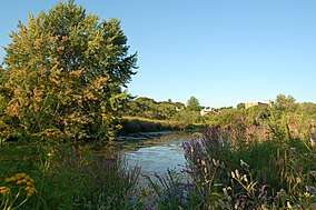 | A major portion of the Alewife Reservation is designated wetland. The Reservation is located at the end of the Minuteman Bike Path in Arlington | |
| Ames Nowell State Park | Plymouth 42°7′12.8994″N 70°59′13.632″W | 612 acres | 248 ha | Cleveland Pond |  | The park is primarily used for boating and fishing. | |
| Ashland State Park | Middlesex 42°14′30″N 71°27′58″W | 472 acres | 191 ha | Ashland Reservoir |  | ||
| Bash Bish Falls State Park | Berkshire 42°06′53″N 73°29′34″W | 424 acres | 172 ha | Bash Bish Falls |  | Massachusetts' highest single-drop waterfall lies within the park borders. | |
| Beartown State Forest | Berkshire 42°14′00″N 73°16′28″W | 120 acres | 49 ha | Benedict Pond |  | Approximately 7.5 miles (12.1 km) of the Appalachian Trail travels through the forest. | |
| Beaver Brook Reservation | Middlesex 42°23′26″N 71°11′52″W | 303 acres | 123 ha |  | The park includes a cascading waterfall and a wading pool. | ||
| Belle Isle Marsh Reservation | Suffolk 42°23′21″N 70°59′21″W | 188 acres | 76 ha | Belle Isle Marsh |  | The reservation includes landscaped pathways, benches, and an observation tower. A portion of the Boston Harborwalk runs through the reservation. | |
| Blackstone River and Canal Heritage State Park | Worcester 42°05′40″N 71°37′23″W | 1,066 acres | 431 ha | Blackstone River |  | The park is the midpoint of the Blackstone River Valley National Heritage Corridor of the National Park System. | |
| Blue Hills Reservation | Norfolk 42°12′40″N 71°7′40″W | 6,165 acres | 2,495 ha | Houghton's Pond, Ponkapoag Pond |  | The reservation has the distinction of being the largest conservation land within a major metropolitan area. | |
| Borderland State Park | Bristol, Norfolk 42°4′3″N 71°9′13″W | 1,843 acres | 746 ha | 1971 |  | On National Register of Historic Places | |
| Boston Harbor Islands State Park | Norfolk, Plymouth, Suffolk 42°19′11.6″N 70°55′45.6″W | 404 acres | 163 ha | 1996 | Boston Harbor |  | |
| Bradley Palmer State Park | Essex 42°38′0″N 70°53′43″W | 736 acres | 298 ha | Ipswich River |  | The park that features rolling meadows, lush evergreens and old carriage roads lined with rhododendrons. | |
| Breakheart Reservation | Essex, Middlesex 42°29′21″N 71°2′23″W | 652 acres | 264 ha | Silver Lake, Pearce Lake, Saugus River |  | The reservation is hardwood forest principally used for birding, fishing and hiking. | |
| Brimfield State Forest | Hampden 42°6′0″N 72°14′56″W | 3,523 acres | 1,426 ha | Dean Pond |  | ||
| Bristol Blake State Reservation | Norfolk 42°6′28.6″N 71°19′5″W | 140 acres | 57 ha | Adjacent to Stony Brook Wildlife Sanctuary | |||
| Brook Farm Historic Site | Suffolk 42°17′29″N 71°10′26.7″W | 141 acres | 57 ha | 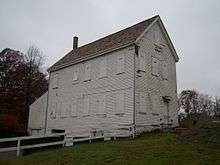 | |||
| C. M. Gardner State Park | Hampden 42°16′31″N 72°52′14.5″W | 85 acres | 34 ha | Westfield River |  | ||
| Callahan State Park | Middlesex 42°20′35″N 71°26′55″W | 958 acres | 388 ha | 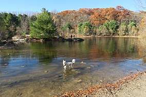 | |||
| Camp Nihan Environmental Education Camp | Essex 42°29′32.6″N 71°1′11.4″W | 65 acres | 26 ha | 1929 | Saugus River | Part of Breakheart Reservation | |
| Castle Island | Suffolk 42°20′15″N 71°0′38″W | 22 acres | 8.9 ha | Boston Harbor | _-_DSC00727.JPG) | The present fort, built between 1834 and 1851, is the eighth generation of forts and it is one of the oldest fortified sites in British North America. | |
| Charles River Reservation | Suffolk, Middlesex 42°21′20″N 71°6′56″W | 863 acres | 349 ha | Charles River |  | Includes Charles River Dam, Charles River Basin and Esplanade, John F. Kennedy Park, and Teddy Ebersol’s Red Sox Fields. Covers Charles River below Watertown Dam; see also Upper Charles River Reservation | |
| Chester-Blandford State Forest | Hampden 42°14′58″N 72°56′58″W | 2,776 acres | 1,123 ha | ||||
| Chestnut Hill Reservation | Suffolk 42°20′7″N 71°9′29″W | 1 acre | 0.40 ha | 1870 | Chestnut Hill Reservoir |  | The Chestnut Hill Reservoir Historic District is considered a nineteenth-century masterpiece of engineering, urban planning and landscape design. |
| Chicopee Memorial State Park | Hampden 42°10′45″N 72°32′13″W | 562 acres | 227 ha | Cooley Brook Reservoir | The park includes two 25-acre (10 ha) ponds. | ||
| Clarksburg State Park | Berkshire 42°44′5″N 73°4′35″W | 3,629 acres | 1,469 ha | Mauserts Pond |  | Adjoins 3,011 acre Clarksburg State Forest | |
| Cochituate State Park | Middlesex 42°18′45″N 71°22′27″W | 872 acres | 353 ha | Lake Cochituate |  | ||
| Connecticut River Greenway State Park | Franklin, Hampden, Hampshire 42°36′27″N 72°32′30″W | 1,048 acres | 424 ha | Connecticut River |  | Multiple state land holdings in the Pioneer Valley of Western Massachusetts | |
| Constitution Beach | Suffolk 42°23′5.5″N 71°0′36.2″W | 82 acres | 33 ha | Boston Harbor |  | ||
| Cutler Park Reservation | Norfolk 42°16′16″N 71°11′45″W | 739 acres | 299 ha | Charles River |  | It contains the largest remaining fresh water marsh on the middle Charles, and includes a boardwalk through a cattail marsh out onto an island. | |
| D.A.R. State Forest | Hampshire 42°27′25″N 72°47′50″W | 1,728 acres | 699 ha | 1929 | Upper and Lower Highland Lake |  | |
| Demarest Lloyd State Park | Bristol 41°31′44″N 70°59′0″W | 200 acres | 81 ha | Buzzards Bay | |||
| Dighton Rock State Park | Bristol 41°48′46″N 71°6′23″W | 98 acres | 40 ha | Taunton River |  | Dighton Rock is an 11-foot (3.4 m) high glacial erratic covered with petroglyphs and has since been moved to a museum at the park. | |
| Dorchester Shores Reservation | Suffolk 42°17′50″N 71°2′44″W | 44 acres | 18 ha | Neponset River | The reservation comprises two beaches and a park. | ||
| Douglas State Forest | Worcester 42°3′30″N 71°47′13″W | 5,525 acres | 2,236 ha | Wallum Lake |  | Features include a rare Atlantic White Cedar swamp and 7.8 miles (12.6 km) of the Midstate Trail | |
| Dunn State Park | Worcester 42°34′48″N 71°58′12″W | 132 acres | 53 ha | Dunn Pond |  | ||
| Ellisville Harbor State Park | Plymouth 41°50′34″N 70°32′13″W | 97 acres | 39 ha | Cape Cod Bay |  | Walking trails overlooking a tidal marsh, sandy/rocky beach at trail end | |
| Elm Bank Reservation | Norfolk 42°16′34″N 71°18′9″W | 175 acres | 71 ha | c. 1996 | Charles River |  | Benjamin Pierce Cheney's property, now run by Massachusetts Horticultural Society |
| Erving State Forest | Franklin 42°37′21″N 72°22′41″W | 2,422 acres | 980 ha | Millers River | 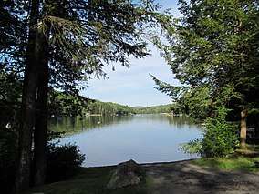 | The 110-mile (180 km) Metacomet-Monadnock Trail passes through a western parcel of the state forest. | |
| F. Gilbert Hills State Forest | Norfolk 42°3′28″N 71°17′0″W | 1,030 acres | 420 ha | 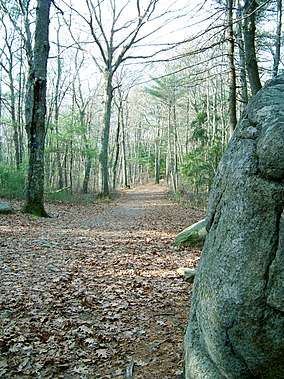 | |||
| Fall River Heritage State Park | Bristol 41°42′20″N 71°9′38″W | 14 acres | 5.7 ha | Taunton River |  | ||
| Federated Women's Club State Forest | Worcester 42°29′27″N 72°15′15″W | 970 acres | 390 ha | Fever Brook |  | ||
| Fort Phoenix State Reservation | Bristol 41°37′27″N 70°53′56″W | 1 acre | 0.40 ha | Atlantic Ocean |  | Revolutionary War fort; 1/2 mile of Buzzards Bay beachfront | |
| Fort Revere Park | Plymouth 42°18′17″N 70°54′21″W | 6 acres | 2.4 ha | Atlantic Ocean | 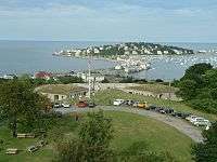 | On Telegraph Hill in Hull, Massachusetts. Remnants of two seacoast fortifications, water tower with observation deck, military history museum and picnic facilities | |
| Francis D. Martini Memorial Shell Park and Moynihan Recreation Area | Suffolk 42°14′36″N 71°7′37″W | 5.6 acres | 2.3 ha | Neponset River | Outdoor theatre and play fields | ||
| Freetown-Fall River State Forest | Bristol 41°45′28″N 71°3′48″W | 5,217 acres | 2,111 ha | 1930 |  | The park includes Profile Rock, a granite outcropping which local Native Americans believe to be the image of Chief Massasoit. Also in the forest is a 227-acre (92 ha) Wampanoag reservation | |
| Gardner Heritage State Park | Worcester 42°34′38″N 71°59′39″W | 0 acres | 0 ha | 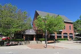 | Restored 19th century fire station with exhibits; closed | ||
| Georgetown-Rowley State Forest | Essex 42°42′5″N 70°58′26″W | 1,041 acres | 421 ha | ||||
| Granville State Forest | Hampden 42°3′35″N 72°58′17″W | 2,432 acres | 984 ha | Hubbard River |  | ||
| Great Brook Farm State Park | Middlesex 42°33′21″N 71°21′12″W | 909 acres | 368 ha | Meadow Pond |  | ||
| Greycourt State Park | Essex 42°43′46″N 71°10′51″W | 24 acres | 9.7 ha | 2001 |  | The park is built atop the restored ruins of the Charles H. Tenney estate. | |
| Halibut Point State Park | Essex 42°41′22″N 70°37′59″W | 55 acres | 22 ha |  | Features a former granite quarry and 60-foot (18 m) tower with coastal views | ||
| Hammond Pond Reservation | Middlesex 42°19′30″N 71°10′36″W | 59 acres | 24 ha |  | |||
| Hampton Ponds State Park | Hampden 42°10′45″N 72°41′22″W | 47 acres | 19 ha | Pequot Pond |  | ||
| Harold Parker State Forest | Essex 42°37′33″N 71°4′54″W | 3,320 acres | 1,340 ha | Stearns Pond |  | ||
| Hemlock Gorge Reservation | Middlesex 42°18′52″N 71°13′35″W | 16 acres | 6.5 ha | Charles River | 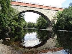 | ||
| Holyoke Heritage State Park | Hampden 42°12′18″N 72°36′26″W | 7 acres | 2.8 ha | 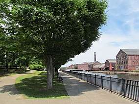 | The park features include a visitor center with exhibits about paper manufacturing and Holyoke's industrial and cultural history. | ||
| Hopkinton State Park | Middlesex 42°14′57″N 71°31′32″W | 1,245 acres | 504 ha | Hopkinton Reservoir |  | The park features a bathing pond for swimming that is physically separated from the reservoir, where nonmotorized boating is permitted | |
| Horseneck Beach State Reservation | Bristol 41°30′28″N 71°2′55″W | 815 acres | 330 ha |  | Popular for its two-mile (3 km) long sandy beach on the shore of Buzzards Bay. Also camping, fishing and a salt marsh. | ||
| Jug End State Reservation and Wildlife Management Area | Berkshire | 1,191 acres | 482 ha |  | |||
| Kenneth Dubuque Memorial State Forest | Franklin | 7,405 acres | 2,997 ha | 1997 | Hallockville Pond, Crooked Pond | ||
| Lake Dennison Recreation Area | Worcester | 121 acres | 49 ha | Lake Dennison | The park is an extension of Otter River State Forest | ||
| Lake Lorraine State Park | Hampden | 3 acres | 1.2 ha | ||||
| Lake Wyola State Park | Franklin | 42 acres | 17 ha | Lake Wyola |  | ||
| Lawrence Heritage State Park | Essex | 0 acres | 0 ha |  | |||
| Leominster State Forest | Worcester | 4,246 acres | 1,718 ha |  | The Midstate Trail runs through the western edge of the forest. | ||
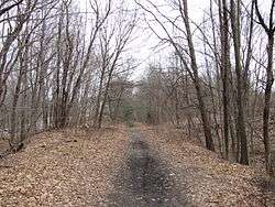
| Lowell-Dracut-Tyngsboro State Forest | Middlesex | 1,109 acres | 449 ha | ||||
| Lowell Heritage State Park | Middlesex | 60 acres | 24 ha | 1975 | Merrimack River |  | Precursor to Lowell National Historical Park; preserves the city's seminal role in the American Industrial Revolution |
| Lynn Heritage State Park | Essex | 4 acres | 1.6 ha |  | |||
| Lynn Shore Reservation | Essex | 22 acres | 8.9 ha |  | |||
| Manuel F. Correllus State Forest | Dukes | 5,215 acres | 2,110 ha | 1908 | Little Pond | In the interior of Martha's Vineyard, the park is the focus of one of the largest environmental restoration projects in the country. | |
| Massasoit State Park | Bristol | 1,207 acres | 488 ha | Lake Rico, Furnace Pond, King's Pond, Middle Pond, Little Bearhole Pond, and Big Bearhole Pond |  | ||
| Maudslay State Park | Essex | 483 acres | 195 ha | Merrimack River |  | ||
| Middlesex Fells Reservation | Middlesex | 2,283 acres | 924 ha | Bellevue and Spot Ponds | |||
| Mohawk Trail State Forest | Franklin | 7,758 acres | 3,140 ha | Includes Cold River Virgin Forest, National Natural Landmark | |||
| Monroe State Forest | Franklin | 3,750 acres | 1,520 ha | Dunbar Brook | |||
| Moore State Park | Worcester | 737 acres | 298 ha | Eames Pond | 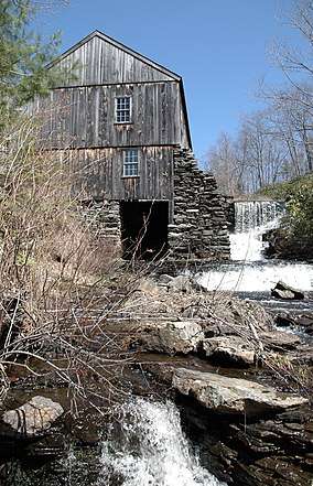 | ||
| Mount Everett State Reservation | Berkshire | 2,492 acres | 1,008 ha | Guilder Pond | 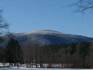 | ||
| Mount Grace State Forest | Franklin | 1,578 acres | 639 ha | ||||
| Mount Greylock State Reservation | Berkshire | 12,455 acres | 5,040 ha | 1898 | 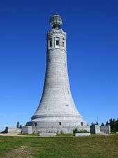 | ||
| Mount Holyoke Range State Park | Hampshire | 3,000 acres | 1,200 ha | 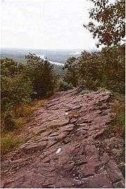 | |||
| Mount Sugarloaf State Reservation | Franklin | 533 acres | 216 ha | 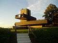 | |||
| Mount Tom State Reservation | Hampden | 1,967 acres | 796 ha |  | |||
| Mount Washington State Forest | Berkshire | 4,619 acres | 1,869 ha | ||||
| Myles Standish Monument State Reservation | Plymouth | 30 acres | 12 ha | 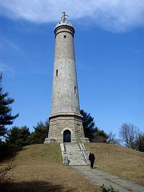 | A 120-foot (37 m) tower with 125 steps that overlooks Plymouth Harbor and Duxbury Beach. | ||
| Myles Standish State Forest | Plymouth | 12,029 acres | 4,868 ha |  | Pitch pine and scrub oak forest with sixteen ponds for fishing, canoeing, swimming. Camping on four of the ponds, bicycle trails, equestrian trails, and horse camping. | ||
| Mystic River Reservation | Middlesex | 359 acres | 145 ha | 1893 | Mystic Lakes; Mystic River |  | |
| Nahant Beach Reservation | Essex | 67 acres | 27 ha | Atlantic Ocean |  | ||
| Nantasket Beach Reservation | Plymouth | 39 acres | 16 ha | ||||
| Nasketucket Bay State Reservation | Plymouth | 210 acres | 85 ha | 1999 |  | ||
| Natural Bridge State Park | Berkshire | 44 acres | 18 ha | Hudson Brook | It contains the only natural white marble arch/bridge in North America. The natural bridge spanning Hudson Brook, was formed by glacial melt about 11,000 BC, from 550 million year old bedrock. | ||
| Neponset River Reservation | Suffolk | 1,880 acres | 760 ha | ||||
| Nickerson State Park | Barnstable | 1,967 acres | 796 ha | Cliff Pond |  | ||
| October Mountain State Forest | Berkshire | 16,460 acres | 6,660 ha | ||||
| Otter River State Forest | Worcester | 1,022 acres | 414 ha | 1915 | Otter River, Millers River | ||
| Pearl Hill State Park | Middlesex | 1,000 acres | 400 ha | Park Hill Brook |  | ||
| Pilgrim Memorial State Park | Plymouth | 6 acres | 2.4 ha | Site of Plymouth Rock | |||
| Pittsfield State Forest | Berkshire | 10,601 acres | 4,290 ha | ||||
| Pope John Paul II Park Reservation | Suffolk | 66 acres | 27 ha | 2001 | Neponset River Estuary |  | Reclaimed former landfill and commercial area |
| Purgatory Chasm State Reservation | Worcester | 100 acres | 40 ha | 1919 |  | The Chasm was created when glacial meltwater from a burst ice dam ripped out blocks of bedrock at the end of the last Ice Age (14,000 years ago). | |
| Quabbin Reservoir | Hampshire | 39 sq mi | 100 km2 |  | |||
| Quincy Quarries Reservation | Norfolk | 22 acres | 8.9 ha | 1985 |  | ||
| Quincy Shores Reservation | Norfolk | 87 acres | 35 ha |  | |||
| Quinsigamond State Park | Worcester | 38 acres | 15 ha | ||||
| Revere Beach Reservation | Suffolk | 84 acres | 34 ha | 1896 |  | ||
| Robinson State Park | Hampden | 1,025 acres | 415 ha | Westfield River |  | ||
| Roxbury Heritage State Park | Suffolk | 3 acres | 1.2 ha |  | The 1750 Dillaway-Thomas House and a small park | ||
| Rumney Marsh Reservation | Essex, Suffolk | 815 acres | 330 ha | Saugus River; Pines River |  | ||
| Rutland State Park | Worcester | 284 acres | 115 ha | Whitehall Pond | Swimming, picnicking and boating. | ||
| Salisbury Beach State Reservation | Essex | 355 acres | 144 ha |  | The park's main feature is its 3.8-mile (6.1 km)-long beach, one of the most popular in the Commonwealth. | ||
| Sandisfield State Forest | Berkshire | 4,190 acres | 1,700 ha | York Lake |  | ||
| Sandy Point State Reservation | Essex | 134 acres | 54 ha |  | |||
| Savoy Mountain State Forest | Berkshire | 10,457 acres | 4,232 ha | ||||
| Scusset Beach State Reservation | Barnstable | 459 acres | 186 ha |  | On Cape Cod Bay at the east end of the Cape Cod Canal, a popular swimming and camping area. | ||
| Shawme-Crowell State Forest | Barnstable | 624 acres | 253 ha |  | Forested 285 site campground | ||
| J.A. Skinner State Park | Hampshire | 843 acres | 341 ha | Connecticut River |  | ||
| South Cape Beach State Park | Barnstable | 460 acres | 190 ha |  | A component of the Waquoit Bay National Estuarine Research Reserve with a one-mile (1.6 km) stretch of beach. | ||
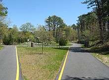
| Southwest Corridor Park | Suffolk | 221 acres | 89 ha |  | Greenway of 4.7 miles (7.6 km) that runs South End, Back Bay, Roxbury and Jamaica Plain neighborhoods | ||
| Spencer State Forest | Worcester | 903 acres | 365 ha | Howe Pond |  | ||
| Squantum Point Park | Norfolk | 46 acres | 19 ha | 2001 | 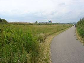 | ||
| Stony Brook Reservation | Suffolk | 616 acres | 249 ha | Turtle Pond | |||
| Streeter Point Recreation Area | Worcester | 1 acre | 0.40 ha | East Brimfield Reservoir | Fishing, swimming, picnicking | ||
| Sudbury Reservoir | Middlesex; Worcester | 4,943 acres | 2,000 ha | Sudbury Reservoir |  | ||
| Tolland State Forest | Berkshire | 4,415 acres | 1,787 ha | Otis Reservoir | |||
| Upper Charles River Reservation | Middlesex, Norfolk, Suffolk | 863 acres | 349 ha | Charles River | _-_DSC09456.JPG) | Covers Charles River between Watertown Dam and Riverdale Park, West Roxbury; see also Charles River Reservation | |
| Upton State Forest | Worcester | 2,790 acres | 1,130 ha | 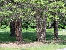 | Has Civilian Conservation Corps structures | ||
| Wachusett Mountain State Reservation | Worcester | 2,288 acres | 926 ha | 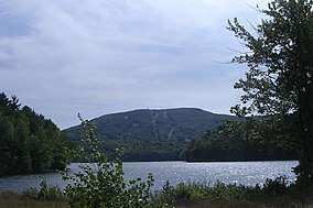 | |||
| Wachusett Reservoir | Worcester | 4,135 acres | 1,673 ha | Nashua River; Quinapoxet River |  | ||
| Wahconah Falls State Park | Berkshire | 48 acres | 19 ha | Wahconah Falls Brook | |||
| Walden Pond State Reservation | Middlesex | 335 acres | 136 ha | 1922 | Walden Pond | 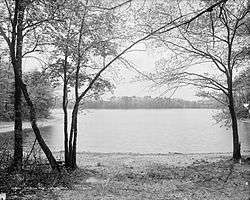 | |
| Waquoit Bay National Estuarine Research Reserve | Barnstable | 110 acres | 45 ha | Waquoit Bay; Quashnet River; Childs River; ponds |  | ||
| Ware River Watershed Area | Worcester | 23,000 acres | 9,300 ha | ||||
| Watson Pond State Park | Bristol | 163 acres | 66 ha |  | |||
| Webb Memorial State Park | Norfolk | 59 acres | 24 ha | 1980 | Hingham Bay |  | |
| Wells State Park | Worcester | 1,445 acres | 585 ha | Walker Pond | |||
| Wendell State Forest | Franklin | 8,000 acres | 3,200 ha | Millers River, Quabbin Reservoir | |||
| Western Gateway Heritage State Park | Berkshire | 8 acres | 3.2 ha |  | |||
| Weymouth Back River Reservation | Norfolk | 35 acres | 14 ha |  | Site of Stodder's Neck and Abigail Adams Park | ||
| Whitehall State Park | Middlesex | 837 acres | 339 ha | Whitehall Reservoir | |||
| Willard Brook State Forest | Middlesex | 2,929 acres | 1,185 ha |  | |||
| Willowdale State Forest | Essex | 2,491 acres | 1,008 ha | Hood Pond |  | ||
| Wilson Mountain Reservation | Norfolk | 215 acres | 87 ha | 1995 |  | ||
| Windsor State Forest | Berkshire | 1,824 acres | 738 ha | Westfield River | |||
| Winthrop Shore Reservation | Suffolk | 18 acres | 7.3 ha | Atlantic Ocean | 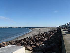 | ||
| Wompatuck State Park | Plymouth | 3,579 acres | 1,448 ha | 1967 | Aaron River Reservoir | .jpg) | |
State trails


Other trails
| Name | Towns | County | Length | Estab- lished |
Image | Remarks | |
|---|---|---|---|---|---|---|---|
| mi | km | ||||||
| Appalachian Trail | Great Barrington, Dalton, Cheshire, North Adams, Williamstown | Berkshire | 90 mi | 140 km | 1923 | 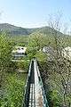 |
Part of 2200-mile East Coast foot trail; maintained by the Berkshire Chapter of the Appalachian Mountain Club |
References
- "Massachusetts State Parks". MassParks. Executive Office of Energy and Environmental Affairs. Retrieved August 6, 2015.
- "2012 Acreage Listing" (PDF). Department of Conservation and Recreation. April 2012. Retrieved August 6, 2015.
External links

| |||||||||||||||||
| |||||||||||||||||
| |||||||||||||||||
| |||||||||||||||||
| |||||||||||||||||
| |||||||||||||||||
| |||||||||||||||||
| |||||||||||||||||