Rio Linda, California
Rio Linda is a census-designated place (CDP) in Sacramento County, California, United States. It is part of the Sacramento–Arden-Arcade–Roseville Metropolitan Statistical Area. As of the 2010 census, the CDP population was 15,106, up from 10,466 at the 2000 census.
Rio Linda | |
|---|---|
 | |
 Location in Sacramento County and the state of California | |
 Rio Linda Location in the United States | |
| Coordinates: 38°41′25″N 121°27′14″W | |
| Country | |
| State | |
| County | Sacramento |
| Area | |
| • Total | 9.904 sq mi (25.65 km2) |
| • Land | 9.904 sq mi (25.65 km2) |
| • Water | 0 sq mi (0 km2) 0% |
| Elevation | 56 ft (17 m) |
| Population (2010) | |
| • Total | 15,106 |
| • Density | 1,500/sq mi (590/km2) |
| Time zone | UTC-8 (PST) |
| • Summer (DST) | UTC-7 (PDT) |
| ZIP code | 95673 |
| Area code(s) | 916, 279 |
| FIPS code | 06-60942 |
| GNIS feature ID | 1659514 |
History
The Rio Linda/Elverta community is located on part of the Rancho Del Paso Mexican land grant of 1844. In 1910, a Fruit Land Company of Minneapolis acquired 12,000 acres (49 km2) of the Grant and in 1912 the area was subdivided. Renamed Rio Linda in 1913, it was known as 'Dry Creek Station', a flag stop for the Northern Electric Railroad. Two families settled in Rio Linda by 1912, three more arrived in 1913 and nine more in 1914. By 1918 approximately fifty families in the community, mostly of Scandinavian and German descent. By 1920 poultry farming had proved to be feasible in the area which was advertised throughout several Eastern states during the 1920s. An association was formed in 1942 as the area became well known for its excellent poultry production.[2]
Geography
Rio Linda is located at 38°41′25″N 121°27′14″W (38.690252, -121.453814).[3]
According to the United States Census Bureau, the CDP has a total area of 9.9 square miles (26 km2), all of it land.
Nature and Wildlife
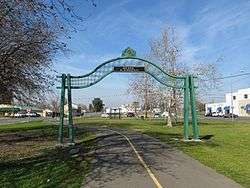
- Wild chickens are commonly spotted roaming neighborhoods. Gibson Ranch Park is 325 acres of pristine natural countryside. There is a dog park, children's playground, picnic area, walking trails and horse stables. The Sacramento Northern Bike Trail is a 10-mile long paved pathway that connects the Rio Linda area with Downtown Sacramento. The trail was constructed along an abandoned railroad right-of-way.[4]
- Depot Park in Rio Linda has a community center with commercial kitchen, playground, horseshoe pits, basketball court, tennis court, shuffleboard, parking lot, picnic areas and trail access.[5]
- Rio Linda Elverta Recreation and Park District is located at 810 Oak Lane. It is a rec center that offers aquatics, adult activities, youth activities and other classes to the local community.
- Rio Linda Airport
- There is a seed library in Rio Linda. A seed library is a collection of seeds that are available free of charge to all members of the community. Seed-savers are asked to bring some of theirs to these locations' Seed Libraries. With enough heirloom seed donations from the region, there will ultimately be a seed library containing plants ideally suited for Sacramento weather.
Demographics
2010
At the 2010 census Rio Linda had a population of 15,106. The population density was 1,525.3 people per square mile (588.9/km²). The racial makeup of Rio Linda was 11,654 (77.1%) White, 621 (4.1%) African American, 235 (1.6%) Native American, 665 (4.4%) Asian, 62 (0.4%) Pacific Islander, 1,304 (8.6%) from other races, and 821 (5.4%) from two or more races. Hispanic or Latino of any race were 3,033 persons (20.1%).[6]
The census reported that 15,053 people (99.6% of the population) lived in households, 53 (0.4%) lived in non-institutionalized group quarters, and no one was institutionalized.
There were 4,792 households, 1,944 (40.6%) had children under the age of 18 living in them, 2,532 (52.8%) were opposite-sex married couples living together, 753 (15.7%) had a female householder with no husband present, 345 (7.2%) had a male householder with no wife present. There were 343 (7.2%) unmarried opposite-sex partnerships, and 42 (0.9%) same-sex married couples or partnerships. 843 households (17.6%) were one person and 302 (6.3%) had someone living alone who was 65 or older. The average household size was 3.14. There were 3,630 families (75.8% of households); the average family size was 3.50.
The age distribution was 4,087 people (27.1%) under the age of 18, 1,434 people (9.5%) aged 18 to 24, 3,769 people (25.0%) aged 25 to 44, 4,251 people (28.1%) aged 45 to 64, and 1,565 people (10.4%) who were 65 or older. The median age was 35.9 years. For every 100 females, there were 101.0 males. For every 100 females age 18 and over, there were 98.5 males.
There were 5,129 housing units at an average density of 517.9 per square mile, of the occupied units 3,475 (72.5%) were owner-occupied and 1,317 (27.5%) were rented.The homeowner vacancy rate was 2.8%; the rental vacancy rate was 4.3%. 10,516 people (69.6% of the population) lived in owner-occupied housing units and 4,537 people (30.0%) lived in rental housing units.
2000
At the 2000 census there were 10,466 people, 3,461 households, and 2,647 families in the CDP. The population density was 1,911.2 people per square mile (737.4/km²). There were 3,596 housing units at an average density of 656.7 per square mile (253.4/km²). The racial makeup of the CDP was 83.04% White, 2.23% African American, 1.46% Native American, 2.69% Asian, 0.48% Pacific Islander, 4.88% from other races, and 5.22% from two or more races. Hispanic or Latino of any race were 11.10%.[7]
Of the 3,461 households 38.8% had children under the age of 18 living with them, 54.1% were married couples living together, 15.1% had a female householder with no husband present, and 23.5% were non-families. 17.8% of households were one person and 6.6% were one person aged 65 or older. The average household size was 3.01 and the average family size was 3.35.
The age distribution was 30.8% under the age of 18, 8.0% from 18 to 24, 30.2% from 25 to 44, 21.7% from 45 to 64, and 9.3% 65 or older. The median age was 34 years. For every 100 females, there were 98.7 males. For every 100 females age 18 and over, there were 95.6 males.
The median household income was $44,026 and the median family income was $45,272. Males had a median income of $38,178 versus $29,504 for females. The per capita income for the CDP was $17,656. About 9.9% of families and 14.1% of the population were below the poverty line, including 20.6% of those under age 18 and 10.3% of those age 65 or over.
Politics
In the California State Legislature, Rio Linda is in the 4th Senate District, represented by Republican Jim Nielsen, and in the 7th Assembly District, represented by Democrat Kevin McCarty.[8]
In the United States House of Representatives, Rio Linda is in California's 3rd congressional district, represented by Democrat John Garamendi.[9]
Conservative radio host and former Sacramento resident Rush Limbaugh frequently mentions Rio Linda, both on The Rush Limbaugh Show and in print.[10][11]
Sports and Recreation
Rio Linda is home to the Roy Hayer Memorial Race Track. This track is noted as the first track that four-time NASCAR champion Jeff Gordon ever competed on.[12]
Rio Linda hosts the northern terminus of the Sacramento Northern Bike Trail.
Education
- Orchard Elementary
- Dry Creek Elementary School
- West Side Elementary
- Heritage Peak Charter School
- Rio Linda High School
- Rio Linda Preparatory Academy
Library
- Rio Linda library has computers, and a children's area offers toys, puppets, and a small puppet theatre for the children, donated by the active Friends group. Windows look out over a playground and softball field. Entrance to the large parking lot is from 6th Street. The first library in Rio Linda opened on September 26, 1916. The library also features a Seed Library for sharing seeds.
Notable people
- Ken Ackerman, KFBK and KCBS radio announcer, grew up at 22nd and E Streets in Rio Linda
- Sheila Hudson, Triple-Jump record holder
- Bob Oliver, Professional Baseball player
- Darren Oliver, Professional Baseball player
- Chuck Quackenbush, former California Insurance Commissioner, lived in Rio Linda while in office
- Justin E. H. Smith, philosopher and author, lived in Rio Linda from 1974 to 1987
Places adjacent to Rio Linda, California | |
|---|---|
References
- "2010 Census U.S. Gazetteer Files – Places – California". United States Census Bureau.
- Buckland, Joyce (May 1, 2006). Rio Linda and Elverta (Images of America). Arcadia Publishing. pp. 7–8. ISBN 9780738531144. Retrieved 1 June 2015.
- "US Gazetteer files: 2010, 2000, and 1990". United States Census Bureau. 2011-02-12. Retrieved 2011-04-23.
- "Sacramento Northern Bike Trail, California - Walk Ride U.S.A." www.walkrideusa.com. Retrieved 2017-12-14.
- "Rio Linda Parks | Rio Linda, California". www.rleparks.com. Retrieved 2017-12-14.
- "2010 Census Interactive Population Search: CA - Rio Linda CDP". U.S. Census Bureau. Archived from the original on July 15, 2014. Retrieved July 12, 2014.
- "U.S. Census website". United States Census Bureau. Retrieved 2008-01-31.
- "Statewide Database". UC Regents. Retrieved February 1, 2015.
- "California's 3rd Congressional District - Representatives & District Map". Civic Impulse, LLC. Retrieved February 28, 2013.
- "Rio Linda Explained for Those in Rio Linda". Rush Limbaugh. November 30, 2007. Archived from the original on August 20, 2010. Retrieved 2010-09-04.
I love the people of Rio Linda and I want to make sure they understand what's being discussed on the program, so I always will change or expand certain words' definition so they are not left out. It's an act of true compassion by a broadcast specialist.
- Dwight Lang (February 2, 2010). "The Rio Lindas Rush Limbaugh never knew". AnnArbor.com. Retrieved 2011-11-28.
He routinely mocked Rio Linda for its white-trash, trailer park ways – cars up on blocks, laziness and unemployment all around – or so he thought.
- Caraviello, David (2007-06-23). "Only traces of past linger in Gordon's hometown in Cali". NASCAR.com. Retrieved 2007-12-21.
External links
- Rio Linda Online Independent News and Information for Rio Linda and Elverta.
- Rio Linda Online on Facebook The RioLindaOnline.com community on Facebook.
- Rio Linda Elverta Community Water District The Rio Linda Elverta Community Water District.
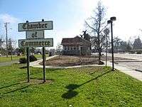
- Rio Linda Elverta Chamber of Commerce The Rio Linda Elverta Chamber of Commerce.
| Wikimedia Commons has media related to Rio Linda, California. |
Municipalities and communities of Sacramento County, California, United States | ||
|---|---|---|
| Cities | 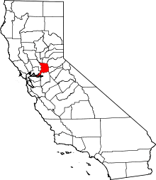 Sacramento County map | |
| CDPs | ||
| Unincorporated communities | ||
| Ghost towns | ||
| Authority control |
|
|---|