Citrus Heights, California
Citrus Heights is a city in Sacramento County, California. As of the 2010 U.S. Census, the city had a population of 83,301, down from 85,071 at the 2000 U.S. Census.
Citrus Heights, California | |
|---|---|
City | |
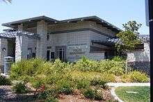
| City of Citrus Heights | |
 Location of Citrus Heights in Sacramento County and California | |
 Citrus Heights, California Location in the United States | |
| Coordinates: 38°42′N 121°17′W | |
| Country | |
| State | |
| County | |
| Incorporated | January 1, 1997[1] |
| Government | |
| • Mayor | Jeff Slowey[2] |
| Area | |
| • Total | 14.23 sq mi (36.9 km2) |
| • Land | 14.23 sq mi (36.9 km2) |
| • Water | 0.00 sq mi (0.0 km2) 0% |
| Elevation | 167 ft (51 m) |
| Population | |
| • Total | 83,301 |
| • Estimate (2019)[6] | 87,796 |
| • Rank | 92nd in California |
| • Density | 5,900/sq mi (2,300/km2) |
| Time zone | UTC-8 (PST) |
| • Summer (DST) | UTC-7 (PDT) |
| ZIP codes | 95610, 95611 (PO Box only), 95621 |
| Area code | 916, 279 |
| FIPS code | 06-13588 |
| GNIS feature ID | 1655900 |
| Website | www |
Citrus Heights is part of the Sacramento–Arden-Arcade–Roseville Metropolitan Statistical Area.
Geography
Citrus Heights is located at 38°42′N 121°17′W (38.6947, -121.2905).[7] According to the United States Census Bureau, the city has a total area of 14.2 square miles (37 km2), all land. The city incorporated January 2, 1997 (January 1 according to the official city website), becoming the fifth city in Sacramento County.
Demographics
| Historical population | |||
|---|---|---|---|
| Census | Pop. | %± | |
| 1970 | 21,760 | — | |
| 1980 | 85,911 | 294.8% | |
| 1990 | 107,439 | 25.1% | |
| 2000 | 85,071 | −20.8% | |
| 2010 | 83,301 | −2.1% | |
| Est. 2019 | 87,796 | [6] | 5.4% |
| U.S. Decennial Census[8] | |||
2010
At the 2010 census Citrus Heights had a population of 83,301. The population density was 5,854.6 people per square mile (2,260.5/km²). The racial makeup of Citrus Heights was 66,856 (80.3%) White, 2,751 (3.3%) African American, 753 (0.9%) Native American, 2,714 (3.3%) Asian (1.2% Filipino, 0.4% Indian, 0.4% Chinese, 0.3% Japanese, 0.2% Vietnamese, 0.4% Other), 363 (0.4%) Pacific Islander, 5,348 (6.4%) from other races, and 4,516 (5.4%) from two or more races. Hispanic or Latino of any race were 13,734 persons (16.5%).[9]
The census reported that 82,815 people (99.4% of the population) lived in households, 304 (0.4%) lived in non-institutionalized group quarters, and 182 (0.2%) were institutionalized.
There were 32,686 households, 10,452 (32.0%) had children under the age of 18 living in them, 14,241 (43.6%) were opposite-sex married couples living together, 4,689 (14.3%) had a female householder with no husband present, 2,027 (6.2%) had a male householder with no wife present. There were 2,653 (8.1%) unmarried opposite-sex partnerships, and 252 (0.8%) same-sex married couples or partnerships. 8,860 households (27.1%) were one person and 3,280 (10.0%) had someone living alone who was 65 or older. The average household size was 2.53. There were 20,957 families (64.1% of households); the average family size was 3.08.
The age distribution was 19,241 people (23.1%) under the age of 18, 8,480 people (10.2%) aged 18 to 24, 23,022 people (27.6%) aged 25 to 44, 21,473 people (25.8%) aged 45 to 64, and 11,085 people (13.3%) who were 65 or older. The median age was 36.2 years. For every 100 females, there were 94.1 males. For every 100 females age 18 and over, there were 91.0 males.
There were 35,075 housing units at an average density of 2,465.1 per square mile, of the occupied units 18,832 (57.6%) were owner-occupied and 13,854 (42.4%) were rented.The homeowner vacancy rate was 2.7%; the rental vacancy rate was 7.8%. 47,329 people (56.8% of the population) lived in owner-occupied housing units and 35,486 people (42.6%) lived in rental housing units.
2000
At the 2000 census there were 85,071 people in 33,478 households, including 21,660 families, in the city. The population density was 5,929.3 inhabitants per square mile (2,288.9/km²). There were 34,897 housing units at an average density of 2,432.3 per square mile (938.9/km²). The racial makeup of the city was 84.64% White, 2.87% African American, 1.01% Native American, 2.85% Asian, 0.34% Pacific Islander, 3.56% from other races, and 4.73% from two or more races. Hispanic or Latino of any race were 10.04%.[10]
Of the 33,478 households 30.9% had children under the age of 18 living with them, 46.4% were married couples living together, 12.9% had a female householder with no husband present, and 35.3% were non-families. 26.9% of households were one person and 9.5% were one person aged 65 or older. The average household size was 2.52 and the average family size was 3.06.
The age distribution was 25.2% under the age of 18, 10.2% from 18 to 24, 30.3% from 25 to 44, 21.3% from 45 to 64, and 12.9% 65 or older. The median age was 35 years. For every 100 females, there were 93.7 males. For every 100 females age 18 and over, there were 90.4 males.
The median household income was $53,859 and the median family income was $60,207. Males had a median income of $48,614 versus $39,399 for females. The per capita income for the city was $30,744. About 5.6% of families and 8.3% of the population were below the poverty line, including 10.9% of those under age 18 and 6.1% of those age 65 or over.
Government
In the California State Legislature, Citrus Heights is in the 4th Senate District, represented by Republican Jim Nielsen, and in the 8th Assembly District, represented by Democrat Ken Cooley.[11]
In the United States House of Representatives, Citrus Heights is in California's 7th congressional district, represented by Democrat Ami Bera.[12]

Politics
| Year | Democratic | Republican | Third Parties |
|---|---|---|---|
| 2016[13] | 42.12% 14,008 | 50.56% 16,815 | 7.32% 2,434 |
| 2012[14] | 43.74% 13,744 | 53.31% 16,753 | 2.95% 926 |
| 2008[15] | 46.11% 15,677 | 51.86% 17,634 | 2.03% 691 |
| 2004[16] | 38.54% 12,678 | 60.44% 19,885 | 1.02% 336 |
| 2000[17] | 41.02% 12,862 | 54.55% 17,105 | 4.44% 1,391 |
| Year | Democratic | Republican | Third Parties |
|---|---|---|---|
| 2018[18] | 44.66% 13,441 | 55.34% 16,693 | |
| 2014[19] | 50.35% 9,973 | 49.65% 9,834 | |
| 2010[20] | 45.52% 12,119 | 48.00% 12,779 | 6.48% 1,726 |
| 2006[21] | 25.53% 6,042 | 69.85% 16,530 | 4.62% 1,093 |
| 2002[22] | 32.38% 7,231 | 55.50% 12,395 | 12.13% 2,709 |
| 1998[23] | 49.32% 13,253 | 48.06% 12,916 | 2.62% 704 |
Citrus Heights has supported the Republican candidate in all five presidential elections since its incorporation. In the six gubernatorial elections since its incorporation, Democrats have carried the city twice, and Republicans have carried the city four times.
Incorporation
Citrus Heights voters approved the measure to incorporate the City on November 5, 1996, effective January 1, 1997. The measure won, with 62.5% of the votes.
Transportation/access
Citrus Heights is centrally located between the region's major freeways and highways. Interstate 80 passes through the west side of the city, and Interstate 5, U.S. Highway 50 and California State Route 99 are all located from three to 11 miles (18 km) from the city. The Business 80 freeway otherwise known as the Capital City Freeway begins near Citrus Heights and ends in Downtown Sacramento. Sacramento International Airport is located approximately 20 miles (32 km) from the city, while rail transportation provided by Amtrak is accessible in Roseville (about 10 miles (16 km) from the city). A public bus transportation is currently provided by the Sacramento Regional Transit District.
Education
Citrus Heights is primarily served by the San Juan Unified School District. San Juan is the ninth largest school district in California and serves a 75-square-mile (190 km2) area in northeast Sacramento County, including Citrus Heights. Within the city of Citrus Heights there are ten elementary schools, one middle school, and two high schools. These schools serve over 10,000 students from the city of Citrus Heights. San Juan Unified School District also offers other educational schools and programs such as a special education centers, adult schools, adult handicapped schools, preschool, and before-and after-school programs. Universities and colleges that serve the area include: University of California, Davis; California State University, Sacramento; American River College; Sierra College; McGeorge School of Law; Lincoln Law School of Sacramento; Golden Gate University; University of Phoenix; and National University.
Climate
Citrus Heights has a climate that is characterized by mild winters and dry hotter summers. The area usually has a low humidity and the average temperature throughout the year is 68 Fahrenheit, with the daily average ranging from 45° in December and January to 76° in July. Average daily high temperatures range from 53° in December and January to 93° in July. Average daily low temperatures range from 38° to 58°. The average year has 73 days with a high over 90°, with the highest temperature on record being 114° on July 17, 1925, and 18 days when the low drops below 32°, with the coldest one day record being December 11, 1932, at 17°.
Average yearly precipitation is 24.61 inches according to weather.com (,[24] 2018). Almost no rain falls during the summer months (less than 1%), and over 80% falls between November and March. 3.47", 3.39", 4.46", and 4.34" per month respectively, though rainfall can be much greater than average. On average, 96 days in the year have fog, mostly in the morning, primarily in December and January. Typically, Citrus Heights enjoys 268 sunny days throughout the year.
Business and shopping
Citrus Heights is home to a bustling retail and service industry. Sunrise Mall, newly remodeled with over 100 stores, including major department and specialty stores (Macy's, Sear’s (which is now closed), JC Penney's, etc.), is located in the center of the city, along with the Sunrise MarketPlace a growing retail community offering a wide variety of retail, dining, and service establishments (Barnes & Noble, Target Greatland, Best Buy, Lowe's Home Improvement, etc.). Citrus Heights also features major discount retail stores such as Costco, Sam's Club, and Wal-Mart.
Police department
In June 2006, the City of Citrus Heights formed its own police department. The department attracted lateral police officers from 62 different police agencies throughout California.[25] Under the leadership of Chief of Police Christopher Boyd, the newly formed department took over law enforcement responsibility from the Sacramento County Sheriff's Department on June 26, 2006.[26] The police department is a full service agency, with specialty units such as SWAT, Special Investigations, Traffic and School Resource Officers.[27] The department operates its own state of the art communications center, which answers 911 calls and dispatches police throughout the city.[26]


Notable Residents
- Jackie Lynn Taylor - Our Gang actress (1934)
- Bill Conroy - MLB catcher
- Kelley Jones - artist [28]
- Mandisa - Contemporary Christian music artist
- Joseph James DeAngelo - Golden State Killer[29]
See also
References
- "California Cities by Incorporation Date". California Association of Local Agency Formation Commissions. Archived from the original (Word) on November 3, 2014. Retrieved August 25, 2014.
- "Members". Citrus Heights, CA. Retrieved December 16, 2014.
- "2016 U.S. Gazetteer Files". United States Census Bureau. Retrieved Jul 19, 2017.
- "Citrus Heights". Geographic Names Information System. United States Geological Survey. Retrieved December 16, 2014.
- "Citrus Heights (city) QuickFacts". United States Census Bureau. Archived from the original on March 23, 2015. Retrieved March 19, 2015.
- "Population and Housing Unit Estimates". Retrieved May 21, 2020.
- "US Gazetteer files: 2010, 2000, and 1990". United States Census Bureau. 2011-02-12. Retrieved 2011-04-23.
- "Census of Population and Housing". Census.gov. Retrieved June 4, 2015.
- "2010 Census Interactive Population Search: CA - Citrus Heights city". U.S. Census Bureau. Archived from the original on July 15, 2014. Retrieved July 12, 2014.
- "U.S. Census website". United States Census Bureau. Retrieved 2008-01-31.
- "Statewide Database". UC Regents. Archived from the original on February 1, 2015. Retrieved December 4, 2014.
- "California's 7th Congressional District - Representatives & District Map". Civic Impulse, LLC. Retrieved March 9, 2013.
- https://elections.cdn.sos.ca.gov/sov/2016-general/ssov/pres-by-political-districts.pdf
- https://elections.cdn.sos.ca.gov/sov/2012-general/ssov/pres-by-political-districts.pdf
- https://elections.cdn.sos.ca.gov/sov/2008-general/ssov/5-pres-by-political-districts.pdf
- https://elections.cdn.sos.ca.gov/sov/2004-general/ssov/pres_general_ssov_all.pdf
- https://elections.cdn.sos.ca.gov/sov/2000-general/ssov/pol-dis.pdf
- https://elections.cdn.sos.ca.gov/sov/2018-general/ssov/governor-pol-districts.pdf
- https://elections.cdn.sos.ca.gov/sov/2014-general/ssov/governor-pol-districts.pdf
- https://elections.cdn.sos.ca.gov/sov/2010-general/ssov/governor-all.pdf
- https://elections.cdn.sos.ca.gov/sov/2006-general/ssov/gov_by_all.pdf
- https://elections.cdn.sos.ca.gov/sov/2002-general/ssov/gov-pol-dis.pdf
- https://archive.org/details/statementofvote31998cali/page/18
- "Intellicast | Weather Underground".
- [http://citrusheights.net/222/Police
- "Welcome to the City of Citrus Heights - Police". City of Citrus Heights. Archived from the original on 2009-06-14. Retrieved 2009-04-21.
- "Welcome to the City of Citrus Heights - Investigative Services Division". City of Citrus Heights. Archived from the original on 2009-07-05. Retrieved 2009-04-21.
- 1980 Greenback Notes, San Juan High School, Citrus Heights, California
- "What It Was Like Living Next Door to the Suspected Golden State Killer: 'He Was Always Angry'". People. Retrieved 29 April 2018.
External links
| Wikimedia Commons has media related to Citrus Heights, California. |
Places adjacent to Citrus Heights, California | ||||||||||
|---|---|---|---|---|---|---|---|---|---|---|
| ||||||||||
Municipalities and communities of Sacramento County, California, United States | ||
|---|---|---|
| Cities | 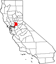 Sacramento County map | |
| CDPs | ||
| Unincorporated communities | ||
| Ghost towns | ||
| Authority control |
|
|---|