Fair Oaks, California
Fair Oaks is a census-designated place (CDP) in Sacramento County, California, United States. It is part of the Sacramento–Arden-Arcade–Roseville Metropolitan Statistical Area. The population was 30,912 at the 2010 census, up from 28,008 at the 2000 census. The Fair Oaks zip code is 95628 and its area codes are 916 and 279.
Fair Oaks | |
|---|---|
Census designated place | |
 | |
| Coordinates: 38°39′5″N 121°15′33″W | |
| Country | |
| State | |
| County | Sacramento |
| Area | |
| • Total | 11.245 sq mi (29.12 km2) |
| • Land | 10.793 sq mi (27.95 km2) |
| • Water | 0.452 sq mi (1.17 km2) 4.02% |
| Elevation | 174 ft (53 m) |
| Population | |
| • Total | 30,912 |
| • Density | 2,700/sq mi (1,100/km2) |
| Time zone | UTC-8 (Pacific) |
| • Summer (DST) | UTC-7 (PDT) |
| ZIP code | 95628 |
| Area code | 916, 279 |
| FIPS code | 06-23294 |
| GNIS feature IDs | 277510, 2408100 |
Geography and climate
Geography
Fair Oaks is located at 38°39′5″N 121°15′33″W (38.651254, -121.259279),[3] between Sacramento and Folsom.
Fair Oaks is bounded on the south side by the American River, and Rancho Cordova, on the north side by the city of Citrus Heights, on the west side by Carmichael, and the east side by Orangevale and Folsom. Fair Oaks has a mix of suburban and semi-rural neighborhoods.
According to the United States Census Bureau, the CDP has a total area of 11.2 square miles (29 km2), of which, 10.8 square miles (28 km2) of it is land and 0.5 square miles (1.3 km2) of it (4.02%) is water.
Climate
Fair Oaks has a hot-summer Mediterranean climate (Köppen Csa), characterized by damp to wet, mild winters and hot, dry summers. The wet season is generally October through April, though there may be a day or two of light rainfall in June or September. The normal annual mean temperature is 61.0 °F (16.1 °C), with the monthly daily average temperature ranging from 46.4 °F (8.0 °C) in December to 75.5 °F (24.2 °C) in July.[4] Summer heat is often moderated by a sea breeze known as the "delta breeze" which comes through the Sacramento–San Joaquin River Delta from the San Francisco Bay, and temperatures cool down sharply at night. The foggiest months are December and January. Tule fog can be extremely dense, lowering visibility to less than 100 feet (30 m) and making driving conditions extremely hazardous. Chilling tule fog events have been known to last for several consecutive days or weeks. During Tule fog events, temperatures do not exceed 50 degrees.
Snowfall is rare in Fair Oaks, which is only 174 ft (53 m) above sea level. During especially cold winter and spring storms, intense showers do occasionally produce a significant amount of hail, which can create hazardous driving conditions. The occasional rare snowfall melts upon ground contact, with traceable amounts of snow occurring in some years. On average, there are 73 days where the high exceeds 90 °F (32 °C), and 14 days where the high exceeds 100 °F (38 °C); On the other extreme, there are 15 days where the temperature does not exceed 50 °F (10 °C), and 15 freezing nights per year.[4]
The average annual precipitation is 18.52 inches (470 mm). On average, precipitation falls on 60 days each year in Fair Oaks, and nearly all of this falls during the winter months. Average January rainfall is 3.67 in (93 mm), and measurable precipitation is rare during the summer months. On rare occasions, monsoonal moisture surges from the Desert Southwest can bring upper-level moisture to the Sacramento region, leading to increased summer cloudiness, humidity, and even light showers and thunderstorms. Monsoon clouds do occur, usually during late July through early September.
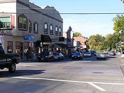
Town center

The town center of Fair Oaks is called Old Fair Oaks Village, which is located approximately a half-mile away from the American River Parkway. The Veterans Memorial Amphitheatre is located in this part of town. Events that take place here include the Fair Oaks Theater Festival,[5] the Fair Oaks Fiesta and Car Show,[6] and the annual Fair Oaks Chicken Festival each September.[7] The town also has a population of about 200 chickens.[8]
The town center also houses the Fair Oaks History Center,[9] which contains the history of the founding and development of Fair Oaks including displays featuring pictures and artifacts dating from the early 1900s, as well as a small collection of early Maidu Indian artifacts.
Demographics
| Historical population | |||
|---|---|---|---|
| Census | Pop. | %± | |
| 1980 | 23,294 | — | |
| 1990 | 26,867 | 15.3% | |
| 2000 | 28,008 | 4.2% | |
| 2010 | 30,912 | 10.4% | |
| U.S. Decennial Census[10] | |||
2010
The 2010 United States Census[11] reported that Fair Oaks had a population of 30,912. The population density was 2,748.8 people per square mile (1,061.3/km²). The racial makeup of Fair Oaks was 26,479 (85.7%) White, 729 (2.4%) African American, 255 (0.8%) Native American, 1,289 (4.2%) Asian, 57 (0.2%) Pacific Islander, 738 (2.4%) from other races, and 1,365 (4.4%) from two or more races. Hispanic or Latino of any race were 2,954 persons (9.6%).
The Census reported that 30,482 people (98.6% of the population) lived in households, 261 (0.8%) lived in non-institutionalized group quarters, and 169 (0.5%) were institutionalized.
There were 12,838 households, out of which 3,469 (27.0%) had children under the age of 18 living in them, 6,655 (51.8%) were opposite-sex married couples living together, 1,298 (10.1%) had a female householder with no husband present, 611 (4.8%) had a male householder with no wife present. There were 761 (5.9%) unmarried opposite-sex partnerships, and 109 (0.8%) same-sex married couples or partnerships. 3,304 households (25.7%) were made up of individuals and 1,304 (10.2%) had someone living alone who was 65 years of age or older. The average household size was 2.37. There were 8,564 families (66.7% of all households); the average family size was 2.84.
The population was spread out with 6,050 people (19.6%) under the age of 18, 2,380 people (7.7%) aged 18 to 24, 6,677 people (21.6%) aged 25 to 44, 10,078 people (32.6%) aged 45 to 64, and 5,727 people (18.5%) who were 65 years of age or older. The median age was 45.8 years. For every 100 females, there were 95.3 males. For every 100 females age 18 and over, there were 92.2 males.
There were 13,558 housing units at an average density of 1,205.6 per square mile (465.5/km²), of which 8,605 (67.0%) were owner-occupied, and 4,233 (33.0%) were occupied by renters. The homeowner vacancy rate was 1.4%; the rental vacancy rate was 6.7%. 21,038 people (68.1% of the population) lived in owner-occupied housing units and 9,444 people (30.6%) lived in rental housing units.
2000
As of the census[12] of 2000, there were 28,008 people, 11,203 households, and 7,842 families residing in the CDP. The population density was 2,832.7 people per square mile (1,093.4/km²). There were 11,461 housing units at an average density of 1,159.2 per square mile (447.4/km²). The racial makeup of the CDP was 88.04% White, 1.84% African American, 0.59% Native American, 4.22% Asian, 0.16% Pacific Islander, 1.78% from other races, and 3.37% from two or more races. Hispanic or Latino of any race were 6.31% of the population.
There were 11,203 households out of which 29.6% had children under the age of 18 living with them, 56.4% were married couples living together, 9.8% had a female householder with no husband present, and 30.0% were non-families. 23.5% of all households were made up of individuals and 6.5% had someone living alone who was 65 years of age or older. The average household size was 2.47 and the average family size was 2.91.
In the CDP, the population was spread out with 22.8% under the age of 18, 6.8% from 18 to 24, 26.8% from 25 to 44, 29.9% from 45 to 64, and 13.8% who were 65 years of age or older. The median age was 41 years. For every 100 females, there were 96.8 males. For every 100 females age 18 and over, there were 93.3 males.
The median income for a household in the CDP was $63,252, and the median income for a family was $74,864, these figures had risen to $72,636 and $88,630 respectively as of a 2007 estimate. Males had a median income of $52,365 versus $39,138 for females. The per capita income for the CDP was $31,874. About 4.6% of families and 6.5% of the population were below the poverty line, including 9.2% of those under age 18 and 2.2% of those age 65 or over.
History
19th century
The community began as part of the 1844 Rancho San Juan Mexican land grant. In 1895, Brevet Brigadier General Charles Henry Howard and James W. Wilson of the Howard-Wilson Publishing Company of Chicago acquired rights to present Fair Oaks community, then primarily covered by citrus farms, from California Senator Frederick K. Cox and businessman Crawford W. Clarke. The Howard-Wilson company surveyed and mapped the land and began to promote Fair Oaks as one of their “Sunset Colonies.” The Howard-Wilson company advertised Fair Oaks as an innovative and growing citrus colony after destructive freezes in Southern California and Florida and a national depression hitting in 1893. Many of the purchasers were professionals and other friends of the investors and the Fair Oaks community was initially composed primarily of businessmen and other professionals, including bankers and engineers.[13]:7
In 1897, 300 permanent settlers lived in Fair Oaks, and purchased land in 5 to 20-acre tracts. Few farmers came to Fair Oaks, causing investment to diminish. This led to the Howard-Wilson Company withdrawing from the area. A club of businessmen in Chicago and Sacramento who had an investment (land or fruit) in the newborn colony and Orangevale formed the Chicago-Fair Oaks Club in 1899. They lobbied the government and other investors. They also helped in the construction of a bridge in Fair Oaks in 1901.[13]:7 Then a group of local businessmen, including Valentine S. McClatchy (the co-owner of the Sacramento Bee), incorporated the Fair Oaks Development Company in 1900. The boosters proclaimed Fair Oaks to be the “crown of the [Sacramento] valley,” in the “heart of California.”
Together these groups were able to succeed in constructing an efficient water supply. They convinced the Sacramento Chamber of Commerce, which McClatchy's business partners from Orangevale created and chaired, to build a bridge across the American River at Fair Oaks in 1901. At the same time, the community leaders were also able to persuade the Southern Pacific Rail Road Company to build a railroad line to the bridge. Today, the bridge is known to locals as "The Red Bridge." There is now a trail on the Northeast side of the bridge that people climb to sit on the cliffs high above the river and watch the sunset
20th century and growth
Fair Oaks grew rapidly with the completion of the Fair Oaks Bridge and the railroad line. The Fair Oaks Fruit Company incorporated in 1902 and built a warehouse in Fair Oaks to export not only citrus, but also almonds and olives. Also, in 1902, Dr. R. N. Bramhall became the first medical doctor to reside and set up office in Fair Oaks. The agricultural productivity attracted the development of other community services. Fair Oaks had become a typical small town by 1906 with a post office, hotel, blacksmith shop, lumber yard, pharmacy, bank, cemetery, newspaper, and a number of small dry-goods and grocery stores located along Main Street.
Two churches (Methodist and Presbyterian) were built and two schools (The Four Gables School and the Fair Oaks School—the current Community Clubhouse) appeared by 1910. The Fair Oaks Library Association formed in 1908 and constructed a permanent building in 1912. The Fair Oaks Civic Club purchased and developed the Plaza in 1918 for recreational and leisure activities. This plaza is still in use today.
Loss of the Citrus Crops
A big freeze hit in 1932 at the height of the Great Depression and many or most citrus groves were lost. After this and a similar freeze in 1934, Fair Oaks was no longer a major producer of citrus fruit in California. For the decades following and until the end of WWII, the Fair Oaks economy struggled to recover. In 1955, Aerojet, a rocket-engine producing company helped the Fair Oaks economy recover by bringing a new on of their facilities nearby in what is now present-day Rancho Cordova.[14] Some temporary dislocations occurred when employment at Aerojet dropped over 90% in the late 1960s and early 1970s. The growth rate still continued, however, because of the increased access to Sacramento by Highway 50 and the construction of the Sunrise Boulevard Bridge in 1954. This allowed for both residents of Fair Oaks to find greater employment in the connecting area and for Sacramentans to relocate to Fair Oaks more easily. The former citrus colony transformed into a bedroom community of greater Sacramento.
Government
Republican Brian Dahle represents the community in the State Senate, while Republican Kevin Kiley represents the community in the State Assembly.
In the United States House of Representatives, Fair Oaks is in California's 7th congressional district, represented by Democrat Ami Bera.[15]
Fair Oaks is an unincorporated community represented by Republican Susan Peters on the Sacramento County Board of Supervisors. A Local Planning Council, made up of 7 community members, is appointed by the Board of Supervisors to recommend land-use decisions for Fair Oaks. These recommendations are then sent to the Planning Commission of Sacramento County. The Sacramento County Sheriff provides law enforcement for Fair Oaks.
Education
Public schools in Fair Oaks are part of the San Juan Unified School District[16] and include Earl LeGette Elementary School,[17] Northridge Elementary School,[18] Orangevale Open K-8 School,[19] Will Rogers Middle School,[20] Del Campo High School,[21] and Bella Vista High School.[22] Major private schools in Fair Oaks include Summit Christian School,[23] Sacramento Waldorf School,[24] and St. Mel Catholic School.[25]
Transportation
The main highways used to access Fair Oaks are Interstate 80 and Highway 50. The main boulevards are Madison Avenue (east–west), Sunrise Boulevard (County Highway E2) (north–south), Hazel Avenue (County Highway E3) (north–south), Sunset Avenue (east–west), and Fair Oaks Boulevard (east–west).
Fair Oaks is also served by the Sacramento Regional Transit District, but has no light rail service in the area as of now.[26]
Many bike trails are in the area, the largest of which is the American River Parkway Bike Trail.
Public library
Fair Oaks' public library, which is part of the Sacramento Public Library system, is located at 11601 Fair Oaks Boulevard, near the corner of Madison Avenue, and adjacent to Fair Oaks Park. Fair Oaks Library is open seven days a week:
- Monday, Tuesday, Wednesday, and Thursday 10am - 7pm
- Friday and Saturday 10am - 5pm
- Sunday 12pm - 5pm[27]
Notable natives and residents
- Lynn Anderson, singer, best known for "(I Never Promised You a) Rose Garden"
- Barbara Alby, former California State Assemblywoman, 5th district
- Matt Barnes, professional basketball player
- Joe Carnahan, Smokin' Aces director and worked briefly on Mission: Impossible III before quitting the project
- Geoffrey Carter, Australian-American composer, musician, producer, physicist, and engineer
- Delvin Countess, professional soccer player
- Dave Cox, California state senator, 1st district
- Steve Cronin, professional soccer player
- Matt Walbeck, former catcher for Chicago Cubs, former coach for Texas Rangers; lives in Fair Oaks
- Andy Fox, former shortstop for Arizona Diamondbacks, coach for Florida Marlins; lives in Fair Oaks
- Beth Gaines, California State Assemblywoman from Roseville; grew up in Fair Oaks, attended the former La Sierra High School
- Taylor Graham, professional soccer player
- Christianne Klein, actor and TV personality, former ABC News correspondent and entrepreneur; appeared as Linda Garvey in film American Dreamz, and as herself on TV programs Politically Incorrect and Emeril Green with chef Emeril Lagasse; host of Truth Fairy TV.
- Joan Lunden, former host of Good Morning America
- Roger Niello, California State Assemblyman, 5th district; Niello Motors
- Tyler Robertson, professional baseball player
- Rick Schu, former professional baseball player
- Nicholas Sparks, author of The Notebook, A Walk to Remember, and Dear John, others
- Gavin Newsom, governor of California (maintains his private residency in the town)[28]
References
- "2010 Census U.S. Gazetteer Files – Places – California". United States Census Bureau.
- "Fair Oaks". Geographic Names Information System. United States Geological Survey. Retrieved November 13, 2014.
- "US Gazetteer files: 2010, 2000, and 1990". United States Census Bureau. 2011-02-12. Retrieved 2011-04-23.
- "NowData – NOAA Online Weather Data". National Oceanic and Atmospheric Administration. Retrieved December 6, 2012.
- "Veteran's Memorial Amphitheatre". Fair Oaks Theater Festival. Archived from the original on March 22, 2015. Retrieved March 24, 2015.
- "Fair Oaks Fiesta / Car Show". Fair Oaks Chamber of Commerce. Archived from the original on April 2, 2015. Retrieved March 24, 2015.
- "Chicken Festival". Fair Oaks Recreation & Parks District. Retrieved March 24, 2015.
- Bauer, Laura. “Free Range: California Town Celebrates Their Wild Chickens.” Modern Farmer, Modern Farmer Media, 10 May 2016, modernfarmer.com/2014/08/go-wild-chickens-worth-celebrating/.
- http://www.fairoakshistory.org/center/
- "Census of Population and Housing". Census.gov. Retrieved June 4, 2016.
- "2010 Census Interactive Population Search: CA - Fair Oaks CDP". U.S. Census Bureau. Archived from the original on July 15, 2014. Retrieved July 12, 2014.
- "U.S. Census website". United States Census Bureau. Retrieved 2008-01-31.
- Simpson, Lee; Sandul, Paul (2005). Images of America: Fair Oaks. Charleston SC, Chicago IL, Portsmouth NH, San Francisco CA: Arcadia Publishing. ISBN 0738530883.
- Starke, Sarah Christine, Tracing the Past in Fair Oaks: Interpretation and Exhibit Design in a Local History Museum. 2013. California State University, Masters Thesis.
- "California's 7th Congressional District - Representatives & District Map". Civic Impulse, LLC.
- https://www.sanjuan.edu
- https://www.sanjuan.edu/legette
- https://www.sanjuan.edu/northridge
- https://www.sanjuan.edu/orangevale
- https://www.sanjuan.edu/rogers
- https://www.sanjuan.edu/delcampo
- https://www.sanjuan.edu/bellavista
- http://www.summitcs.net
- http://www.sacwaldorf.org
- http://www.stmelschool.org/
- "Archived copy". Archived from the original on 2017-05-02. Retrieved 2017-12-29.CS1 maint: archived copy as title (link)
- "Sacramento Public Library - Fair Oaks". Sacramento Public Library. Retrieved August 24, 2019.
- Keeling, Brock. "Gavin Newsom will skip living in the governor's mansion [Update]". Curbed San Francisco. Retrieved 15 May 2019.
External links
- Fair Oaks Community Planning Advisory Council
- Fair Oaks Official Community Website
- Fair Oaks Chamber of Commerce
- American River Messenger Newspaper
- Fair Oaks Recreation and Park District
- Fair Oaks Water District (FOWD)
- Fair Oaks Historical Society
Places adjacent to Fair Oaks, California | |
|---|---|
Municipalities and communities of Sacramento County, California, United States | ||
|---|---|---|
| Cities | 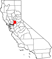 Sacramento County map | |
| CDPs | ||
| Unincorporated communities | ||
| Ghost towns | ||
| Authority control |
|---|