Kenmore Hills, Queensland
Kenmore Hills is a suburb of the City of Brisbane, Queensland, Australia approximately 10 kilometres (6.2 mi) south-west of the CBD.[3] At the 2016 census, the suburb recorded a population of 2,402.[1]
| Kenmore Hills Brisbane, Queensland | |||||||||||||||
|---|---|---|---|---|---|---|---|---|---|---|---|---|---|---|---|
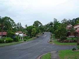 Mirbelia Street | |||||||||||||||
| Population | 2,402 (2016 census)[1] | ||||||||||||||
| • Density | 572/km2 (1,481/sq mi) | ||||||||||||||
| Established | 1975 | ||||||||||||||
| Postcode(s) | 4069 | ||||||||||||||
| Area | 4.2 km2 (1.6 sq mi) | ||||||||||||||
| Location | 10 km (6 mi) from Brisbane GPO | ||||||||||||||
| LGA(s) | City of Brisbane (Pullenvale Ward)[2] | ||||||||||||||
| State electorate(s) | Moggill | ||||||||||||||
| Federal Division(s) | Ryan | ||||||||||||||
| |||||||||||||||
Kenmore Hills originally formed part of Brookfield, but in 1975 the name was changed to Kenmore Hills, based on the nearby suburb of Kenmore.
Demographics
In the 2011 census, Kenmore Hills recorded a population of 2,577 people, 53.2% female and 46.8% male.
The median age of the Kenmore Hills population was 44 years of age, 7 years above the Australian median.
60.5% of people living in Kenmore Hills were born in Australia, compared to the national average of 69.8%; the next most common countries of birth were England 7.5%, South Africa 4.2%, New Zealand 3%, India 2.4%, Scotland 1.3%.
81.3% of people spoke only English at home; the next most common languages were 1.9% Mandarin, 1.1% German, 1% Cantonese, 0.9% Telugu, 0.8% Afrikaans.
References
- Australian Bureau of Statistics (27 June 2017). "Kenmore Hills (State Suburb)". 2016 Census QuickStats. Retrieved 25 March 2018.

- "Pullenvale Ward". Brisbane City Council. Brisbane City Council. Retrieved 12 March 2017.
- "Kenmore Hills (entry 48322)". Queensland Place Names. Queensland Government. Retrieved 13 September 2015.
External links
- University of Queensland: Queensland Places: Kenmore Hills
- "Kenmore Hills". BRISbites. Brisbane City Council. Archived from the original on 19 July 2008.
- "Kenmore Hills". Our Brisbane. Brisbane City Council. Archived from the original on 22 February 2008.