Enoggera, Queensland
Enoggera is a suburb of the City of Brisbane, in Queensland, Australia.
| Enoggera Brisbane, Queensland | |||||||||||||||
|---|---|---|---|---|---|---|---|---|---|---|---|---|---|---|---|
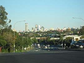 Enoggera Road, with view of Brisbane CBD. | |||||||||||||||
| Population | 5,157 (2016 census)[1] | ||||||||||||||
| • Density | 560.5/km2 (1,452/sq mi) | ||||||||||||||
| Postcode(s) | 4051 | ||||||||||||||
| Area | 9.2 km2 (3.6 sq mi) | ||||||||||||||
| Location | 8 km (5 mi) from Brisbane | ||||||||||||||
| LGA(s) | City of Brisbane (Enoggera Ward)[2] | ||||||||||||||
| State electorate(s) | |||||||||||||||
| Federal Division(s) | |||||||||||||||
| |||||||||||||||
Geography
Enoggera is 6 kilometres (3.7 mi) north-west of the Brisbane CBD.[3] The west of the suburb is dominated by Enoggera Hill.
History
Aboriginal history
The word Enoggera is a wrongly spelled by an error made at the Government Lands Office, when the letter u was mistaken for n. It was intended that the name should be recorded as Euogerra, a contraction of the Turrbal phrase youara-ngarea meaning literally "sing-play" or song and dance. It refers to a ceremonial site used for dancing.[3] It is said to have first applied to a site near the mouth of Breakfast Creek. It is possible, however, that the name was independently applied to a site at the place at presently known as Enoggera.[4] They named the area near Bancroft Park "Bu-yu-ba", which means, "straight shin bone", referring to a straight stretch of creek.[5][6] Enoggera is a corruption of Yowogerra, which in Turrbal means corroboree. Because this area was given a distinct name indicates that it held a significant place in Turbull culture as a camping and corroboree region.[6]
19th Century
In 1845, John Brennan purchased six hectares of land in Enoggera. Six years later, Thomas Hayes moved to the area and bought thirty-three acres of land. Enoggera initially developed as a farming community with orchards and vineyards.
In the 1860s, the track to the Gympie goldfields passed through Enoggera, and this assisted with development. As the population increased, the first school opened in 1871, and the railway line to Enoggera Station opened in 1899.
In 1887, the local government Division of Enoggera was proclaimed, bound to north and south by Kedron Brook and Enoggera Creek, and stretching from Alderley to The Gap and beyond the Enoggera Dam. Enoggera became a shire in 1903 before being amalgamated into the City of Brisbane.
In 1890, an advertisement was published to auction the Blackheath Estate, being re-subdivisions of part of portion 190, County of Stanley, Parish of Enoggera, by E. Hooker & Son Auctioneers.[7]
In 1890, re-subdivisions 1 to 17, of subdivision 24 of portion 190, County of Stanley, Parish of Enoggera, were advertised for auction by W. J. Hooker.[8]
20th Century
The land for the Enoggera Army Barracks was acquired in 1910, and opened in the same year. The barracks is still operation but now known as Gallipoli Barracks.
On Saturday 15 May 1915 there was a stump capping ceremony for a new Presbyterian church at Enoggera.[9] The location was on the corner of Pickering Street and Station Avenue (27.4185°S 152.9859°E), now within Gaythorne. In 1926 the church was extended to create a Sunday school.[10] As part of the merger of many of the Methodist, Presbyterian and Congregational churches into the Uniting Church of Australia in 1977, the church became Gaythorne Uniting Church. However, falling congregation numbers led to a consolidation of Uniting churches in the area, leading to the closure of the former Presbyerian church. Since 2012, it has been used as an early education centre.[11]

In May 1919, subdivided allotments of Rangeview Estate Enoggera were auctioned by Cameron Bros.[12] This area is now within the suburb of Gaythorne. The map advertising the auction states that the Estate was within 5 minutes' walk away from the Rifle Range Railway Station, now known as Gaythorne Station.[13][14] In April 1921, the land unsold in the previous auction was re-auctioned as "Gaythorne & Rangeview Estates" made up of 53 allotments were advertised to be auctioned by Cameron Bros.[15][16]
In July 1920, subdivided allotments of Elswick Estate Enoggera were auctioned by Isles, Love, and Co.[17] The map advertising the auction depicts the estate’s proximity to the Enoggera Railway Station, and describes the land as having “beautiful grassy park-link ridges” and “lovely foliage trees”.[18] The map further states that a water main passes through the estate and that there would be a good prospect of trams and electric light extension.
In 1925. Derby Estate, which was once owned by Tim Corbett, was bordered by Laurel Street, Elkhorn Street, Derby Lane, and Clover Street.[19][20]
In December 1927, 31 blocks in Abbotsford Estate Enoggera were advertised for auction by Isles, Love & Co. Limited Auctioneers.[21] The map advertising the sale states the land for sale is resubdivisions 1 to 32 & (Easement A) of subdivision 2 of resubdivision 2 of subdivision 3 of portion 406 & of subdivision 2 of portion 407, Enoggera.[22] The map depicts the close proximity of Abbotsford Estate to the Enoggera Railway Station.[22]
In 1949, the tram line from Newmarket was extended along Samford Road to Enoggera. The tram line closed on 2 December 1968.
Heritage listings

Enoggera has a number of heritage-listed sites, including:
- Inwood Road, Gallipoli Barracks: Enoggera Magazine Complex[23]
- 9 Laurel Street: Killarney[24]
- 431 Lloyd Street, Gallipoli Barracks: School of Musketry[25]
- Murray Avenue, Gallipoli Barracks: Small Arms Magazine[26]
- corner of Trundle and Wardell streets: Enoggera Memorial Hall[27]
- Wynter Road, Gallipoli Baracks: Remount Complex[28]
Demographics
In the 2016 Census, there were 5,157 people in Enoggera. Of these 53.4% were male and 46.6% were female.
The median age of the Enoggera population was 30 years of age, 8 years below the Australian median.
78.9% of people were born in Australia compared with the national average of 66.7%. The next most common countries of birth were England 2.8% and New Zealand 2.7%. 87.0% of people spoke only English at home.
The most common responses for religion were No Religion 35.5%, Catholic 28.5% and Anglican 11.3%.[1]
Education
Enoggera is home to a number of educational institutions, including Hillbrook Anglican School, Our Lady of The Assumption and Enoggera State School.

Transport
Via train, Gaythorne Railway Station and Enoggera Railway Station provide access to regular Queensland Rail City network services on the Ferny Grove railway line arranging travel to the Brisbane CBD, Beenleigh and Ferny Grove.
Via bus, Enoggera is serviced by Brisbane Transport buses, predominantly from the bus-rail interchange at Enoggera Railway Station and at Wardell Street, which travel to the Brisbane CBD, Chermside, Ashgrove and Indooroopilly.
Via road, Enoggera's main arterials are Samford Road which is the main corridor for motorists travelling to The City, Mitchelton and Samford, as well as Wardell Street which is the main corridor for motorists travelling to the Inner Western suburbs such as Paddington and Toowong.
Sport
The Brisbane Irish Rugby Football Club "The McBrats" play at Memorial Park.
References
- Australian Bureau of Statistics (27 June 2017). "Enoggera (State Suburb)". 2016 Census QuickStats. Retrieved 25 June 2013.

- "Enoggera Ward". Brisbane City Council. Brisbane City Council. Retrieved 12 March 2017.
- "Enoggera (entry 41374)". Queensland Place Names. Queensland Government. Retrieved 11 August 2013.
- Watson, 1944. page 105
- Tom Petrie's Reminiscences of Early Queensland. St Lucia, Queensland: University of Queensland Press. 1992. p.11. ISBN 0702223832.
- Tram Stops September OCtober 2004 Volume 2 Number 5. Ashgrove Historical Society.
- "The Blackheath Estate". 14 June 1890. hdl:10462/deriv/280862. Cite journal requires
|journal=(help) - "Advertising". The Telegraph (5561). Queensland, Australia. 9 August 1890. p. 8. Retrieved 24 September 2019 – via National Library of Australia.
- "A NEW PRESBYTERIAN CHURCH". The Brisbane Courier (17, 888). Queensland, Australia. 17 May 1915. p. 9. Retrieved 11 August 2019 – via National Library of Australia.
- Bartsch, Phil (28 February 2020). "Church deal just a bit of child's play". The Courier-Mail. p. 53.
- "Site 71 - Enoggera Presbyterian Church, Pickering Street, Gaythorne, 1915". Mitchy Memories. Archived from the original on 10 August 2019. Retrieved 10 August 2019.
- "SALE OF RANGEVIEW ESTATE". The Daily Mail (5173). Queensland, Australia. 26 May 1919. p. 2. Retrieved 30 July 2019 – via National Library of Australia.
- "Rangeview Estate". 1919. hdl:10462/deriv/252824. Cite journal requires
|journal=(help) - "Railway Station Renamed". The Brisbane Courier (20, 437). Queensland, Australia. 24 July 1923. p. 9. Retrieved 30 July 2019 – via National Library of Australia.
- "Advertising". Daily Standard (2584). Queensland, Australia. 13 April 1921. p. 6 (SECOND EDITION). Retrieved 25 March 2019 – via National Library of Australia.
- "Gaythorne & Rangeview Estates". hdl:10462/deriv/410769. Cite journal requires
|journal=(help) - "Elswick Estate". The Brisbane Courier (19, 509). Queensland, Australia. 30 July 1920. p. 11. Retrieved 30 July 2019 – via National Library of Australia.
- "Elswick Enoggera". 1920. hdl:10462/deriv/427738. Cite journal requires
|journal=(help) - "11 Jul 1931 - Picturesque Enoggera". Retrieved 28 May 2019.
- "Derby Estate, 1st Section, Enoggera". hdl:10462/deriv/264247. Cite journal requires
|journal=(help) - "Advertising". The Telegraph (17, 160). Queensland, Australia. 2 December 1927. p. 20. Retrieved 29 October 2019 – via National Library of Australia.
- "Abbotsford Estate, right on the station, Enoggera". 3 December 1927. hdl:10462/deriv/264232. Cite journal requires
|journal=(help) - "Enoggera Magazine Complex (Place ID 105229)". Australian Heritage Database. Department of the Environment. Retrieved 15 May 2019.
- "Killarney (entry 600194)". Queensland Heritage Register. Queensland Heritage Council. Retrieved 6 July 2013.
- "School Of Musketry (former) (Place ID 105227)". Australian Heritage Database. Department of the Environment. Retrieved 15 May 2019.
- "Small Arms Magazine (former) (Place ID 105228)". Australian Heritage Database. Department of the Environment. Retrieved 15 May 2019.
- "Enoggera Memorial Hall". Brisbane Heritage Register. Brisbane City Council. Retrieved 12 March 2018.
- "Remount Complex (former) (Place ID 105638)". Australian Heritage Database. Department of the Environment. Retrieved 15 May 2019.
External links
| Wikimedia Commons has media related to Enoggera, Queensland. |
- University of Queensland: Queensland Places: Enoggera
- "Enoggera/E. Reservoir". BRISbites. Brisbane City Council. Archived from the original on 19 July 2008.
- "Enoggera". Our Brisbane. Brisbane City Council. Archived from the original on 16 January 2008.