Ferry County, Washington
Ferry County is a county located on the northern border of the U.S. state of Washington. As of the 2010 census, the population was 7,551,[1] making it the fourth-least populous county in Washington.[2] The county seat and largest city is Republic.[3] The county was created out of Stevens County in February 1899[4] and is named for Elisha P. Ferry, the state's first governor.[5]
Ferry County | |
|---|---|
 Ferry County Courthouse in Republic | |
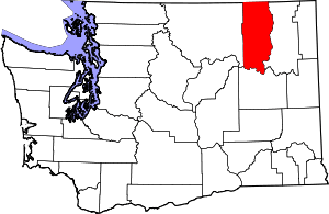 Location within the U.S. state of Washington | |
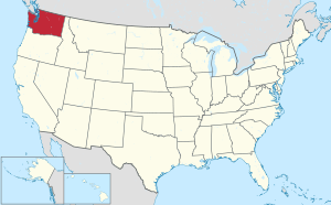 Washington's location within the U.S. | |
| Coordinates: 48°28′N 118°31′W | |
| Country | |
| State | |
| Founded | February 21, 1899 |
| Named for | Elisha P. Ferry |
| Seat | Republic |
| Largest city | Republic |
| Area | |
| • Total | 2,257 sq mi (5,850 km2) |
| • Land | 2,203 sq mi (5,710 km2) |
| • Water | 54 sq mi (140 km2) 2.4%% |
| Population (2010) | |
| • Total | 7,551 |
| • Estimate (2019) | 7,627 |
| • Density | 3.5/sq mi (1.4/km2) |
| Time zone | UTC−8 (Pacific) |
| • Summer (DST) | UTC−7 (PDT) |
| Congressional district | 5th |
| Website | www |
History
During the time of Washington Territory, the Territorial Legislature created Stevens County in 1863, containing the entire NE corner of the new state, as well as portions of Montana and Idaho. The original area of Stevens County was eventually carved off to form thirteen counties.[6] The western section of Stevens County was separated (18 February 1899) and named Ferry County, in recognition of the Territory's final governor and the State's first governor, Elisha P. Ferry. The new county's area (2257 square miles) nearly equalled the remaining territory of Stevens County (2,541 square miles).
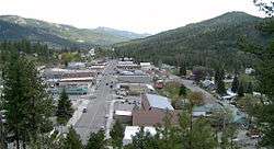
The town of Republic is the county's seat of government, as well as the largest town. It was founded at the end of the nineteenth century by gold prospectors, and was incorporated in 1900.
The original county courthouse, made of wood, burned in 1934. Its replacement, made of concrete and stucco, is presently being considered for historical preservation.[7]
Economy
Ferry County reaches to Canada on the north, and to the Columbia River on the east. Its southern portion is in the boundary of the Colville Indian Reservation, controlled by the Colville Confederated Tribes, and its northern portion is largely occupied by Colville National Forest. As a result, only eighteen percent of the total county area is taxable-use ground.[7] The county's economy is largely based on timber-extraction, and mining.
Ferry County’s topography and climate make it an ideal recreation destination, so tourism is becoming a significant portion of the county's economy. Washington State Highway 20, designated a National Scenic Highway, crosses the county east-west, and has the state's highest navigable pass (5,575 feet above sea level).
The county seat, Republic, is the site of the Stonerose Interpretive Center and Fossil Site, which exhibits and explains Eocene-era fossils from an ancient lake bed north of Republic.[7]
Geography
According to the U.S. Census Bureau, the county has a total area of 2,257 square miles (5,850 km2), of which 2,203 square miles (5,710 km2) is land and 54 square miles (140 km2) (2.4%) is water.[8] Most of the county is covered by the rugged Kettle River Range, which extends from the Canada–US border to its southernmost perimeter bounded by the Columbia River and Lake Roosevelt. Only a narrow north–south strip running the length of the county on the west between the San Poil River and the Okanogan County line is covered by the Okanogan Highland. Except for the town of Republic, the county is sparsely populated.
Geographic features
|
|
|
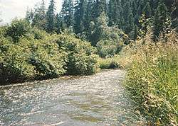
Major rivers and lakes
- Columbia River
- Kettle River
- Sanpoil River
- Franklin D. Roosevelt Lake, called Lake Roosevelt
- Curlew Lake
- Swan Lake
- Ferry Lake
- Fish Lake
- Long Lake
Adjacent counties
- Kootenay Boundary Regional District, British Columbia, north
- Stevens County, east
- Lincoln County, southwest
- Okanogan County, west
National protected areas
- Pacific Northwest National Scenic Trail (part)
- Colville National Forest (part)
- Lake Roosevelt National Recreation Area (part)
Demographics
| Historical population | |||
|---|---|---|---|
| Census | Pop. | %± | |
| 1900 | 4,562 | — | |
| 1910 | 4,800 | 5.2% | |
| 1920 | 5,143 | 7.1% | |
| 1930 | 4,292 | −16.5% | |
| 1940 | 4,701 | 9.5% | |
| 1950 | 4,096 | −12.9% | |
| 1960 | 3,889 | −5.1% | |
| 1970 | 3,655 | −6.0% | |
| 1980 | 5,811 | 59.0% | |
| 1990 | 6,295 | 8.3% | |
| 2000 | 7,260 | 15.3% | |
| 2010 | 7,551 | 4.0% | |
| Est. 2019 | 7,627 | [9] | 1.0% |
| U.S. Decennial Census[10] 1790–1960[11] 1900–1990[12] 1990–2000[13] 2010–2019[1] | |||
2000 census
As of the census[14] of 2000, there were 7,260 people, 2,823 households, and 1,987 families living in the county. The population density was 3 inhabitants per square mile (1.2/km2). There were 3,775 housing units at an average density of 2 per square mile (1/km²). The racial makeup of the county was 75.48% White, 0.21% Black or African American, 18.28% Native American, 0.29% Asian, 0.06% Pacific Islander, 2.23% from other races, and 3.46% from two or more races. 2.82% of the population were Hispanic or Latino of any race. 14.1% were of German, 9.5% United States or American, 9.1% Irish, and 7.6% English ancestry. 96.7% spoke English and 1.9% Spanish as their first language.
There were 2,823 households out of which 30.10% had children under the age of 18 living with them, 54.70% were married couples living together, 10.20% had a female householder with no husband present, and 29.60% were non-families. 24.80% of all households were made up of individuals and 9.10% had someone living alone who was 65 years of age or older. The average household size was 2.49 and the average family size was 2.95.
In the county, the population was spread out with 26.90% under the age of 18, 7.60% from 18 to 24, 23.40% from 25 to 44, 29.50% from 45 to 64, and 12.60% who were 65 years of age or older. The median age was 40 years. For every 100 females there were 107.70 males. For every 100 females age 18 and over, there were 105.20 males.
The median income for a household in the county was $30,388, and the median income for a family was $35,691. Males had a median income of $32,103 versus $23,371 for females. The per capita income for the county was $15,019. About 13.30% of families and 19.00% of the population were below the poverty line, including 20.40% of those under age 18 and 10.30% of those age 65 or over.
2010 census
As of the 2010 United States Census, there were 7,551 people, 3,190 households, and 2,070 families living in the county.[15] The population density was 3.4 inhabitants per square mile (1.3/km2). There were 4,403 housing units at an average density of 2.0 per square mile (0.77/km2).[16] The racial makeup of the county was 76.3% white, 16.7% American Indian, 0.7% Asian, 0.3% black or African American, 0.1% Pacific islander, 1.2% from other races, and 4.8% from two or more races. Those of Hispanic or Latino origin made up 3.4% of the population.[15] In terms of ancestry, 23.0% were German, 18.0% were English, 12.3% were Irish, and 3.7% were American.[17]
Of the 3,190 households, 23.9% had children under the age of 18 living with them, 49.2% were married couples living together, 9.2% had a female householder with no husband present, 35.1% were non-families, and 28.5% of all households were made up of individuals. The average household size was 2.29 and the average family size was 2.75. The median age was 47.3 years.[15]
The median income for a household in the county was $35,485 and the median income for a family was $43,576. Males had a median income of $41,755 versus $30,972 for females. The per capita income for the county was $18,021. About 13.6% of families and 20.8% of the population were below the poverty line, including 24.3% of those under age 18 and 12.4% of those age 65 or over.[18]
Government
| Year | Republican | Democratic | Third parties |
|---|---|---|---|
| 2016 | 60.4% 2,202 | 30.1% 1,098 | 9.4% 344 |
| 2012 | 57.2% 1,995 | 37.1% 1,294 | 5.7% 199 |
| 2008 | 54.2% 1,916 | 41.5% 1,467 | 4.3% 153 |
| 2004 | 60.4% 2,019 | 35.9% 1,201 | 3.7% 124 |
| 2000 | 62.4% 1,896 | 30.7% 932 | 6.9% 210 |
| 1996 | 38.7% 1,091 | 42.5% 1,197 | 18.8% 529 |
| 1992 | 30.2% 773 | 37.7% 963 | 32.1% 821 |
| 1988 | 48.1% 972 | 48.1% 972 | 3.8% 77 |
| 1984 | 55.8% 1,232 | 42.3% 935 | 2.0% 43 |
| 1980 | 52.8% 1,108 | 38.2% 802 | 9.1% 190 |
| 1976 | 45.9% 776 | 48.1% 814 | 6.0% 102 |
| 1972 | 53.4% 815 | 36.7% 560 | 10.0% 152 |
| 1968 | 43.8% 608 | 43.0% 596 | 13.2% 183 |
| 1964 | 36.1% 526 | 63.8% 931 | 0.1% 2 |
| 1960 | 40.3% 623 | 59.6% 921 | 0.1% 2 |
| 1956 | 44.3% 662 | 55.6% 830 | 0.1% 1 |
| 1952 | 47.4% 687 | 52.0% 754 | 0.6% 9 |
| 1948 | 35.3% 473 | 61.5% 824 | 3.2% 43 |
| 1944 | 39.4% 518 | 60.2% 792 | 0.4% 5 |
| 1940 | 31.9% 590 | 67.4% 1,247 | 0.7% 12 |
| 1936 | 21.1% 320 | 74.5% 1,130 | 4.4% 66 |
| 1932 | 22.3% 322 | 71.6% 1,035 | 6.1% 88 |
| 1928 | 45.8% 640 | 52.3% 732 | 1.9% 27 |
| 1924 | 34.5% 507 | 23.7% 349 | 41.8% 614 |
| 1920 | 43.6% 592 | 37.2% 505 | 19.3% 262 |
| 1916 | 33.7% 581 | 53.0% 913 | 13.3% 229 |
| 1912 | 16.9% 286 | 36.1% 609 | 47.0% 793[20] |
| 1908 | 47.2% 467 | 39.7% 393 | 13.1% 130 |
| 1904 | 54.9% 511 | 31.9% 297 | 13.2% 123 |
| 1900 | 33.3% 423 | 65.3% 830 | 1.5% 19 |
County law enforcement
County-wide law enforcement is provided by Ferry County Sheriff Office, headquartered in Republic.
Henry Waisman was the county's first sheriff, appointed by the county commissioners following the county's 1899 organization, with a mandate to serve until the first general election in 1900. The county's first elected sheriff was A.E. Stewart.[21]
The Sheriff's Office has had two line-of-duty deaths in its history, in 1981 and 2003. Both deaths were the result of aircraft crashes.[22]
As of 2016 the sheriff is Ray Maycumber.[23]
Communities
Census-designated places
See also
- Ansorge Hotel
- Ferry County Carousel
- National Register of Historic Places listings in Ferry County, Washington
- Stonerose Interpretive Center and Fossil Site
- List of law enforcement agencies in Washington
References
- "State & County QuickFacts". United States Census Bureau. Archived from the original on June 7, 2011. Retrieved January 7, 2014.
- Ahead of Columbia (4,078), Wahkiakum (3,978), and Garfield (2,266) counties.
- "Find a County". National Association of Counties. Archived from the original on May 31, 2011. Retrieved June 7, 2011.
- "Milestones for Washington State History — Part 2: 1851 to 1900". HistoryLink.org. March 6, 2003.
- Gannett, Henry (1905). The Origin of Certain Place Names in the United States. Govt. Print. Off. pp. 125.
- "About Stevens County". www.co.stevens.wa.us. Retrieved December 10, 2018.
- "Ferry County Government". www.ferry-county.com. Retrieved December 10, 2018.
- "2010 Census Gazetteer Files". United States Census Bureau. August 22, 2012. Retrieved July 5, 2015.
- "Population and Housing Unit Estimates". Retrieved April 12, 2020.
- "U.S. Decennial Census". United States Census Bureau. Retrieved January 7, 2014.
- "Historical Census Browser". University of Virginia Library. Retrieved January 7, 2014.
- "Population of Counties by Decennial Census: 1900 to 1990". United States Census Bureau. Retrieved January 7, 2014.
- "Census 2000 PHC-T-4. Ranking Tables for Counties: 1990 and 2000" (PDF). United States Census Bureau. Retrieved January 7, 2014.
- "U.S. Census website". United States Census Bureau. Retrieved May 14, 2011.
- "Profile of General Population and Housing Characteristics: 2010 Demographic Profile Data". United States Census Bureau. Archived from the original on February 13, 2020. Retrieved March 1, 2016.
- "Population, Housing Units, Area, and Density: 2010 - County". United States Census Bureau. Archived from the original on February 13, 2020. Retrieved March 1, 2016.
- "Selected Social Characteristics in the United States – 2006-2010 American Community Survey 5-Year Estimates". United States Census Bureau. Archived from the original on February 13, 2020. Retrieved March 1, 2016.
- "Selected Economic Characteristics – 2006-2010 American Community Survey 5-Year Estimates". United States Census Bureau. Archived from the original on February 13, 2020. Retrieved March 1, 2016.
- Leip, David. "Dave Leip's Atlas of U.S. Presidential Elections". uselectionatlas.org. Retrieved April 6, 2018.
- The leading "other" candidate, Progressive Theodore Roosevelt, received 286 votes, while Socialist candidate Eugene Debs received 269 votes, Prohibition candidate Eugene Chafin received 13 votes, and Socialist Labor candidate Arthur Reimer received 9 votes.
- An Illustrated History of Stevens, Ferry, Okanogan and Chelan Counties, State of Washington. Western Historical Publishing Company. 1904. p. 446.
- "Ferry County Sheriff's Department". Officer Down Memorial Page. Officer Down Memorial Page, Inc. Retrieved December 23, 2016.
- Jackson, Steve (June 23, 2016). "New Colville Reservation Fireworks Ban in Response to Wildfire Hazards". KPBX-FM. Retrieved December 23, 2016.
Further reading
External links
- Ferry County, Washington at HistoryLink.org
- Official website of Ferry County Government
- SummitPost.org, Kettle River Range (Washington State)
- Ferry County, Washington at Curlie
- Sheriff's office official website
Places adjacent to Ferry County, Washington | |
|---|---|
Municipalities and communities of Ferry County, Washington, United States | ||
|---|---|---|
| City | Map of Washington highlighting Ferry County | |
| CDPs | ||
| Other unincorporated communities | ||
| Indian reservation | ||
| Ghost town | ||
| Footnotes | ‡This populated place also has portions in an adjacent county or counties | |

| Authority control |
|
|---|