Spokane Valley, Washington
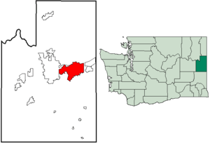
Spokane Valley is a city in Spokane County, Washington, United States, and the largest suburb of Spokane. It is located east of Spokane, west of Coeur d'Alene, Idaho and surrounds the city of Millwood on three sides. The city incorporated as the City of Spokane Valley on March 31, 2003. The Washington State Office of Financial Management estimates the city's population as 101,060 as of 2019.[3] Spokane Valley is named after the valley of the Spokane River, in which it is located. Before becoming an incorporated city, the area was and still is referred to as "The Valley" by residents of the Spokane–Coeur d'Alene area.
Spokane Valley, Washington | |
|---|---|
| City of Spokane Valley | |
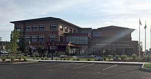 Spokane Valley City Hall | |
 Logo | |
| Nickname(s): The Valley | |
| Motto(s): "A community of opportunity where individuals and families can grow and play, and businesses will flourish and prosper." | |
 | |
| Coordinates: 47°40′24″N 117°14′22″W | |
| Country | United States |
| State | Washington |
| County | Spokane |
| Settled | 1849 |
| Incorporated | March 31, 2003 |
| Named for | The Spokane Valley |
| Government | |
| • Type | Council–manager |
| • Body | City council |
| • City manager | Mark Calhoun |
| • Mayor | Ben Wick |
| • Deputy mayor | Brandi Peetz |
| Area | |
| • City | 38.01 sq mi (98.44 km2) |
| • Land | 37.72 sq mi (97.69 km2) |
| • Water | 0.29 sq mi (0.75 km2) |
| Elevation | 2,002 ft (610 m) |
| Population | |
| • City | 89,755 |
| • Estimate (2019)[3] | 101,060 |
| • Rank | US: 312th WA: 9th |
| • Density | 2,643.24/sq mi (1,020.57/km2) |
| • Metro | 573,493 (US: 98th) |
| • CSA | 721,396 (US: 72nd) |
| Time zone | UTC−8 (Pacific (PST)) |
| • Summer (DST) | UTC−7 (PDT) |
| ZIP code | 99206, 99216, 99212, 99016, 99027, 99037 [4] |
| Area code(s) | 509 |
| FIPS code | 53-67167[5] |
| GNIS feature ID | 1967430[6] |
| Website | Official website |
The city was formed from a merger of the unincorporated census-designated places (CDPs) of Dishman, Opportunity, Trentwood, Veradale, as well as the western section of the CDP of Greenacres. Unlike the other five towns, Millwood avoided becoming part of Spokane Valley by incorporating itself in 1927; although, it is part of the Greater Spokane Valley Chamber of Commerce.
History
For thousands of years, the Spokane Valley area was populated by members of the Upper Band of the Interior Salish Indians, calling themselves "Sn-tutuul-i", the meaning of which is not known. In about 1783, fur traders from the North West Company began traveling through the area. They called these Indians the "Spokanes" which has been interpreted as meaning "Children of the Sun." The Spokanes were a peaceful people, on friendly terms with neighboring tribes and later the fur traders and missionaries who came to the area. They fished salmon, hunted game, and ate camassia roots and berries they gathered.
Despite their many years of acceptance of the white settlers, and the calming influence of Chief Garry (sometimes Spokan Garry), the Spokanes protested the loss of their lands by joining in the Indian Rebellion of 1857. The final battle, in 1858, culminated in the Spokane Valley with the destruction of over 800 of their horses, their food, and teepees. The Spokanes were eventually forced from the lands of their ancestors to a reservation north of the Spokane River, just west of the Spokane area.
The first permanent white settler in the Spokane Valley was a retired French-Canadian trapper, Antoine Plante, who built a small cabin near the Spokane River in 1849. Plante ran a small Hudson's Bay Company trading post in the home he shared with his American Indian wife and family. In 1850, Plante constructed and operated the first ferry across the Spokane River, the only means of crossing the river in the area. It was used for transportation across the river by Fort Colville military personnel, U.S. Army surveyors, and miners traveling to western Montana and southeastern British Columbia.
In 1862, A. C. "Charley" Kendall established a store on the north side of the Spokane River. A bridge to cross the river at Kendall's store was soon built by Joe Herring, Timothy Lee, and Ned Jordan in 1864. A small community, known as Spokane Bridge, began to build up near the bridge. M. M. Cowley took over the holdings of Charley Kendall in 1872, including the bridge, a trading post and a log hotel.
The history of the settlement of the Spokane Valley predates the history of the city of Spokane, Washington. Spokane Valley holds many of the "firsts" for the Spokane area. In addition to being home to the area's first settler, Antoine Plante, the Spokane Valley had the first business and first ferry in 1850; the first store (1862) and bridge (1864); the first house (1866); and the first post office (1867). All these firsts occurred before the 1873 arrival of James N. Glover, considered the founding father of Spokane.
Before the turn of the century, early pioneers, many of them silver miners, arrived from the East by way of the Northern Pacific and Great Northern railroads, for which Spokane was a major hub. By 1883, the first transcontinental rail was established. The railroad activity created support for extensive shops and facilities. Within a few years, Spokane was tied to the outside world by five transcontinental railroads, making it the hub of commerce it remains today.
Irrigation efforts stimulated population growth in the Spokane Valley significantly in the early part of the 20th century. Developers and real estate speculators tapped into nearby lakes, the Spokane River and the aquifer lying under the valley in an effort to turn the dry land into saleable agricultural land. In 1899, the Spokane Valley Land and Water Co., later owned by long-time irrigation advocate D.C. Corbin, built a canal to irrigate land in the Greenacres area with water from Liberty Lake. In 1905, the Spokane Canal Company built a canal to irrigate the Otis Orchard area with water from Newman Lake, and Modern Irrigation and Land Company tapped into the underground aquifer to irrigate 3,000 acres (12 km2) in Opportunity. Within just twenty years, 30,000 acres (120 km2) of dry land was converted into fertile farmland. Water access greatly increased land values. Valley population grew from 1,000 residents in 1900 to nearly 10,000 by 1922. Extensive apple orchards thrived in the gravelly soil of the Valley, and by 1912 nearly 2 million apple trees had been planted. A huge packing plant was built in 1911 by the Spokane Valley Growers Union.
With the exception of the incorporated Town of Millwood, Washington, the Spokane Valley was developed as townships with no governmental functions. Most of the townships platted in the early 1900s were surveyed as a tool for promotion and sales, and remain as names for neighborhoods and post office designations today.
A few Spokane Valley townships were developed for residential and/or business purposes. Trent was originally platted as a residential area for Northern Pacific railroad workers in 1881, Millwood began as a "company town", developed by Inland Empire Paper Mill for their employees, and Dishman developed primarily as a business center. All other Valley townships were developed as irrigation districts and owe their existence to their agricultural roots. Between 1901 and 1915, the townships of Orchard Avenue, Greenacres, Otis Orchards, Opportunity, Vera, Dishman, Liberty Lake, Newman Lake, East Spokane, Mica and Chester were platted. Pasadena Park is a populated place located in Spokane County at latitude 47.697 and longitude -117.283, North of Millwood across the Spokane River that existed at least as early as 1916.[7]
The Spokane Valley was promoted as a wonderful place to live. Though most Valley residents were farmers or orchardists, canneries, brickyards, railroad maintenance facilities and lumber mills provided jobs for many. The beauty of the surrounding area, pleasant communities, fertile farmlands, business opportunities, outdoor sports and activities, local recreational areas and community organizations caused it to be called "Spokane Valley, the Valley Bountiful". As the population increased, small communities with schools, churches, businesses, community clubs and organizations thrived. Tied to Spokane, local lakes and Coeur d’Alene by railroads and bus systems, the people of the Valley enjoyed a full life.
In the years that followed, crop troubles and irrigation system maintenance problems prompted many residents to sell their farms in five, ten, or 20-acre (81,000 m2) plots for suburban home sites. Many of the apple trees were pulled out and replaced by neighborhoods and truck farms. The truck farms were successful in raising strawberries, raspberries, tomatoes, beans, peas, watermelons, asparagus, squash, cucumbers and thousands of acres of Heart of Gold cantaloupes. Dairy, poultry and fur farms also appeared in the Valley during these years.
While jobs were scarce during the Great Depression, most people in the Spokane Valley had enough land to grow food for their families. The Spokane Valley Chamber of Commerce adhered to a positive agenda throughout these hard times. They placed street signs on Valley roads and in an effort to show solidarity with Spokane, east-west roads were renamed to correspond with Spokane's roads. Observing that fires were a constant and catastrophic problem for area residents, the Chamber lobbied to begin a fire protection district in the Valley. Their efforts were successful and Valley residents were first offered fire protection in 1940, with the formation of Spokane County Fire Protection District Number One.
The people of the valley always maintained independence from the City of Spokane on its borders. The first local newspaper, The Spokane Valley Herald, was launched in 1920. In 1919 an early municipal airfield was carved out, later named Felts Field in honor of Herald owner Buell Felts who died in a plane crash there. A streetcar line was started as early as 1908, and later extended to Liberty Lake in the east part of the valley, where entertainment facilities were built for music and outdoor gatherings. Other than Millwood, which incorporated in 1927 and Liberty Lake, Washington which did so in 2001, the Valley remained unincorporated throughout the 20th century.
Industry began to replace agriculture more rapidly after the completion of Grand Coulee Dam in 1941, which combined cheap electricity with readily available water from the Spokane River and the extensive aquifer which underlies the Valley. At its height, the Valley was the site for an aluminum plant, a cement plant and a paper mill. Plans to attract light industry through the establishment of an industrial park at a former military depot were not very successful. The cement plant closed in the 1950s, but the paper mill and aluminum plant remain.
In the 1950s a further transformation swept the valley as the post World War II population boom began to push into the valley, replacing most of the remaining apple orchards with tracts of houses. The first shopping mall was built at University Village on Sprague Avenue (formerly called Appleway), which became the major artery through the Valley, lined with stores and restaurants. The last large-scale orchard irrigations ended in the late 1950s, canvas pipes running down residential streets replacing the old ditches by that time.
In the later decades of the last century the Valley experienced a large influx of retirees due to inexpensive housing and the relatively dry weather. Retirement complexes and apartment blocks began to appear. At the present time the Valley remains principally a suburban area, a mixture of families and retirees and the retail commerce to support them. In the 1990s and the early part of the twenty-first century the Spokane Valley continued to grow more urban, becoming one of the fastest growing regions in the state. Commercial growth increased and joined residential growth as it moved towards the state line. The urban development included the opening of the long-awaited Spokane Valley Mall in 1997, the establishment of dozens of other businesses along business corridors, and the development of the Mirabeau Point community complex.
The City of Spokane Valley incorporated on March 31, 2003,[8] after being turned down in four previous referendums. At its creation, it was the third-largest newly incorporated city in US history (after Centennial, Colorado, which incorporated in 2001; and Miami Gardens, Florida, which incorporated about five weeks before Spokane Valley).
The situation of the City of Spokane Valley as an urban outgrowth of Spokane is very similar to the outgrowth of Sandy Springs, Georgia, a suburb of Atlanta. Sandy Springs would itself incorporate on December 1, 2005, passing City of Spokane Valley for third place on the list of largest newly incorporated U.S. cities.
Geography
Spokane Valley lies along both banks of the Spokane River as it flows between Idaho and the City of Spokane. Most of the city lies to the south of the river as the Selkirk Mountains rise immediately to the north of the river in most places. To the south of the valley rise Mica Peak and Krell Hill, the southernmost extremity of the Selkirks.
Shelley Lake is a small lake located entirely in city limits, fed by the Saltese Creek.
Spokane Valley city proper consists of the communities of Dishman, Greenacres, Opportunity, Trentwood, Veradale, Yardley, and parts of Chester and Otis Orchards. According to the United States Census Bureau, the city has a total area of 38.06 square miles (98.57 km2), of which, 37.77 square miles (97.82 km2) is land and 0.29 square miles (0.75 km2) is water.[9]
Because the City of Spokane Valley shares its name with the unincorporated area it was carved from, the term "Spokane Valley" is often used in reference to an area greater than that which falls within the city limits.
Climate
Spokane Valley experiences a Hot-summer mediterranean climate (Köppen Csa), or a Humid continental climate (Dsa) depending on the temperature threshold used.
| Climate data for Spokane (Felts Field) 1998-present normals and extremes | |||||||||||||
|---|---|---|---|---|---|---|---|---|---|---|---|---|---|
| Month | Jan | Feb | Mar | Apr | May | Jun | Jul | Aug | Sep | Oct | Nov | Dec | Year |
| Record high °F (°C) | 59 (15) |
60 (16) |
74 (23) |
87 (31) |
95 (35) |
108 (42) |
112 (44) |
112 (44) |
102 (39) |
86 (30) |
69 (21) |
63 (17) |
112 (44) |
| Mean maximum °F (°C) | 51.5 (10.8) |
53.4 (11.9) |
64.9 (18.3) |
76.2 (24.6) |
86.6 (30.3) |
93.5 (34.2) |
100.3 (37.9) |
99.2 (37.3) |
90.6 (32.6) |
75.3 (24.1) |
59.6 (15.3) |
51.6 (10.9) |
101.9 (38.8) |
| Average high °F (°C) | 37.1 (2.8) |
42.5 (5.8) |
51.0 (10.6) |
59.0 (15.0) |
68.6 (20.3) |
75.2 (24.0) |
87.0 (30.6) |
85.6 (29.8) |
75.6 (24.2) |
60.2 (15.7) |
44.8 (7.1) |
36.6 (2.6) |
60.3 (15.7) |
| Average low °F (°C) | 26.2 (−3.2) |
27.2 (−2.7) |
31.7 (−0.2) |
36.2 (2.3) |
43.3 (6.3) |
50.3 (10.2) |
56.2 (13.4) |
54.8 (12.7) |
46.6 (8.1) |
37.9 (3.3) |
30.6 (−0.8) |
25.6 (−3.6) |
38.9 (3.8) |
| Mean minimum °F (°C) | 9.3 (−12.6) |
13.8 (−10.1) |
20.4 (−6.4) |
26.8 (−2.9) |
32.0 (0.0) |
41.3 (5.2) |
46.4 (8.0) |
45.5 (7.5) |
36.0 (2.2) |
25.6 (−3.6) |
17.1 (−8.3) |
9.4 (−12.6) |
2.5 (−16.4) |
| Record low °F (°C) | −10 (−23) |
−3 (−19) |
2 (−17) |
24 (−4) |
28 (−2) |
37 (3) |
39 (4) |
40 (4) |
26 (−3) |
12 (−11) |
−2 (−19) |
−10 (−23) |
−10 (−23) |
| Average precipitation inches (mm) | 1.92 (49) |
1.14 (29) |
1.91 (49) |
1.23 (31) |
1.51 (38) |
1.66 (42) |
0.40 (10) |
0.51 (13) |
0.61 (15) |
1.10 (28) |
1.94 (49) |
2.31 (59) |
16.25 (413) |
| Source 1: [10] | |||||||||||||
| Source 2: [11] | |||||||||||||
Demographics
| Historical population | |||
|---|---|---|---|
| Census | Pop. | %± | |
| 2000 | 80,927 | — | |
| 2010 | 89,755 | 10.9% | |
| Est. 2019 | 101,060 | [12] | 12.6% |
| U.S. Decennial Census[13] 2018 Estimate[14] | |||
2010 census
As of the census[2] of 2010, there were 89,755 people, 36,558 households, and 23,119 families residing in the city. The population density was 2,376.4 inhabitants per square mile (917.5/km2). There were 38,851 housing units at an average density of 1,028.6 per square mile (397.1/km2). The racial makeup of the city was 90.9% White, 1.1% African American, 1.2% Native American, 1.7% Asian, 0.3% Pacific Islander, 1.4% from other races, and 3.3% from two or more races. Hispanic or Latino of any race were 4.6% of the population.
There were 36,558 households of which 31.6% had children under the age of 18 living with them, 45.6% were married couples living together, 12.2% had a female householder with no husband present, 5.4% had a male householder with no wife present, and 36.8% were non-families. 29.0% of all households were made up of individuals and 11.2% had someone living alone who was 65 years of age or older. The average household size was 2.43 and the average family size was 2.99.
The median age in the city was 37.3 years. 24% of residents were under the age of 18; 9.5% were between the ages of 18 and 24; 26.1% were from 25 to 44; 26.4% were from 45 to 64; and 14.1% were 65 years of age or older. The gender makeup of the city was 48.9% male and 51.1% female.
Infrastructure
Emergency Services
Law Enforcement
The Spokane Valley Police Department is a contracted division of the Spokane County Sheriff's Office, with Spokane Valley being the largest City the sheriff's office serves.[15] The Spokane Valley Police Precinct headquarters is located at 12710 E. Sprague Ave.[16] Deputies assigned to the Spokane Valley Precinct use distinct Spokane Valley Police Department patrol vehicles and uniforms, including a Spokane Valley Police Department patch. As of 2019, the current Spokane Valley Police Chief of Police is Mark Werner, a position he's held since 2016.[17] The Spokane Valley Police Department has been a WASPC accredited agency since 2011.[18]
The Spokane County Sheriff's Office has been featured in 26 episodes of the A&E Television series Live PD,[19] with the majority of filming happening in or near the City of Spokane Valley.[20]
Fire & Rescue
The Spokane Valley Fire Department (SVFD) has served the greater Spokane Valley area since 1940.[21] SVFD is a special purpose fire district that was formed 63 years before the incorporation of the City of Spokane Valley, and as result is a separate entity from the City. SVFD has 7 of its 10 fire stations located in the City of Spokane Valley,[22] with the remaining 3 fire stations in Liberty Lake, Millwood, and Otis Orchards. SVFD has plans for an 8th Spokane Valley fire station on Barker Road in 2022.[23]
In 2011, SVFD received accreditation by the Commission on Fire Accreditation International (CFAI),[24] becoming one of only roughly 250 accredited fire service agencies worldwide.[25] In 2017 SVFD improved its WSRB fire insurance rating to a Protection Class 2 in the City of Spokane Valley, becoming one of only 5 fire departments with a Class 2 rating in Washington State (Along with Seattle, Bellevue, Olympia, and Federal Way), and the only Class 2 rating in eastern Washington.[26] In Washington State, only the Spokane Valley Fire Department and Bellevue Fire Department are both a Class 2 rating and internationally Accredited.[27]
Ambulance Services
Ambulance service in Spokane Valley is currently contracted to American Medical Response.[28] AMR Spokane is a CAAS accredited agency.[29]
Education
Public & Private Schools
Spokane Valley is served by multiple school districts, including the Central Valley School District,[30] West Valley School District,[31] East Valley School District,[32] and a portion of western Spokane Valley by Spokane Public Schools.[33] Private schools include Valley Christian School, St. John Vianney School, The Oaks Classical Christian Academy, and several others. High School students may also attend Spokane Valley Tech,[34] a public vocational school serving the Spokane Valley and greater Spokane region.
Spokane Valley higher education includes a small campus of Carrington College.[35]
Spokane University
University Road in Spokane Valley is named for Spokane University, a four-year liberal arts college that operated in the Spokane Valley from 1913 to 1933.[36] During the great depression, Spokane University had "no endowment and nothing to fall back on" causing its closure in 1933.[37] It briefly reopened as Spokane Valley Junior College, before facilities were moved to Spokane's South Hill and merged into the newly formed Spokane Junior College in 1935.[38] World War II brought decreased enrollment and increased operations costs, and in 1942 Spokane Junior College was merged into Whitworth College (Now Whitworth University).[39]
The campus of Spokane University at 9th & Herald eventually turned into University High School. U-High operated at this location from 1962 until 2002,[40] before moving to its current location on East 32nd.[41] The 9th & Herald campus has been occupied by Valley Christian School since 2005.[42]
Culture
Museums
The Spokane Valley Heritage Museum opened its doors on August 18, 2005,[43] and is located in the historic Opportunity Township Hall. The museum's goal is to collect, preserve and exhibit the history and culture of the Spokane Valley. The museum houses archives of photos and documents, as well as public exhibits.[44]
Spokane Indians
Spokane Valley is the home of the Spokane Indians, a Minor League Baseball team of the Northwest League (NWL) and Class A Short Season affiliate of the Texas Rangers. The Indians play its home games at Avista Stadium, which opened in 1958 and has a seating capacity of 6,803.[45] From 1958 through 1982, excluding 1972, the Indians were in the Triple-A Pacific Coast League (PCL). They have won 12 league titles: four in the PCL and eight in the NWL.[46] The Spokane region has over a century of history in Minor League Baseball, dating back to the 1890s.[47]
Fair & Expo Center
The Spokane County Fair and Expo Center is home to dozens of various events throughout the year,[48] including the 10-day Spokane County Interstate Fair.[49] The Fair & Expo Center is situated on 97 acres, with over 140,000 square feet of exhibition space, livestock facilities, indoor and outdoor arenas, lawns, and parking.[50]
Valleyfest
Valleyfest is a 3-day community festival held every September since 1990 at Mirabeau Point Park and CenterPlace Regional Event Center. Events include the Hearts of Gold Parade, hot air balloon launches, 5K/10K Run for Hunger, Pancake Breakfast, Classic Car Show, Kids Zone, 3 stages of live music, Miss Spokane Valley Scholarship Program, and much more. Attendance each year is estimated at over 50,000 people, with over 150 exhibits, and 200+ volunteers.[51]
References
- "2018 U.S. Gazetteer Files". United States Census Bureau. Retrieved February 16, 2020.
- "U.S. Census website". United States Census Bureau. Retrieved December 19, 2012.
- "Annual Estimates of the Resident Population for Incorporated Places in Washington: April 1, 2010 to July 1, 2019". United States Census Bureau. May 2020. Retrieved May 26, 2020.
- "Spokane Valley, Washington Zip Code Boundary Map (WA)". www.zipmap.net.
- "US Gazetteer files: 2010, 2000, and 1990". United States Census Bureau. February 12, 2011. Retrieved April 23, 2011.
- "US Board on Geographic Names". United States Geological Survey. December 23, 2002. Retrieved March 13, 2017.
- http://washington.hometownlocator.com/wa/spokane/pasadena-park.cfm Hometown Locator: Pasadena Park
- "History of the Spokane Valley". Spokane.net. Archived from the original on 2 December 2009. Retrieved 12 July 2009.
- "US Gazetteer files 2010". United States Census Bureau. Archived from the original on July 2, 2012. Retrieved 2012-12-19.
- "NOWData - NOAA Online Weather Data". NOAA. Retrieved February 25, 2018.
- "THE SUMMERS OF 1939, 1961 AND 1967 WERE THE HOTTEST EVER IN COEUR D'ALENE". Coeur d'Alene Press. Archived from the original on November 17, 2018. Retrieved February 26, 2018.
- "Annual Estimates of the Resident Population for Incorporated Places in Washington: April 1, 2010 to July 1, 2019". United States Census Bureau. May 2020. Retrieved May 21, 2020.
- United States Census Bureau. "Census of Population and Housing". Retrieved August 3, 2013.
- "Population Estimates". United States Census Bureau. Retrieved June 5, 2019.
- Bureau, U. S. Census. "U.S. Census website". United States Census Bureau. Retrieved 2019-07-07.
- "Police - Spokane Valley, WA". www.spokanevalley.org.
- "Spokane Valley Police Chief - Undersheriff Mark Werner | Spokane County, WA". www.spokanecounty.org.
- "Spokane Valley Police Department earns reaccreditation - Spokane Valley News Herald - Spokane Valley Online".
- Flynn, Caroline (August 8, 2017). "Spokane County Sheriff's Office featured on "Live PD"". www.kxly.com. Retrieved 2020-01-11.
- "Shawn Vestal: 'Live PD' paints Spokane at its ugliest | The Spokesman-Review". www.spokesman.com.
- "OUR HISTORY". Spokane Valley Fire Department. Retrieved July 6, 2019.
- "FACILITIES & APPARATUS". Spokane Valley Fire Department. Retrieved July 6, 2019.
- "MAINTENANCE & OPERATIONS (M&O) REPLACEMENT LEVY". Spokane Valley Fire Department. Retrieved July 6, 2019.
- "CPSE Home". Center for Public Safety Excellence. Retrieved July 6, 2019.
- "ACCREDITATION". Spokane Valley Fire Department. Retrieved July 6, 2019.
- "Spokane Valley earned best rating in Eastern Washington; insurance rates likely to fall". The Spokesman Review. Retrieved July 6, 2019.
- "FIRE INSURANCE RATING – WSRB". Spokane Valley Fire Department. Retrieved July 6, 2019.
- "AMR in the Spokane Community". American Medical Response. Retrieved July 6, 2019.
- "Welcome to CAAS". Commission on Accreditation of Ambulance Services. Retrieved July 6, 2019.
- "Central Valley School District". www.cvsd.org.
- "West Valley School District #363". www.wvsd.org.
- "EVSD website". www.evsd.org. Retrieved 2020-01-11.
- "Spokane Public Schools / Homepage" Check
|url=value (help). https. - "Spokane Valley Tech". www.spokanevalleytech.org.
- "Carrington College - The Starting Point for Health Care Careers". Carrington.
- Kassa, Thomas. "Spokane University". Spokane Historical.
- "Spokane Valley -- Thumbnail History". www.historylink.org.
- "The Spokesman-Review - Google News Archive Search". news.google.com.
- "Spokane Daily Chronicle - Google News Archive Search". news.google.com.
- "History – About Us – Central Valley School District". www.cvsd.org.
- "University High School". uhs.cvsd.org.
- "History".
- Yahya, Ayisha. Spokane Valley Museum brings a blast from past . The Spokesman-Review, August 19, 2005, http://www.spokesman.com/stories/2005/aug/19/spokane-valley-museum-brings-a-blast-from-past/
- "Archived copy". Archived from the original on 2008-05-17. Retrieved 2015-02-18.CS1 maint: archived copy as title (link)
- "Official website" (PDF). www.spokesman.com. Retrieved 2020-01-11.
- "Spokane Indians History". MiLB.com.
- Price, Jim (June 21, 2003). "Birth of the Indians". Spokesman-Review. Spokane Valley, Washington. p. H2.
- "Fair & Expo Center | Spokane County, WA". www.spokanecounty.org.
- "Interstate Fair | Spokane County, WA". www.spokanecounty.org.
- "Spokane County Fair & Expo Center". Spokane County, WA.
- "About Valleyfest > Valleyfest".
External links
Municipalities and communities of Spokane County, Washington, United States | ||
|---|---|---|
| Cities | 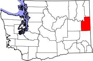 Map of Washington highlighting Spokane County | |
| Towns | ||
| CDPs | ||
| Unincorporated communities | ||
| Ghost towns/Neighborhoods | ||

| Authority control |
|---|