Kodagu district
Kodagu (also known by its former name Coorg) is an administrative district in the Karnataka state of India. Before 1956, it was an administratively separate Coorg State,[3] at which point it was merged into an enlarged Mysore State. It occupies an area of 4,102 square kilometres (1,584 sq mi) in the Western Ghats of southwestern Karnataka. In 2001 its population was 548,561, 13.74% of which resided in the district's urban centre, making it the least populous of the 30 districts in Karnataka.The nearest railway stations are Mysore Junction, located around 95 km away and Thalassery and Kannur in Kerala, at a distance of 79 km. The nearest airports are Kannur International Airport in Kerala (59 km from Kodagu) and Mangalore International Airport (116 km from Kodagu).
Kodagu district Coorg district | |
|---|---|
District | |
 .jpg)   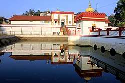 | |
| Nicknames: Scotland of India, The land of warriors | |
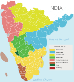
 Location in Karnataka | |
| Coordinates: 12.4208°N 75.7397°E | |
| Country | |
| State | Karnataka |
| Region | Malnad |
| Headquarters | Madikeri |
| Talukas | Madikeri, Somwarpet, Virajpet |
| Government | |
| • Deputy Commissioner | Anees Kanmani Joy |
| • MP | Pratap Simha |
| • MLA |
|
| Area | |
| • Total | 4,102 km2 (1,584 sq mi) |
| Elevation | 900 m (3,000 ft) |
| Population (2011)[2] | |
| • Total | 554,519 |
| • Density | 140/km2 (350/sq mi) |
| Demonym(s) | Kodava |
| Languages | |
| • Official | Kannada |
| • Regional | Kodava |
| Time zone | UTC+5:30 (IST) |
| PIN | 571201 (Madikeri) |
| Telephone code |
|
| Vehicle registration | KA-12 |
| Literacy | 82.52% |
| Lok Sabha constituency | Mysore Lok Sabha constituency |
| Karnataka Legislative Assembly constituency | Madikeri, Virajpet |
| Climate | Tropical Wet (Köppen) |
| Precipitation | 2,725.5 millimetres (107.30 in) |
| Avg. summer temperature | 28.6 °C (83.5 °F) |
| Avg. winter temperature | 14.2 °C (57.6 °F) |
| Website | kodagu |
Geography
Kodagu is located on the eastern slopes of the Western Ghats. It has a geographical area of 4,102 km2 (1,584 sq mi).[4] The district is bordered by Dakshina Kannada district to the northwest, Hassan district to the north, Mysore district to the east, Kasaragod district of Kerala in west and Kannur district of Kerala to the southwest, and Wayanad district of Kerala to the south. It is a hilly district, the lowest elevation of which is 120 metres (390 ft) above sea-level. The highest peak, Tadiandamol, rises to 1,750 metres (5,740 ft), with Pushpagiri, the second highest, at 1,715 metres (5,627 ft). The main river in Kodagu is the Kaveri (Cauvery), which originates at Talakaveri, located on the eastern side of the Western Ghats, and with its tributaries, drains the greater part of Kodagu.
Administrative divisions
Representation
Two members of the legislative assembly are elected from Kodagu to the Karnataka Legislative Assembly, one each from the Madikeri and Virajpet. M P Appachu Ranjan represents the Madikeri constituency while K. G. Bopaiah represents the Virajpet constituency; they are from the Bharatiya Janata Party. Kodagu, formerly part of the Kodagu-Dakshina Kannada (Mangalore) constituency, is now part of the Mysore Lok Sabha parliamentary constituency. The current MP for this constituency is Shri Pratap Simha, from the Bharatiya Janata Party.
The Codava National Council and Kodava Rashtriya Samiti are campaigning for autonomy to Kodagu district.[5][6]
History
The Kodavas were the earliest inhabitants and agriculturists in Kodagu, having lived there for centuries. Being a warrior community as well, they carried arms during times of war and had their own chieftains. The Haleri dynasty, an offshoot of the Keladi Nayakas, ruled Kodagu between 1600 and 1834. Later the British ruled Kodagu from 1834, after the Coorg War, until India's independence in 1947. A separate state (called Coorg State) until then, in 1956 Kodagu was merged with the Mysore State (now Karnataka).
Coorg in British India
In 1834, the East India Company annexed Kodagu into British India, after deposing Chikka Virarajendra of the Kodagu kingdom, as 'Coorg'. The people accepted British rule peacefully. British rule led to the establishment of educational institutions, introduction of scientific coffee cultivation, better administration and improvement of the economy.[7]
Demographics
According to the 2011 census of India, Kodagu has a population of 554,519, roughly equal to the Solomon Islands[8] or the US state of Wyoming.[9] This ranks it 539 out of 640 districts in India in terms of population. The district has a population density of 135 inhabitants per square kilometre (350/sq mi). Its population growth rate over the decade 2001–2011 was 1.13%. Kodagu has a sex ratio of 1019 females for every 1000 males, and a literacy rate of 82.52%.
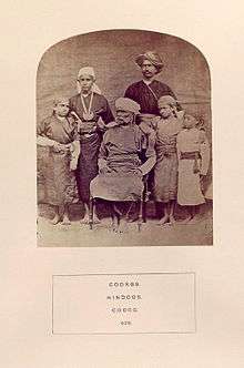
Kodava Takk is the spoken language native to Kodagu. Are Bhashe, a dialect of Kannada, is native to Sulya in Dakshina Kannada. Both use Kannada script for literature.[10] According to Karnataka Kodava Sahitya Academy (Karnataka's Kodava Literary Academy), apart from Kodavas, and their related groups, the Amma Kodavas, the Kodava Peggade (Kodagu Heggade) and the Kodava Maaple (Kodava Muslims), 18 other smaller-numbered ethnic groups speak Kodava Takk in and outside the district including the Iri (Airi, or the carpenters and the village smiths), the Koyava, the Banna, the Kodagu Madivala (washermen), the Kodagu Hajama (barber, also called Nainda), the Kembatti Poleya (household servants and labourers) and the Meda (basket and mat weavers and drummers).[11] Less frequent are Tulu speakers Billavas, Mogaveeras, Bunts, Goud Saraswat Brahmins.[11]
Other Kodava speakers
Among other Kodava speaking communities are: the Heggades, cultivators from Malabar; the Kodava Nair, cultivators from Malabar; the Ayiri, who constitute the artisan caste; the Medas, who are basket and mat-weavers and act as drummers at feasts; the Binepatta, originally wandering musicians from Malabar, now farmers; and the Kavadi, cultivators settled in Yedenalknad (Virajpet). All these groups speak the Kodava language and conform generally to Kodava customs and dress.[10]
Kodagu Aarebashe Gowda people
The Arebhashe gowdas,[12] or Kodagu Gowdas, and Tulu Gowdas, are an ethnic group of Dakshina Kannada and Kodagu. They live in Sulya (in Dakshina Kannada) and in parts of Somwarpet, Kushalanagar, Bhagamandala and Madikeri. They speak a language known as Arebhashe a dialect of Kannada. Guddemane Appaiah Gowda along with many other freedom fighters from different communities revolted against the British in an armed struggle which covered entire Kodagu and Dakshina Kannada. This was one of the earliest freedom movements against the British[13] called "Amara Sulliada Swantantrya Sangraama"[14] (Amara Sulya Dhange[13] formally called the 'Coorg Rebellion' by the British) started in 1837.[15][16][17][18]
Muslims and Christians
A huge minority of Muslims dot the Coorg district, especially the towns of Kushalnagar, Virajpet and Mercara. A sizeable of them are the Nawayaths who shifted in the eighties from Bhatkal and Murdeshwar in order to pursue coffee & arecanut plantations and textile business. The numerous mosque dotting the landscape is the testimony of Muslim presence in the district.
A small number of Mangalorean Catholics are also found in Coorg. They are mostly descended from those Konkani Catholics who fled the roundup and, later, captivity by Tippu Sultan. These immigrants were welcomed by Raja Veerarajendra (himself a former captive of Tippu Sultan, having escaped six years of captivity in 1788) who realising their usefulness and expertise as agriculturists, gave them lands and tax breaks and built a church for them.[19]
| Historical population | ||
|---|---|---|
| Year | Pop. | ±% p.a. |
| 1901 | 180,607 | — |
| 1911 | 174,976 | −0.32% |
| 1921 | 163,838 | −0.66% |
| 1931 | 163,327 | −0.03% |
| 1941 | 168,726 | +0.33% |
| 1951 | 229,405 | +3.12% |
| 1961 | 322,829 | +3.48% |
| 1971 | 378,291 | +1.60% |
| 1981 | 461,888 | +2.02% |
| 1991 | 488,455 | +0.56% |
| 2001 | 548,561 | +1.17% |
| 2011 | 554,519 | +0.11% |
| source:[20] | ||
Tourism


Kodagu is rated as one of the top hill station destinations in India. Some of the most popular tourist attractions in Kodagu include Talakaveri, Bhagamandala, Nisargadhama, Abbey Falls, Dubare, Nagarahole National Park, Iruppu Falls, and the Tibetan Buddhist Golden Temple.[21]
- Talakaveri is the place where the River Kaveri originates.[22] The temple on the riverbanks here is dedicated to Lord Brahma, and is one of only two temples dedicated to Brahma in India and Southeast Asia. Bhagamandala is situated at the Sangama (confluence) of two rivers, the Kaveri and the Kannika. A third river, the Sujyothi, is said to join from underground, and hence this spot is called the Triveni Sangama. Iruppu Falls is a sacred Kodagu Hindu spot in South Kodagu in the Brahmagiri hill range. The Lakshmana Tirtha River, with the waterfalls, flows nearby and has a Rameshwara temple on its banks. It is said that this sacred river was created when Laxmana, prince of Ayodhya and younger brother of Lord Rama, shot an arrow into nearby hill, the Brahmagiri hill. Chelavara falls and Thadiandamol peak are also in South Kodagu. Nagarahole is a national park and wildlife resort.
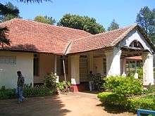
- Madikeri is the capital of the district and Raja's Seat park is popular with tourists.[23] Kootu Poley dam is also popular among tourists. Omkareshwara Temple is a beautiful temple built in the Indo-Sarcenic style in Coorg. A legend is associated with the temple, built by Lingarajendra II in 1820 CE. The king put to death a pious Brahmin who dared to protest against his misdeeds. The spirit of the dead man began to plague the king day and night. On the advice of wise men, the king built this temple and installed a Shivalinga procured from Kashi, North India. St. Mark's Church is located within the Mercara Fort and was raised in 1859, by the officers and men of the East India Company. The building was funded by the Government of Madras,[24] and placed under the Church of England in India, Diocese of Madras.[25] The Church was closed after Indian independence, and taken over by the Government of Karnataka in 1971.[26] The building now houses the Madikeri Fort Museum, managed by the Karnataka State Archaeological Department.[27]
- Dubare is mainly an elephant-capturing and training camp of the Forest Department at the edge of Dubare forest; on the bank of the river Kaveri along the Kushalanagara – Siddapura road.[28] Nisargadhama is a man-made island and picnic spot near Kushalanagara, formed by the river Kaveri. The Tibetan Buddhist Golden Temple is at Bylakuppe near Kushalnagara (Mysore district), in the Tibetan refugee settlement.
- Abbey Falls is a scenic waterfall 5 km from Madikeri. Mallalli falls is 25 km from Somawarapet, downhill of the Pushpagiri hills.[29] Mandalapatti is 28 km from Madikeri. On the way to Abbey Falls, before 3 km from Abbey Falls take right, from there 25 km. Kote Betta temple, Kote Abbey falls are also in North Kodagu. Abbi waterfall and other waterfalls are best during monsoon season, typically some days after it starts raining in June up to the end of rainy season, while there is more water gushing in the streams and rivers.[30]
Notable people
- Field Marshal Kodandera M. Cariappa, first Indian C-in-C, Indian High Commissioner to Australia and New Zealand
- General Kodandera Subayya Thimayya, head of Indian Army, chairman of Korean Repatriation Committee, head of UN Peacekeeping force
- C. B. Muthamma, first woman Indian Foreign Service officer
- M. P. Ganesh, Indian hockey captain, player and coach
- Prema, Indian Actress.
- Robin Uthappa, Indian Cricketer.
- Rohan Bopanna, Indian tennis player.
- Ashwini Ponnappa, Indian badminton player.
See also
References
- "Kodagu district Profile". DSERT. Retrieved 11 January 2011.
- http://www.census2011.co.in/census/district/259-kodagu.html
- Chisholm, Hugh, ed. (1911). . Encyclopædia Britannica. 7 (11th ed.). Cambridge University Press. pp. 91–92.
- "Districts of India". Government of India. Retrieved 11 January 2011.
- "Codava National Council sets up global forum". The Hindu. Archived from the original on 3 January 2013.
- "Dharna staged for Kodagu State". The Hindu. Archived from the original on 3 January 2013.
- Belliappa, C P (4 August 2015). "Call for freedom from a tiny village". Deccan Herald (Bangalore). Retrieved 7 August 2015.
- US Directorate of Intelligence. "Country Comparison:Population". Retrieved 1 October 2011.
Solomon Islands 571,890 July 2011 est.
- "2010 Resident Population Data". U. S. Census Bureau. Archived from the original on 23 August 2011. Retrieved 30 September 2011.
Wyoming 563,626
- K S Rajyashree, Kodava speech community : An ethnolinguistic study
- "Will Kodava find a place in Eighth Schedule". The Hindu. Archived from the original on 3 January 2013.
- Herbert Feis (December 1926). "The Mechanism of Adjustment of International Trade Balances". The American Economic Review. American Economic Association. 16 (4): 593–609. JSTOR 1.
- Archived 17 December 2007 at the Wayback Machine
- South Kanara, 1799–1860 By N. Shyam Bhatt
- http://www.thehindu.com/2004/10/31/stories/2004103102280300.htm
- http://www.hindu.com/2005/05/19/stories/2005051901540300.htm
- http://www.deccanherald.com/content/316458/account-uprising.html
- http://www.deccanherald.com/content/316455/fate-insurgents.html
- Sarasvati's Children: A History of the Mangalorean Christians, Alan Machado Prabhu, I.J.A. Publications, 1999, p. 229
- Decadal Variation In Population Since 1901
- https://www.deccanherald.com/state/mangaluru/tourists-throng-favourite-destinations-to-welcome-2020-790328.html
- http://des.kar.nic.in/sites/ANNUAL%20RAINFALL%202014.pdf
- http://www.fallingrain.com/world/IN/19/Madikeri.html
- Penny, Frank (1922). The Church in Madras: being the History of the Ecclesiastical and Missionary Action of the East India Company in the Presidency of Madras From 1835 to 1861: Volume III. London: John Murray. p. 98. Retrieved 14 August 2015.
- "Chuches Vested in The Crown: Diocese of Madras". Lords Sitting of 31 May 1927. 67 (5): cc650-1. Retrieved 20 August 2015.
- "Museums in Karnataka". Government of Karnataka: Department of Archaeology, Museums and Heritage. 2015. Retrieved 21 August 2015.
- Madur (13 October 2014). "Madikeri Fort, Coorg". Karnataka. Retrieved 20 August 2015.
- "Archived copy". Archived from the original on 4 June 2012. Retrieved 27 January 2020.CS1 maint: archived copy as title (link)
- http://www.newskarnataka.com/nature/abbey-falls-a-tourists-delight
- "A trip to Coorg during Monsoon". Trayaan. 29 July 2016. Retrieved 5 October 2016.
Further reading
- Belliappa, C. P. Tale of a Tiger's Tail & Others Yarns from Coorg. English.
- Belliappa, C. P. Victoria Gowramma. English.
- Bopanna, P. T. Kodagu: Mungaru Maleya Vismayada Nadu/ Discover Coorg. Kannada/ English.
- Bopanna, P. T. Coorg State: Udaya-Pathana / Coorg State. Kannada/ English.
- Ganapathy, B. D. Kodagu mattu Kodavaru. Kannada. 1962.
- Ganapathy, B. D. Nanga Kodava. Kodava. 1973.
- Murphy, Devrala. On a Shoestring to Coorg.
- N Prabhakaran. Kutaku kurippukal (Coorg Notes). Kannur: Kairali Books.
External links
| Wikimedia Commons has media related to Kodagu district. |
| Wikivoyage has a travel guide for Kodagu. |
| Bangalore division | |
|---|---|
| Belgaum division | |
| Gulbarga division | |
| Mysore division |
|
| Proposed states |
|  |
|---|---|---|
| Proposed union territories |
| |