Ziarat District
| Ziarat District | |
|---|---|
| District | |
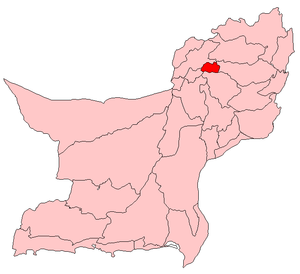 Map of Balochistan with Ziarat District highlighted | |
| Country | Pakistan |
| Province | Balochistan |
| Established | July 1986 |
| Headquarters | Ziarat |
| Area[1] | |
| • Total | 926 km2 (358 sq mi) |
| Population (2017)[2] | |
| • Total | 160,422 |
| • Density | 170/km2 (450/sq mi) |
| Time zone | UTC+5 (PST) |
| Number of Tehsils | 2 [3] |
| Website | ziarat |
Ziarat is a district in the north of Balochistan province of Pakistan. Ziarat town (situated at an altitude of about 2,400 meters) is headquarters of the district of the Sub division, and also of the tehsil. Khalifat Hills are the highest peak with an altitude of 11.400 feet (3.475 m) in Ziarat district.
Administration
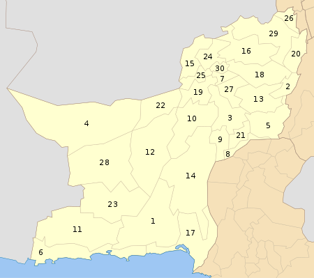
Ziarat District was established in July 1986, previously being part of Sibi District.[1] The district, with a population of 52855, is subdivided into two tehsils Ziarat and Sinjavi the latter is the most densely populated having a population of 32,456, while Ziarat Tehsil has a population of 18,000. The district contain a total of ten Union Councils.[3]
Demography
The population of Ziarat district was 33,300 in 1998,[4] while a 2005 estimate has it as 100,000. Over 99% of the people of the area are Muslims. The main first language of the district is Pashto, spoken by 99.5% of its inhabitants.[5]
Tourism
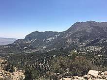
Ziarat has some of the oldest Juniper forests in the world. A tourist destination, the economy of the district also benefits from orchards of apples and cherries. The Ziarat district has the highest Human Development Index of all districts in the province. The Founder of Pakistan, Muhammad Ali Jinnah spent his last days of his life in Ziarat Residency in Ziarat.
References
- 1 2 PCO 1999, p. 13.
- ↑ "DISTRICT WISE CENSUS RESULTS CENSUS 2017" (PDF). www.pbscensus.gov.pk.
- 1 2 Tehsils & Unions in the District of Ziarat - Government of Pakistan Archived February 9, 2012, at the Wayback Machine.
- ↑ PCO 1999, p. 80.
- ↑ PCO 1999, p. 34.
Bibliography
- 1998 District census report of Ziarat. Census publication. 19. Islamabad: Population Census Organization, Statistics Division, Government of Pakistan. 1999.
External links
| Wikimedia Commons has media related to Ziarat District. |