Musakhel District, Pakistan
| Musakhel موسىٰ خيل | |
|---|---|
| District of Balochistan | |
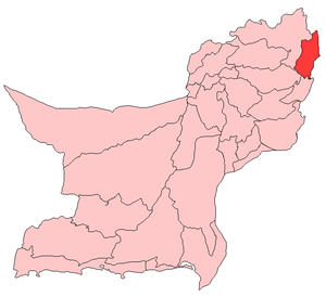 Map of Balochistan with Musakhel District highlighted | |
| Country |
|
| Region | Balochistan |
| District | Musakhel District |
| Union Councils | 17 |
| Mauzas | 71 |
| Government | |
| • NA | 263 |
| • MNA | Maulana Ameer Zaman |
| • Political Party | JUI-F |
| Area | |
| • Total | 5,728 km2 (2,212 sq mi) |
| Population (2017)[1] | |
| • Total | 167,017 |
| • Density | 29/km2 (76/sq mi) |
| Time zone | UTC+5 (PST) |
| Area code(s) | Post Code : 84700 |
Musakhel (Pashto: ضلع موسی خیل) is a district in the northeast of the Balochistan province of Pakistan. It became a separate district in 1992, prior to which it was a tehsil within Loralai District
History
After the first phase of the Afghan war of 1878-79 AD, the British took control of the northern areas of Balochistan under the Treaty of Gandamak. During 1879-84 AD, efforts were made to extend the British influence over the Khetrans and Musakhels of the, now Musakhel, territory. The Musakhels took part in outrages committed by the Kakars under Shah Jahan in 1884, but surrendered to the British government on the conclusion of the expedition in the same year. On 1 November 1887, the whole area was declared part of British India. Zhob agency was formed in 1890 and Musakhel territory was annexed to it. Musakhel was made a tehsil in 1892 and was transferred to Loralai district in October 1903.
In 1905, the Musakhel tehsil comprised 61 villages and the total population, according to 1901 census, was 15,537 (8,374 males and 7,163 females). The principal tribes represented were: Isot Afghans (1,941); Jafar Afghans (1,026); Panri Afghans (10,144) including the Musakhel clan (9,748) the principal divisions of which were the Belkhel (7,662) and Laharzai (2,086); and Saiads (271). The chief language spoken was Pushto.Musakhel remained a tehsil of Loralai district till 1 January 1992 when it was notified as a district as a result of splitting Loralai district into 3 districts, Loralai, Musakhel, and Barkhan.[2] Although Musakhel is an old human settlement there is no remarkable archaeological site.
Geography
District Musakhel is located in north-eastern border of Balochistan and bordering to Khyber Pakhtunkhwa and Dera Ghazi Khan, Punjab. The district comprises 5728 km².[2] The headquarters of the district is Musa Khel.
Climate
The climate of Musakhel, located 1,200-2,400 meters above sea level, is semi-arid. It can be placed in the "warm summer and mild winter" temperature region.The summer is hot with mean temperatures ranging from 21 C to 32 C. June is the hottest month when maximum temperature does exceed 32 C and occasionally rises above 38 C. Summer is longer than winter and lasts for about 7 months (April–October). In winter the temperature drops below 21 C, but in the coolest month (January) the mean monthly temperature drops below 10 C. The mercury may touch the freezing point during cold spells.
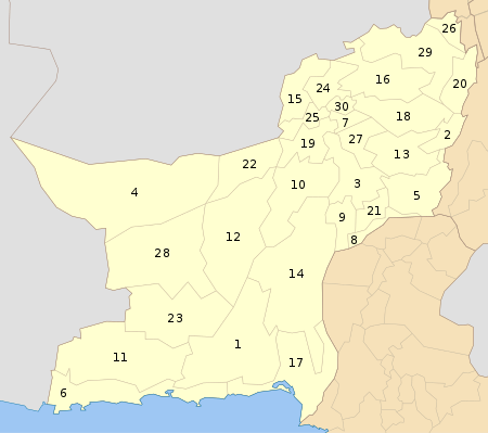
Administrative divisions
The district of Musakhel is divided into four tehsils:
- Darug
- Kingri
- Musakhel
- Toisar
Demography
The population in 1998 was 134,060, 8.7% of which was urban.[3] The main tribes of the district are the Musakhels.
According to the 1988 census, the major first languages[4] spoken were Pashto (79%) and Balochi (14%).[5] According to the United Nations, in 1981 over 85% of households spoke Pashto, 7.2% spoke Jafferki and 7.8% spoke Balochi.
Education
District Musakhel is ranked at the 81st position in the education score index of the Pakistan District Education Rankings 2017 published by Alif Ailaan. The education score is composed of the learning score, retention score and gender parity score. Retention is one of the biggest concerns in this district, with the relevant score being only 43.79 out of a potential 100. While, gender parity and learning scores lying a little above average. There has been only a slight improvement in the provision of post primary school infrastructure, with government primary schools still accounting for over 80% of the total number of government schools in the province, with a score of 27.87.
In percentage terms, the allocations for education in Baluchistan have seen the highest growth compared to all other provinces during 2013-2018 tenure, including district Musakhel. According to the National Education Management Information System data 2016-2017, the structural and governance reforms have yet to create an impact in terms of better provision of school infrastructure to students and teachers of all districts in Baluchistan.[6]
Issues reported by the residents via the Taleem Do! App complain of the lack or absenteeism of teachers.
See also
Notes
- ↑ "DISTRICT WISE CENSUS RESULTS CENSUS 2017" (PDF). www.pbscensus.gov.pk. Archived from the original (PDF) on 2017-08-29.
- 1 2 PCO 1998, p. 1.
- ↑ PCO 1998, p. 15.
- ↑ "Mother tongue": defined as the language of communication between parents and children, and recorded of each individual.
- ↑ PCO 1998, p. 19.
- ↑ Alif Ailaan 2018. 2013-2018 Five Years of Education Reforms in Balochistan. Wins, Losses and challenges for 2018-2023. Islamabad: Alif Ailaan. vi-33 pp. ISBN: 978-969-7624-11-9 https://elections.alifailaan.pk/wp-includes/file/BalochistanEducationReport18.pdf
Bibliography
- 1998 District Census report of Musakhel. Census publication. 81. Islamabad: Population Census Organization, Statistics Division, Government of Pakistan. 2000.
External links
| Wikimedia Commons has media related to Musakhel District, Pakistan. |