Jafarabad District
| Jafarabad District | |
|---|---|
| District | |
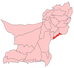 Map of Balochistan with Jafarabad District highlighted | |
| Country | Pakistan |
| Province | Balochistan |
| Established | 1987 |
| Headquarters | Dera Allah Yar/Usta Mohammad |
| Area | |
| • Total | 2,445 km2 (944 sq mi) |
| Population (2017)[1] | |
| • Total | 513,813 |
| • Density | 210/km2 (540/sq mi) |
| Time zone | UTC+5 (PST) |
| Website | Official site |
Jafarabad or Jaffarabad or Jaffar Khan Jamali (Balochi and Urdu: جعفر آباد) district lies in the South-East of the Pakistani province of Balochistan. Jafarabad's headquarters are at Dera Allah Yar. Formerly known as the Jhatpat subdivision, the region was part of the Jacobabad District until 1970 and part of the Sibi District until 1975. It became a district of its own in 1987.[2] Jaffarabad District is sub-divided into three tehsils. At the end of 15th century, Jaffarabad was under of Lasharis. The main tribes of this district are: Jamali, Khoso, Rind, Marri, Bugti, Bulledi, Magsi, Mengal and other communities are Gola, Umrani, lashari, Domki, Kanrani, Gajani, Siapad Brohi and small number of Soomro, bhanger, abro tribes.
According to the 1998 census, the total population of the district was 433,000. The predominant first language[3] is Balochi, spoken by 62% of the population, followed by Sindhi with 24%, and Saraiki with 11%.[4]
Background
The district is named after Mir Jaffar Khan Jamali, a Muslim League veteran from Balochistan and a close friend of Quaid‑e‑Azam. He contributed towards the promotion of the Muslim League cause in the area. He died on 7 April 1967 and was buried in Rojhan Jamali. Before the creation of Jaffarabad District, during the "One‑Unit" period, this district was known as sub‑division Jhatpat and was a part of Jacobabad district of Sindh province. Jhatpat as a sub‑division is very old. It was raised to sub‑division level on 12 January 1932 with Captain Hoc Bland as the first Assistant Commissioner. On the dissolution of "One‑Unit" in 1970 it was included in Sibi district and remained within the jurisdiction of Sibi district till January 1975. In 1975, when Nasirabad district came into existence, Jhatpat was included in Nasirabad district. The Usta Mohammad sub‑division was a part of Sindh up to very recent years. Usta Mohammad is named after Maulvi Usta Mohammad. Chowki Jamali is a Famous Village of Jaffarabad. Jaffarabad is at a main‑road to Sindh province. Its boundaries link five districts: Larkarna, Jacobabad (Sindh), Nasirabad, Jhall Magsi, and Dera Bugti.
Administration
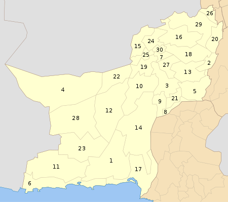
The district of Jaffarabad is administratively subdivided into the following three tehsils:[5]
- Gandakha
- Jhat Pat (Dera Allah Yar)
- Usta Mohammad
Education
According to the Pakistan District Education Rankings 2017, district Jafarabad is ranked at number 113 out of the 141 ranked districts in Pakistan on the Education Score index. This index considers learning, gender parity and retention in the district.
Literacy rate in 2014-15 of population 10 years and older in the district stood at 36% whereas for females it was only 15%.[6]
Post primary access is a major issue in the district with 89% schools being at primary level. Compared with high schools which only constitute 4% of government schools in the district. This is also reflected in the enrolment figures with 27,448 students enrolled in class 1 to 5 and only 736 students enrolled in class 9 and 10.
Gender disparity is another issue in the district. Only 28% schools in the district are girls’ schools. Access to education for girls is a major issue in the district and is also reflected in the low literacy rates for females.
Moreover, the schools in the district lack basic facilities. According to Alif Ailaan Pakistan District Education Rankings 2017, the district is ranked at number 117 out of the 155 districts of Pakistan for primary school infrastructure. At the middle school level, it is ranked at number 116 out of the 155 districts. These rankings take into account the basic facilities available in schools including drinking water, working toilet, availability of electricity, existence of a boundary wall and general building condition. More than 3 out of 5 schools in the district lack electricity, working toilet and a boundary wall. More than 1 out of 5 schools do not have clean drinking water.
The main issues reported in Taleem Do! App for the district are unavailability of class rooms for students and a lack of university. Political interference is also reported in development of new schools.
References
- ↑ "DISTRICT WISE CENSUS RESULTS CENSUS 2017" (PDF). www.pbscensus.gov.pk.
- ↑ PCO 2000, p. 1.
- ↑ defined as the language for communication between parents and children
- ↑ PCO 2000.
- ↑ Tehsils & Unions in the District of Jaffarabad – Government of Pakistan Archived 26 March 2012 at the Wayback Machine.
- ↑ Pakistan Bureau of Statistics (2016). Pakistan Social and Living Standards Measurement Survey 2014-15. [online] Islamabad: Government of Pakistan, p.111. Available at: http://www.pbs.gov.pk/sites/default/files//pslm/publications/PSLM_2014-15_National-Provincial-District_report.pdf [Accessed 6 Aug. 2018].
Bibliography
- 1998 District Census report of Jaffarabad. Census publication. 80. Islamabad: Population Census Organization, Statistics Division, Government of Pakistan. 2000.
External links
| Wikimedia Commons has media related to Jafarabad District. |