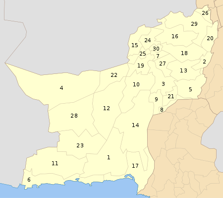
Kharan District
| Kharan District | |
|---|---|
| District | |
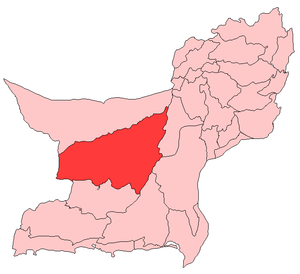 Map of Balochistan with Kharan District highlighted | |
| Country | Pakistan |
| Province | Balochistan |
| Established | March 15, 1952 |
| Headquarters | Kharan |
| Area | |
| • Total | 8,958 km2 (3,459 sq mi) |
| Population (2017)[1] | |
| • Total | 156,152 |
| • Density | 17/km2 (45/sq mi) |
| Time zone | UTC+5 (PST) |
| Number of Tehsils | 1 |
Kharan (Urdu and Balochi: خاران) is a district in the Balochistan province of Pakistan.
Education
According to the Pakistan District Education Rankings 2017, district Kharan is ranked at number 110 out of the 141 ranked districts in Pakistan on the education score index. This index considers learning, gender parity and retention in the district.
Literacy rate in 2014-15 of population 10 years and older in the district stands at 44% whereas for females it is only 27%.[3]
Post primary access is a major issue in the district with 78% schools being at primary level. Compare this with high schools which constitute only 8% of government schools in the district. This is also reflected in the enrolment figures for 2016-17 with 6,987 students enrolled in class 1 to 5 and only 170 students enrolled in class 9 and 10.
Gender disparity is another issue in the district. Only 26% schools in the district are girls’ schools. Access to education for girls is a major issue in the district and is also reflected in the low literacy rates for females.
Moreover, the schools in the district lack basic facilities. According to Alif Ailaan district education rankings 2017, the district is ranked at number 141 out of the 155 districts of Pakistan for primary school infrastructure. At the middle school level, it is ranked at number 126 out of the 155 districts. These rankings take into account the basic facilities available in schools including drinking water, working toilet, availability of electricity, existence of a boundary wall and general building condition. Approximately 4 out of 5 schools do not have electricity in them. 1 out 3 schools lack a toilet and 3 out of 5 do not have a boundary wall. About 1 out of 2 schools do not have clean drinking water.
The main issues reported in Taleem Do! App for the district is the unavailability of schools especially for girls. The schools available are reported to have a lack of teachers.
See also
- Kharan (princely state)
- Qila Ladgasht
- Nausherwani tombs
- Sardar Siapad House
References
- ↑ "DISTRICT WISE CENSUS RESULTS CENSUS 2017" (PDF). www.pbscensus.gov.pk.
- ↑ Mindat info
- ↑ Pakistan Bureau of Statistics (2016). Pakistan Social and Living Standards Measurement Survey 2014-15. [online] Islamabad: Government of Pakistan, p.111. Available at: http://www.pbs.gov.pk/sites/default/files//pslm/publications/PSLM_2014-15_National-Provincial-District_report.pdf [Accessed 6 Aug. 2018].
External links
| Wikimedia Commons has media related to Kharan District. |