York Street (IND Sixth Avenue Line)
York Street | |||||||
|---|---|---|---|---|---|---|---|
|
| |||||||
 Station platform | |||||||
| Station statistics | |||||||
| Address |
York Street & Jay Street Brooklyn, NY 11201 | ||||||
| Borough | Brooklyn | ||||||
| Locale | Dumbo | ||||||
| Coordinates | 40°42′06″N 73°59′12″W / 40.701529°N 73.986783°WCoordinates: 40°42′06″N 73°59′12″W / 40.701529°N 73.986783°W | ||||||
| Division | B (IND) | ||||||
| Line | IND Sixth Avenue Line | ||||||
| Services |
F | ||||||
| Transit connections |
⛴ NYC Ferry: East River and South Brooklyn routes (at Old Fulton Street and Furman Street) | ||||||
| Structure | Underground | ||||||
| Platforms | 1 island platform | ||||||
| Tracks | 2 | ||||||
| Other information | |||||||
| Opened | April 9, 1936 | ||||||
| Station code | 235[1] | ||||||
| Wireless service |
| ||||||
| Traffic | |||||||
| Passengers (2017) |
3,172,717[3] | ||||||
| Rank | 164 out of 425 | ||||||
| Station succession | |||||||
| Next north |
East Broadway: F | ||||||
| Next south |
Jay Street–MetroTech: F | ||||||
| |||||||
| |||||||
| |||||||


York Street is a station on the IND Sixth Avenue Line of the New York City Subway. Served by the F train at all times, it is located at York Street and Jay Street in DUMBO and is the only Sixth Avenue Line station in Brooklyn.
History
More than 50 years before the construction of the IND Sixth Avenue Line, let alone the station, the intersection of York and Jay Streets was between two stations on the original BMT Lexington Avenue Line. West of the intersection was York and Washington Streets station, which had a connection to the Brooklyn Bridge via the New York and Brooklyn Bridge Railway. One block east of the station was the Bridge Street station. The line and the two stations ran west to east, were built by Brooklyn Elevated Railroad on May 13, 1885[4] and closed by Brooklyn Rapid Transit on April 11, 1904.[5]
Mass transit returned to the vicinity when the York Street subway station opened on April 9, 1936,[6] as part of an extension of the IND Sixth Avenue Line from East Broadway to Jay Street, although this was more accurately a replacement for the IRT Sixth Avenue Line in Manhattan. The IND Fulton Street Line to Rockaway Avenue opened on the same day.[6]
Station layout
| G | Street Level | Exit/ Entrance |
| B1 | Mezzanine | Fare control, station agent |
| Ramp to Exits, double-wide staircase to platform level | ||
| B2 | Northbound | ← |
| Island platform, doors will open on the left | ||
| Southbound | → | |
This underground, deep-level station has two tracks and one narrow island platform. Located at the southern end of the Rutgers Street Tunnel, it has round deep-bore walls with matte-finish white brick tiling and purple tile border; this tiling scheme is also present on the large, circular platform columns at the center of the station. The standard I-beam columns are painted blue with alternating ones having black name plates in white lettering.
To the north of the station, the Sixth Avenue Line continues via the Rutgers Street Tunnel to Manhattan; to the south, it converges with the IND Eighth Avenue Line and ends north of Jay Street. The Sixth Avenue Line tracks continue south as the IND Culver Line.
Exit
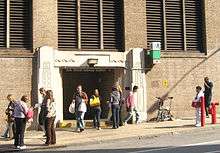
The only exit, located at the station's north end, leads to the Rutgers Street tunnel ventilation tower at the intersection of York Street and Jay Street. It has a turnstile bank and long passageway and staircase to the platform.[7]
There used to be a mezzanine at the station's south end. It had exits leading to Sands Street. It was closed some time after World War II.
Points of interest
References
- ↑ "Station Developers' Information". Metropolitan Transportation Authority. Retrieved June 13, 2017.
- ↑ "NYC Subway Wireless – Active Stations". Transit Wireless Wifi. Retrieved May 18, 2016.
- ↑ "Facts and Figures: Annual Subway Ridership 2012–2017". Metropolitan Transportation Authority. July 12, 2018. Retrieved July 12, 2018.
- ↑ "Done at Last". Brooklyn Daily Eagle. Brooklyn, NY. May 13, 1885. p. 1.
- ↑ "www.nycsubway.org". www.nycsubway.org.
- 1 2 "Two Subway Links Start Wednesday". The New York Times. April 6, 1936. p. 23. Retrieved October 7, 2011.
- 1 2 3 4 "MTA Neighborhood Maps: Downtown Brooklyn and Borough Hall" (PDF). mta.info. Metropolitan Transportation Authority. 2015. Retrieved August 2, 2015.
External links
| Wikimedia Commons has media related to York Street (IND Sixth Avenue Line). |
- nycsubway.org – IND 6th Avenue: York Street
- Station Reporter — F Train
- The Subway Nut — York Street Pictures
- York Street entrance from Google Maps Street View
- Platform from Google Maps Street View
| Sixth Avenue Line |
| ||||
|---|---|---|---|---|---|
| |||||