Wisper
| Wisper | |
|---|---|
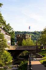 Wisper at Lorch | |
| Country | Germany |
| Physical characteristics | |
| Main source | Taunus |
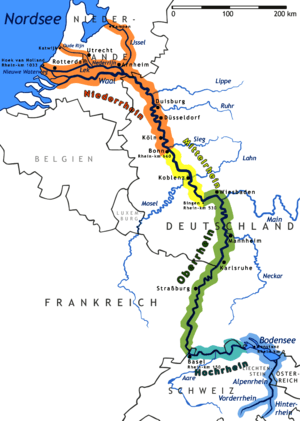
| River mouth |
Rhine 50°02′34″N 7°48′05″E / 50.0429°N 7.8014°ECoordinates: 50°02′34″N 7°48′05″E / 50.0429°N 7.8014°E |
| Length | 29.7 km (18.5 mi) [1] |
| Basin features | |
| Progression | Rhine→ North Sea |
| Basin size | 209 km2 (81 sq mi) [1] |
The Wisper is a 29.715-kilometre-long (18.464 mi) river in Hesse, Germany, right tributary of the Rhine. Its source is in the western Taunus, Rheingau-Taunus-Kreis district, near a small village named Wisper (municipality Heidenrod). It flows southwest through a densely forested valley with some medieval castle ruins surrounded by a popular hiking area. A man-made lake, the Wispersee, is stocked with trout and is a popular fishing destination. The Wisper flows into the Rhine at Lorch.
The river ran through the temporary state Free State Bottleneck from 1919 to 1923.
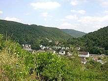
Wisper valley at Lorch
See also
References
This article is issued from
Wikipedia.
The text is licensed under Creative Commons - Attribution - Sharealike.
Additional terms may apply for the media files.