Kraichbach
| Kraichbach | |
|---|---|
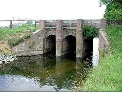 The Kraichbach between Hockenheim and Ketsch. | |
| Physical characteristics | |
| Main source |
300 m (980 ft) 49°2′33″N 8°50′48″E / 49.04250°N 8.84667°E |
| River mouth |
Rhine 93 m (305 ft) 49°21′48″N 8°30′54″E / 49.36333°N 8.51500°ECoordinates: 49°21′48″N 8°30′54″E / 49.36333°N 8.51500°E |
| Length | 60.0 km (37.3 mi) [1] |
| Basin features | |
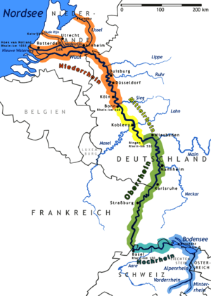
| Progression | Rhine→ North Sea |
| Basin size | 385 km2 (149 sq mi) [1] |
The Kraichbach is a 60 km long right tributary of the Rhine River running through the German state of Baden-Württemberg. Its source is in the Kraichgau region near the municipality of Sternenfels. The brook then flows to the northwest through Kürnbach, Oberderdingen, Kraichtal, Ubstadt-Weiher, Bad Schönborn and Kronau, all in the district of Karlsruhe. It then enters the district of Rhein-Neckar-Kreis and flows through Sankt Leon-Rot, Reilingen, Hockenheim and Ketsch before joining the Rhine.
Notable locations near the stream include Gochsheim Castle, Schloss Kislau prison, and the Hockenheimring racing circuit.
References
This article is issued from
Wikipedia.
The text is licensed under Creative Commons - Attribution - Sharealike.
Additional terms may apply for the media files.