Töss (river)
| Töss | |
|---|---|
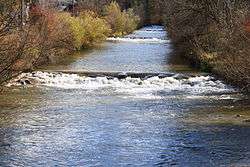 The Töss in Rikon im Tösstal | |
| Physical characteristics | |
| Main source |
Confluence of the Vordertöss and Hindertöss Tössscheidi, Wald ZH and Fischenthal, ZH, Switzerland 796 m (2,612 ft) 47°18′44.4″N 8°57′37.4″E / 47.312333°N 8.960389°E |
| River mouth |
Tössegg, Freienstein-Teufen, ZH, Buchberg, SH, Eglisau, ZH, Switzerland 344 m (1,129 ft) 47°33′7.6″N 8°33′14.6″E / 47.552111°N 8.554056°ECoordinates: 47°33′7.6″N 8°33′14.6″E / 47.552111°N 8.554056°E |
| Length | 56 km (35 mi) |
| Basin features | |
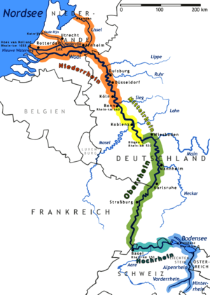
| Progression | Rhine → North Sea |
| River system | Rhine |
The Töss is a river of the canton of Zürich. It starts with the confluence of the Vordertöss and the Hindertöss in the Zürcher Oberland, at Tössscheidi on 796 metres (2,612 ft) on the border between the munacipalities of Wald west of the Dägelschberg (1,267 m (4,157 ft)), east of the Hüttchopf (1,231 m (4,039 ft)), and north of the Tössstock (1,153 m (3,783 ft))).
The Vordertöss (lit.: "Front Töss") rises on the south side of the Tössstock on the north faces of the Schwarzeberg (1,293 m (4,242 ft)) and Höchhand (1,314 m (4,311 ft)) before it circumvent the Tössstock on its western flank.
The larger tributary, the Hindertöss (lit.: "Back Töss") collects the waters, either, by its tributary, the Chreuelbach, below the Höchhand, the western faces of the Habrütispitz (1,274 m (4,180 ft)) and Rossegg (1,254 m (4,114 ft)), or, from its own sources below Schindelegg (1,265 m (4,150 ft)), and the south faces of Schindelberghöchi (1,234 m (4,049 ft)) and the Dägelschberg, and passes the Tössstock on its northern hillside.
The Töss flows to the north before it meets the main valley of its own name, Töss Valley (Tösstal) just before Steg im Tösstal. Here, the river and its valley turns to the west in order to flow through Bauma then turns to the north again. West of the village Turbenthal it turns west again, and the valley gets even more ragged than before.
It traverses Winterthur on its most western part of the city, just northeast of the Töss, a city mountain. After joining the Eulach on the western exit of the city, the river Töss then continues more or less westnorthwestern and joins the Rhine after about 11 kilometres (6.8 mi) on Rhine's large southern bend called Tössegg west of Teufen and just before Eglisau.
References
![]()