Whittemore Glen State Park
| Whittemore Glen State Park | |
| Connecticut State Park | |
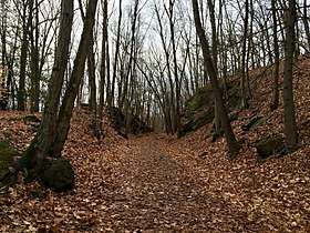 The Larkin Trail in Whittemore Glen State Park in Naugatuck, Connecticut. | |
| Country | |
|---|---|
| State | |
| County | New Haven |
| Towns | Naugatuck, Middlebury |
| Elevation | 351 ft (107 m) [1] |
| Coordinates | 41°30′42″N 73°03′56″W / 41.51167°N 73.06556°WCoordinates: 41°30′42″N 73°03′56″W / 41.51167°N 73.06556°W [1] |
| Area | 242 acres (98 ha) |
| Established | 1945 |
| Management | Connecticut Department of Energy and Environmental Protection |
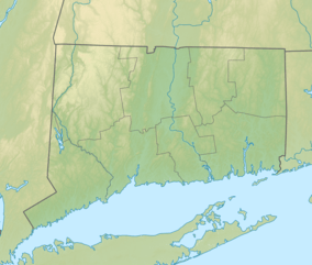 Location in Connecticut | |
| Website: Whittemore Glen State Park | |
Whittemore Glen State Park is an undeveloped public recreation and wilderness area for hiking and horseback riding located in the town of Naugatuck, Connecticut.[2][3] Sitting outside the southwestern edge of the city of Waterbury, the state park is the eastern terminus of the Larkin State Park Trail.[4] It entered the roles as Connecticut's forty-eighth state park in the 1945–46 edition of the Connecticut Register and Manual.[5] The park is managed by the Connecticut Department of Energy and Environmental Protection.
References
- 1 2 "Whittemore Glen State Park". Geographic Names Information System. United States Geological Survey.
- ↑ "Whittemore Glen State Park". State Parks and Forests. Connecticut Department of Energy and Environmental Protection. Retrieved February 5, 2013.
- ↑ "Whittemore Glen State Park". Connecticut Office of Tourism. Retrieved October 4, 2017.
- ↑ "Larkin Trail State Park Map" (PDF). Connecticut Department of Energy and Environmental Protection. October 23, 2015. Retrieved October 4, 2017.
- ↑ "State Parks". State Register and Manual 1945–46. State of Connecticut. 1946. p. 280. Retrieved October 4, 2017.
External links
- Whittemore Glen State Park Connecticut Department of Energy and Environmental Protection
This article is issued from
Wikipedia.
The text is licensed under Creative Commons - Attribution - Sharealike.
Additional terms may apply for the media files.