Lake Lillinonah
| Lake Lillinonah | |
|---|---|
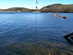 Lake Lillinonah near the Shepaug Dam, April 10, 2010 | |
 Lake Lillinonah | |
| Location | Fairfield, Litchfield and New Haven counties, Connecticut |
| Coordinates | 41°28′08″N 73°18′43″W / 41.469°N 73.312°WCoordinates: 41°28′08″N 73°18′43″W / 41.469°N 73.312°W |
| Type | reservoir |
| Managing agency | Lake Lillinonah Authority, CL&P |
| First flooded | September 27, 1955 |
| Max. length | 12 to 14 miles (19 to 23 km) |
| Surface area | 1,547 to 1,900 acres (626 to 769 ha) |
| Max. depth | 110 feet (34 m) |
| Shore length1 | 45 miles (72 km) |
| References | [1] |
| 1 Shore length is not a well-defined measure. | |
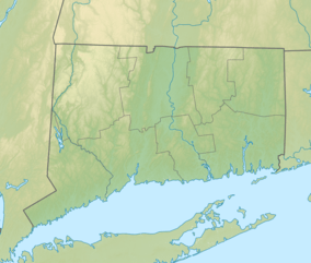
Lake Lillinonah is located in Fairfield, Litchfield and New Haven counties of Western Connecticut, in the northeastern United States.[2] It is the second largest lake in Connecticut, smaller only than Candlewood Lake.[2] The lake is bordered by six towns: Brookfield, Bridgewater, Newtown, New Milford, Roxbury, and Southbury.[2] It was formed in 1955 by impoundment of the Housatonic River and the Shepaug River by the Shepaug Dam which was built by the Connecticut Light and Power Company.[2] Some of the most expensive real estate in Connecticut is located on the shores of the lake, in the towns of Brookfield, Bridgewater and Newtown.
References
| Wikimedia Commons has media related to Lake Lillinonah. |
- ↑ "About". Lake Lillinonah Authority. Retrieved 2012-06-08.
- 1 2 3 4 Jeffrey, Angie (2005-08-16). "Lake Lillinonah has colorful history". The News-Times. Retrieved 2012-03-26.
External links
This article is issued from
Wikipedia.
The text is licensed under Creative Commons - Attribution - Sharealike.
Additional terms may apply for the media files.