Talcott Mountain State Park
| Talcott Mountain State Park | |
| Connecticut State Park | |
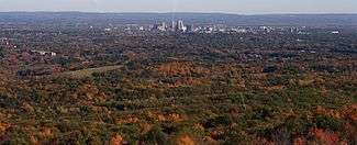
 View of the Hartford skyline from atop Heublein Tower, Talcott Mountain State Park | |
| Country | |
|---|---|
| State | |
| County | Hartford |
| Towns | Simsbury, Avon, Bloomfield |
| Elevation | 915 ft (279 m) [1] |
| Coordinates | 41°49′25″N 72°47′56″W / 41.82361°N 72.79889°WCoordinates: 41°49′25″N 72°47′56″W / 41.82361°N 72.79889°W [1] |
| Area | 574 acres (232 ha) [2] |
| Established | 1965 |
| Management | Connecticut Department of Energy and Environmental Protection |
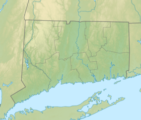
 Location in Connecticut | |
| Website: Talcott Mountain State Park | |
Talcott Mountain State Park is a 574-acre (232 ha) Connecticut state park located primarily in the town of Simsbury. The park is the home of the Heublein Tower, a 165-foot-high (50 m) lookout tower atop Talcott Mountain. The park offers picnicking, scenic views, and hiking on the Metacomet Trail. The Tower Trail is 1.25 miles (2 km) long; a walk to the tower takes approximately 30 to 40 minutes.[3]
References
- 1 2 "Talcott Mountain State Park". Geographic Names Information System. United States Geological Survey.
- ↑ "Appendix A: List of State Parks and Forests" (PDF). State Parks and Forests: Funding. Staff Findings and Recommendations. Connecticut General Assembly. January 23, 2014. p. A-4. Retrieved March 20, 2014.
- ↑ "Talcott MountainState Park". State Parks and Forests. Connecticut Department of Energy and Environmental Protection. September 2017. Retrieved October 25, 2017.
External links
- Talcott Mountain State Park Connecticut Department of Energy and Environmental Protection
- Talcott Mountain State Park Map Connecticut Department of Energy and Environmental Protection
| Wikimedia Commons has media related to Talcott Mountain State Park. |
This article is issued from
Wikipedia.
The text is licensed under Creative Commons - Attribution - Sharealike.
Additional terms may apply for the media files.