Kettletown State Park
| Kettletown State Park | |
| Connecticut State Park | |
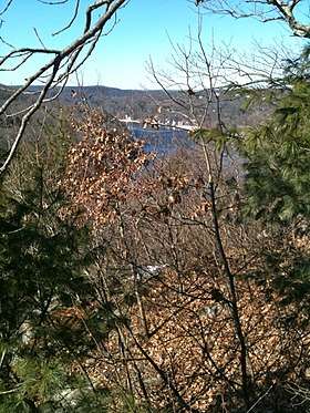 Lake Zoar from the Miller Trail in Upper Kettletown State Park. | |
| Country | |
|---|---|
| State | |
| County | New Haven |
| Towns | Oxford, Southbury |
| Elevation | 151 ft (46 m) [1] |
| Coordinates | 41°25′16″N 73°12′17″W / 41.42111°N 73.20472°WCoordinates: 41°25′16″N 73°12′17″W / 41.42111°N 73.20472°W [1] |
| Area | 599 acres (242 ha) [2] |
| Established | 1950 |
| Management | Connecticut Department of Energy and Environmental Protection |
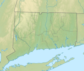 Location in Connecticut | |
| Website: Kettletown State Park | |
Kettletown State Park is a public recreation area on the eastern shore of the Housatonic River's Lake Zoar in the towns of Oxford and Southbury, Connecticut. Park activities include swimming, camping, hiking, picnicking, and fishing. The state park is managed by the Connecticut Department of Energy and Environmental Protection.[3]
References
- 1 2 "Kettletown State Park". Geographic Names Information System. United States Geological Survey.
- ↑ "Appendix A: List of State Parks and Forests" (PDF). State Parks and Forests: Funding. Staff Findings and Recommendations. Connecticut General Assembly. January 23, 2014. p. A-2. Retrieved March 20, 2014.
- ↑ "Kettletown State Park". State Parks and Forests. Connecticut Department of Energy and Environmental Protection. August 3, 2017. Retrieved October 25, 2017.
External links
- Kettletown State Park Connecticut Department of Energy and Environmental Protection
- Kettletown State Park Map Connecticut Department of Energy and Environmental Protection
| Wikimedia Commons has media related to Kettletown State Park. |
This article is issued from
Wikipedia.
The text is licensed under Creative Commons - Attribution - Sharealike.
Additional terms may apply for the media files.