Union Township, Berks County, Pennsylvania
| Union Township | |
|---|---|
| Township | |
 | |
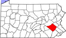
 Union Township Location of Union Township in Pennsylvania  Union Township Union Township (the US) | |
| Coordinates: 40°15′06″N 75°44′35″W / 40.25167°N 75.74306°WCoordinates: 40°15′06″N 75°44′35″W / 40.25167°N 75.74306°W | |
| Country | United States |
| State | Pennsylvania |
| County | Berks |
| Area | |
| • Total | 23.5 sq mi (61 km2) |
| • Land | 23.2 sq mi (60 km2) |
| • Water | 0.3 sq mi (0.8 km2) |
| Elevation | 200 ft (60 m) |
| Population (2010) | |
| • Total | 3,503 |
| • Estimate (2016)[1] | 3,593 |
| • Density | 150/sq mi (58/km2) |
| Time zone | UTC-5 (EST) |
| • Summer (DST) | UTC-4 (EDT) |
| Area code(s) | 610 |
| Website | https://www.unionberks.org/ |
Union Township is a township in Berks County, Pennsylvania, United States. The population was 3,503 at the 2010 census.
History
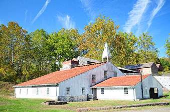
The French Creek State Park: Six Penny Day Use District, French Creek State Park: Organized Group Camp 4 District, and Hopewell Furnace National Historic Site are listed on the National Register of Historic Places.[2]
Demographics
As of the census[3] of 2000, there were 3,453 people, 1,324 households, and 1,035 families residing in the township. The population density was 148.9 people per square mile (57.5/km²). There were 1,370 housing units at an average density of 59.1/sq mi (22.8/km²). The racial makeup of the township was 98.03% White, 0.58% African American, 0.14% Native American, 0.12% Asian, 0.03% Pacific Islander, 0.29% from other races, and 0.81% from two or more races. Hispanic or Latino of any race were 0.96% of the population.
There were 1,324 households, out of which 30.0% had children under the age of 18 living with them, 69.0% were married couples living together, 6.1% had a female householder with no husband present, and 21.8% were non-families. 17.5% of all households were made up of individuals, and 7.3% had someone living alone who was 65 years of age or older. The average household size was 2.59 and the average family size was 2.93.
In the township the population was spread out, with 21.6% under the age of 18, 6.0% from 18 to 24, 28.0% from 25 to 44, 29.7% from 45 to 64, and 14.7% who were 65 years of age or older. The median age was 42 years. For every 100 females there were 100.3 males. For every 100 females age 18 and over, there were 97.6 males.
| Historical population | |||
|---|---|---|---|
| Census | Pop. | %± | |
| 1980 | 2,615 | — | |
| 1990 | 3,440 | 31.5% | |
| 2000 | 3,453 | 0.4% | |
| 2010 | 3,503 | 1.4% | |
| Est. 2016 | 3,593 | [1] | 2.6% |
| U.S. Decennial Census[4] | |||
The median income for a household in the township was $54,205, and the median income for a family was $61,048. Males had a median income of $42,685 versus $27,901 for females. The per capita income for the township was $26,014. About 1.8% of families and 2.8% of the population were below the poverty line, including 2.9% of those under age 18 and 4.7% of those age 65 or over.
Geography
According to the United States Census Bureau, the township has a total area of 23.5 square miles (60.8 km²), of which, 23.2 square miles (60.1 km²) of it is land and 0.3 square miles (0.8 km²) of it (1.28%) is water. The township is located in the Hopewell Big Woods.
References
- 1 2 "Population and Housing Unit Estimates". Retrieved June 9, 2017.
- ↑ National Park Service (2010-07-09). "National Register Information System". National Register of Historic Places. National Park Service.
- ↑ "American FactFinder". United States Census Bureau. Archived from the original on September 11, 2013. Retrieved 2008-01-31.
- ↑ "Census of Population and Housing". Census.gov. Retrieved June 4, 2016.
Places adjacent to Union Township, Berks County, Pennsylvania | |
|---|---|