West Kittanning, Pennsylvania
| West Kittanning, Pennsylvania | |
|---|---|
| Borough | |
.jpg) | |
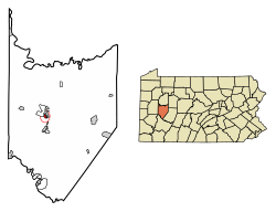 Location of West Kittanning in Armstrong County, Pennsylvania. | |
 West Kittanning Location of West Kittanning in Armstrong County, Pennsylvania. | |
| Coordinates: 40°48′44″N 79°31′48″W / 40.81222°N 79.53000°WCoordinates: 40°48′44″N 79°31′48″W / 40.81222°N 79.53000°W | |
| Country | United States |
| State | Pennsylvania |
| County | Armstrong |
| Settled | 1855 |
| Incorporated | 1900 |
| Government | |
| • Type | Council-Mayor |
| • Mayor | Bernie Bowser, Jr. |
| Area[1] | |
| • Total | 0.43 sq mi (1.11 km2) |
| • Land | 0.43 sq mi (1.11 km2) |
| • Water | 0.00 sq mi (0.00 km2) |
| Elevation | 1,020 ft (310 m) |
| Population (2010) | |
| • Total | 1,175 |
| • Estimate (2016)[2] | 1,122 |
| • Density | 2,615.38/sq mi (1,010.93/km2) |
| Time zone | UTC-5 (Eastern (EST)) |
| • Summer (DST) | UTC-4 (EDT) |
| Zip code | 16201 |
| Area code(s) | 724 |
| FIPS code | 42-83248 |
| Website |
www |
West Kittanning is a borough in Armstrong County, Pennsylvania, United States. The population was 1,175 at the 2010 census.[3]
Geography
West Kittanning is located on a hilltop overlooking the Allegheny River at 40°48′44″N 79°31′48″W / 40.81222°N 79.53000°W (40.812210, -79.529949),[4] approximately 40 miles (64 km) northeast of Pittsburgh. It is bordered by the borough of Applewold at the base of the hill to the east. Kittanning, the county seat, lies across the river to the northeast.
According to the United States Census Bureau, the borough has a total area of 0.42 square miles (1.1 km2), all of it land.[3]
Demographics
| Historical population | |||
|---|---|---|---|
| Census | Pop. | %± | |
| 1910 | 589 | — | |
| 1920 | 861 | 46.2% | |
| 1930 | 1,005 | 16.7% | |
| 1940 | 1,005 | 0.0% | |
| 1950 | 910 | −9.5% | |
| 1960 | 1,101 | 21.0% | |
| 1970 | 956 | −13.2% | |
| 1980 | 1,591 | 66.4% | |
| 1990 | 1,253 | −21.2% | |
| 2000 | 1,199 | −4.3% | |
| 2010 | 1,175 | −2.0% | |
| Est. 2016 | 1,122 | [2] | −4.5% |
| Sources:[5][6][7] | |||
As of the census[6] of 2000, there were 1,199 people, 544 households, and 354 families residing in the borough. The population density was 3,029.6 people per square mile (1,157.3/km²). There were 572 housing units at an average density of 1,445.3 per square mile (552.1/km²). The racial makeup of the borough was 98.92% White, 0.08% Asian, 0.17% from other races, and 0.83% from two or more races. Hispanic or Latino of any race were 0.67% of the population.
There were 544 households, out of which 24.6% had children under the age of 18 living with them, 53.5% were married couples living together, 8.8% had a female householder with no husband present, and 34.9% were non-families. 32.2% of all households were made up of individuals, and 21.0% had someone living alone who was 65 years of age or older. The average household size was 2.20 and the average family size was 2.75.
In the borough the population was spread out, with 20.2% under the age of 18, 6.3% from 18 to 24, 27.8% from 25 to 44, 20.3% from 45 to 64, and 25.4% who were 65 years of age or older. The median age was 42 years. For every 100 females, there were 87.1 males. For every 100 females age 18 and over, there were 80.2 males.
The median income for a household in the borough was $32,850, and the median income for a family was $41,458. Males had a median income of $31,587 versus $22,708 for females. The per capita income for the borough was $18,112. About 6.0% of families and 7.5% of the population were below the poverty line, including 14.5% of those under age 18 and 0.7% of those age 65 or over.
Education
All students in the West Kittanning attendance area attend the Armstrong School District. Currently, no Armstrong School District schools are located within West Kittanning.
References
- ↑ "2016 U.S. Gazetteer Files". United States Census Bureau. Retrieved Aug 13, 2017.
- 1 2 "Population and Housing Unit Estimates". Retrieved June 9, 2017.
- 1 2 "Geographic Identifiers: 2010 Demographic Profile Data (G001): West Kittanning borough, Pennsylvania". U.S. Census Bureau, American Factfinder. Retrieved July 31, 2013.
- ↑ "US Gazetteer files: 2010, 2000, and 1990". United States Census Bureau. 2011-02-12. Retrieved 2011-04-23.
- ↑ "Census of Population and Housing". U.S. Census Bureau. Retrieved 11 December 2013.
- 1 2 "American FactFinder". United States Census Bureau. Retrieved 2008-01-31.
- ↑ "Incorporated Places and Minor Civil Divisions Datasets: Subcounty Resident Population Estimates: April 1, 2010 to July 1, 2012". Population Estimates. U.S. Census Bureau. Retrieved 11 December 2013.
External links
| Wikimedia Commons has media related to West Kittanning, Pennsylvania. |
Municipalities and communities of Armstrong County, Pennsylvania, United States | ||
|---|---|---|
| City | 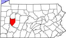 | |
| Boroughs | ||
| Townships | ||
| CDPs | ||
| Unincorporated communities | ||
| Counties |  Map of the Pittsburgh Tri-State with green counties in the metropolitan area and yellow counties in the combined area. | |
|---|---|---|
| Major cities | ||
| Cities and towns 15k-50k (in 2010) | ||
| Airports | ||
| Topics | ||
| ||