Manorville, Pennsylvania
| Manorville, Pennsylvania | |
|---|---|
| Borough | |
 Grace Lutheran Church | |
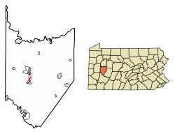 Location of Manorville in Armstrong County, Pennsylvania. | |
 Manorville Location of Manorville in Armstrong County, Pennsylvania. | |
| Coordinates: 40°47′11″N 79°31′18″W / 40.78639°N 79.52167°WCoordinates: 40°47′11″N 79°31′18″W / 40.78639°N 79.52167°W | |
| Country | United States |
| State | Pennsylvania |
| County | Armstrong |
| Government | |
| • Type | Borough Council |
| Area[1] | |
| • Total | 0.12 sq mi (0.31 km2) |
| • Land | 0.10 sq mi (0.26 km2) |
| • Water | 0.02 sq mi (0.05 km2) |
| Elevation | 800 ft (200 m) |
| Population (2010) | |
| • Total | 410 |
| • Estimate (2016)[2] | 389 |
| • Density | 3,851.49/sq mi (1,490.79/km2) |
| Time zone | UTC-5 (Eastern (EST)) |
| • Summer (DST) | UTC-4 (EDT) |
| Zip code | 16238 |
| Area code(s) | 724 |
| FIPS code | 42-47064 |
Manorville is a borough in Armstrong County, Pennsylvania, United States. The population was 410 at the 2010 census.[3]
Geography
Manorville is located on the east bank of the Allegheny River at 40°47′11″N 79°31′18″W / 40.78639°N 79.52167°W (40.786362, -79.521646),[4] about 40 miles (64 km) northeast of Pittsburgh. It is bordered by the borough of Ford City to the south.
Water Street abuts the Allegheny River through most of Manorville. Although along the river, much of the borough is not in a flood zone. Many of the residents have dock access to the river, and one public boat ramp is available for trailering. Two churches are located within the borough (Grace Lutheran Church and Manorville Methodist Church). There is also a post office located towards the center of the town on Water Street.
According to the United States Census Bureau, Manorville has a total area of 0.12 square miles (0.3 km2), of which 0.19 square miles (0.49 km2), or 15.80%, is water.[3]
Demographics
| Historical population | |||
|---|---|---|---|
| Census | Pop. | %± | |
| 1870 | 330 | — | |
| 1880 | 327 | −0.9% | |
| 1890 | 392 | 19.9% | |
| 1900 | 453 | 15.6% | |
| 1910 | 545 | 20.3% | |
| 1920 | 537 | −1.5% | |
| 1930 | 608 | 13.2% | |
| 1940 | 604 | −0.7% | |
| 1950 | 662 | 9.6% | |
| 1960 | 557 | −15.9% | |
| 1970 | 445 | −20.1% | |
| 1980 | 409 | −8.1% | |
| 1990 | 418 | 2.2% | |
| 2000 | 401 | −4.1% | |
| 2010 | 410 | 2.2% | |
| Est. 2016 | 389 | [2] | −5.1% |
| Sources:[5][6][7] | |||
As of the census[6] of 2000, there were 401 people, 180 households, and 106 families residing in the borough. The population density was 4,058.8 people per square mile (1,548.3/km²). There were 191 housing units at an average density of 1,933.2 per square mile (737.5/km²). The racial makeup of the borough was 98.75% White, 0.25% Asian, and 1.00% from two or more races. Hispanic or Latino of any race were 0.50% of the population.
There were 180 households, out of which 26.1% had children under the age of 18 living with them, 49.4% were married couples living together, 6.7% had a female householder with no husband present, and 40.6% were non-families. 33.9% of all households were made up of individuals, and 15.6% had someone living alone who was 65 years of age or older. The average household size was 2.23 and the average family size was 2.93.
In the borough the population was spread out, with 21.9% under the age of 18, 8.0% from 18 to 24, 31.4% from 25 to 44, 19.5% from 45 to 64, and 19.2% who were 65 years of age or older. The median age was 39 years. For every 100 females there were 96.6 males. For every 100 females age 18 and over, there were 89.7 males.
The median income for a household in the borough was $34,500, and the median income for a family was $36,250. Males had a median income of $27,109 versus $20,909 for females. The per capita income for the borough was $16,407. About 11.9% of families and 17.5% of the population were below the poverty line, including 31.2% of those under age 18 and 7.4% of those age 65 or over.
References
- ↑ "2016 U.S. Gazetteer Files". United States Census Bureau. Retrieved Aug 13, 2017.
- 1 2 "Population and Housing Unit Estimates". Retrieved June 9, 2017.
- 1 2 "Geographic Identifiers: 2010 Demographic Profile Data (G001): Manorville borough, Pennsylvania". U.S. Census Bureau, American Factfinder. Retrieved July 31, 2013.
- ↑ "US Gazetteer files: 2010, 2000, and 1990". United States Census Bureau. 2011-02-12. Retrieved 2011-04-23.
- ↑ "Census of Population and Housing". U.S. Census Bureau. Retrieved 11 December 2013.
- 1 2 "American FactFinder". United States Census Bureau. Retrieved 2008-01-31.
- ↑ "Incorporated Places and Minor Civil Divisions Datasets: Subcounty Resident Population Estimates: April 1, 2010 to July 1, 2012". Population Estimates. U.S. Census Bureau. Archived from the original on 17 June 2013. Retrieved 11 December 2013.
Municipalities and communities of Armstrong County, Pennsylvania, United States | ||
|---|---|---|
| City | 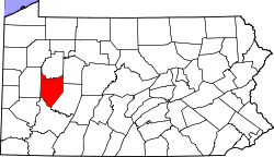 | |
| Boroughs | ||
| Townships | ||
| CDPs | ||
| Unincorporated communities | ||
| Counties |  Map of the Pittsburgh Tri-State with green counties in the metropolitan area and yellow counties in the combined area. | |
|---|---|---|
| Major cities | ||
| Cities and towns 15k-50k (in 2010) | ||
| Airports | ||
| Topics | ||
| ||