Wen'an County
| Wen'an County 文安县 | |
|---|---|
| County | |
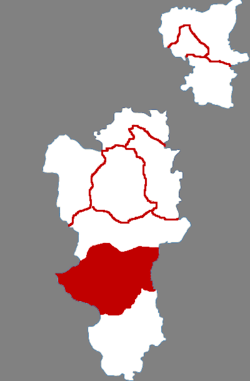 Wen'an in Langfang | |
.png) Langfang in Hebei | |
| Coordinates: 38°52′23″N 116°27′29″E / 38.873°N 116.458°ECoordinates: 38°52′23″N 116°27′29″E / 38.873°N 116.458°E | |
| Country | People's Republic of China |
| Province | Hebei |
| Prefecture-level city | Langfang |
| County seat | Wen'an Town (文安镇) |
| Area | |
| • Total | 980 km2 (380 sq mi) |
| Elevation | 7 m (23 ft) |
| Population (2004) | |
| • Total | 460,000 |
| • Density | 470/km2 (1,200/sq mi) |
| Time zone | UTC+8 (China Standard) |
| Postal code | 065800 |
| Area code(s) | 0316 |
Wen'an (Chinese: 文安; pinyin: Wén'ān) is a county in the central part of Hebei province, China, on the upper reaches of the Daqing River (大清河), a tributary of the Hai River, and bordering Tianjin to the east. It is under the administration of the prefecture-level city of Langfang, and, as of 2004, had a population of 460,000 residing in an area of 980 km2 (380 sq mi).
Administrative divisions
The county administers 12 towns and one ethnic township.[1]
Towns:
- Wen'an (文安镇)
- Xinzhen (新镇镇)
- Suqiao (苏桥镇)
- Daliuhe (大柳河镇)
- Zuogezhuang (左各庄镇)
- Tanli (滩里镇)
- Shigezhuang (史各庄镇)
- Zhaogezhuang (赵各庄镇)
- Xinglonggong (兴隆宫镇)
- Daliuzhen (大留镇镇)
- Sunshi (孙氏镇)
- Degui (德归镇)
The only township is Daweihe Hui and Manchu Ethnic Township (大围河回族满族乡)
References
- ↑ 2011年统计用区划代码和城乡划分代码:饶阳县 (in Chinese). National Bureau of Statistics of the People's Republic of China. Retrieved 2012-07-20.
External links
This article is issued from
Wikipedia.
The text is licensed under Creative Commons - Attribution - Sharealike.
Additional terms may apply for the media files.