Waltham, New Zealand
| Waltham | |
|---|---|
 Waltham | |
| Coordinates: 43°33′04″S 172°38′49″E / 43.55109°S 172.64684°ECoordinates: 43°33′04″S 172°38′49″E / 43.55109°S 172.64684°E | |
| Area | |
| • Total | 0.8627 km2 (0.3331 sq mi) |
| Population (2013) | |
| • Total | 1,049 |
| • Density | 1,200/km2 (3,100/sq mi) |
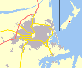
Waltham is an inner suburb of Christchurch, New Zealand, located approximately two kilometres south-east of the city centre. State Highway 76, part of Christchurch's ring road system, and known there as Brougham Street, runs through the suburb, as does the Lyttelton Line rail corridor.
Approximate boundaries of the suburb are Waltham Road, Moorhouse Avenue, Ferry Road, Ensors Road, and the Heathcote River. Waltham was originally part of the Sydenham borough and was incorporated into the City of Christchurch in 1903 when the borough was ended. In the early 1980s local residents and the Christchurch city council tried to name the western part of the suburb, Charleston, between Ferry Road and Ensors Road. This was done to maintain the residential nature of the area against perceived industrial expansion.[1] The attempt was partly successful and that area today is referred to as both Waltham and Charleston.
The boundaries used by the Statistics New Zealand meshblock cover the smaller area of Waltham without Charleston, which gives the suburb an area of about 1 square kilometre (0.39 sq mi). This smaller area was used to give Waltham a residential population of 1,049 in 2013.[2] The full suburb is a mixture of residential and both light and heavy industry. The suburb ranks below average in household income.
History
An early Christchurch settler, Charles Prince, owned a large house, called Waltham House, on nearby Colombo St South. In 1866 a meeting of local residents was held at the house and it unanimously agreed to name the district of the present day suburb, Waltham.[3]
The Christchurch gasworks was located at the inner boundary of Waltham until its closure around 1980.
References
- ↑ "Christchurch City Council Environmental Newsletter". Retrieved 20 April 2017.
- ↑ "2013 Census QuickStats about a place".
- ↑ "Name of Suburb" (PDF). Retrieved 17 April 2017.
External links
| Wikimedia Commons has media related to Waltham, New Zealand. |