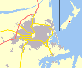
Bromley, New Zealand
| Bromley | |
|---|---|
 Bromley | |
| Coordinates: 43°33′00″S 172°42′00″E / 43.55000°S 172.70000°ECoordinates: 43°33′00″S 172°42′00″E / 43.55000°S 172.70000°E | |
| Area | |
| • Total | 2.8345 km2 (1.0944 sq mi) |
| Population (2013) | |
| • Total | 4,290 |
| • Density | 1,500/km2 (3,900/sq mi) |
Bromley is a suburb of the city of Christchurch, New Zealand. It lies to the east of the city centre, mostly between Pages Road and the Avon river estuary.[1]
History
In 1883, a sewage farm was established next to the Avon estuary. This was later developed when sewage works were built between 1958 and 1962.[2] As of 2018, the area includes oxidation ponds and a wildlife reserve.[3]
Education
- Bromley School[4]
References
- ↑ "Community profile, Bromley - Census area" (PDF). Christchurch City Council. November 2014. Retrieved 15 March 2018.
- ↑ "'Sewage treatment works at Bromley, near Christchurch'". Te Ara - the Encyclopedia of New Zealand. NZ Government. 1966. Retrieved 21 March 2018.
- ↑ "Canterbury places". Te Ara, The Encyclopedia of New Zealand. NZ Government. Retrieved 20 March 2018.
- ↑ "Bromley School". Retrieved 20 March 2018.
This article is issued from
Wikipedia.
The text is licensed under Creative Commons - Attribution - Sharealike.
Additional terms may apply for the media files.