Opawa
| Opawa | |
|---|---|
 Opawa | |
| Coordinates: 43°33′05″S 172°39′43″E / 43.551342°S 172.661937°ECoordinates: 43°33′05″S 172°39′43″E / 43.551342°S 172.661937°E | |
| Area | |
| • Total | 1.9710 km2 (0.7610 sq mi) |
| Population (2006) | |
| • Total | 3,360 |
| • Density | 1,700/km2 (4,400/sq mi) |
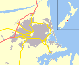
Opawa is an inner suburb of Christchurch, New Zealand, located 2.5 kilometres south-east of the city centre.
The name is a contraction of Ōpāwaho, which means a place of ('o') an outer pā or outpost ('paawaho') in Māori. Ōpāwaho or Opaawaho is the Māori name for the Heathcote River.[1]
References
| Wikimedia Commons has media related to Opawa, New Zealand. |
This article is issued from
Wikipedia.
The text is licensed under Creative Commons - Attribution - Sharealike.
Additional terms may apply for the media files.