Spreydon
| Spreydon | |
|---|---|
| Area | |
| • Total | 1.1996 km2 (0.4632 sq mi) |
| Population (2006) | |
| • Total | 3,432 |
| • Density | 2,900/km2 (7,400/sq mi) |
Spreydon is a suburb of Christchurch, New Zealand, 4 kilometres (2.5 mi) south-south-west of Cathedral Square. The most central street through Spreydon is Lyttelton Street. Spreydon is flanked by the suburbs Hoon Hay, Riccarton, and Lower Cashmere.
Spreydon was constituted as a borough in 1911. It merged into the city of Christchurch in 1921.[1]
Facilities
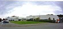
Pioneer Recreation and Sport Centre
- Barrington Shopping Centre,[2] Redeveloped in 2012 houses many shops including a major supermarket, pharmacy, The Warehouse, banks and post office as well as a number of other boutique and lifestyle stores.
- Pioneer Leisure Centre, opened in 1978, is a council-owned and operated centre with swimming pools, an indoor sports stadium and a fitness centre.[1][3]
Education
- Christchurch South Intermediate is a coeducational state intermediate (years 7-8) school with a roll of 515 and a socio-economic decile rating of 6.[4]
- Spreydon School is a coeducational state contributing (years 1-6) primary school with a roll of 304 and a decile rating of 3.[5]
- Te Kura Kaupapa Maori o Te Whanau Tahi is a coeducational state composite (years 1-15) school teaching entirely in the Māori language. It has a roll of 74 and a decile rating of 3.[6]
- West Spreydon School is a coeducational state contributing (years 1-6) primary school with a roll of 208 and a decile rating of 4.[7]
References
- 1 2 Canterbury places - South Christchurch. Te Ara - the Encyclopedia of New Zealand.
- ↑ "Christchurch shopping at Barrington Shopping". www.barringtonshopping.co.nz. Retrieved 2016-08-25.
- ↑ Plans to redevelop Pioneer Leisure Centre
- ↑ Te Kete Ipurangi schools database: South Intermediate
- ↑ Te Kete Ipurangi schools database: Spreydon school
- ↑ Te Kete Ipurangi schools database: TKKM o Te Whanau Tahi
- ↑ Te Kete Ipurangi schools database: West Spreydon school
External links
| Wikimedia Commons has media related to Spreydon. |
This article is issued from
Wikipedia.
The text is licensed under Creative Commons - Attribution - Sharealike.
Additional terms may apply for the media files.