Ucluelet
| Ucluelet | |
|---|---|
| District municipality | |
| District of Ucluelet[1] | |
 Surfing on the beaches of Ucluelet | |
| Nickname(s): Ukee | |
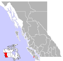 Location of Ucluelet in British Columbia | |
| Coordinates: 48°56′9″N 125°32′36″W / 48.93583°N 125.54333°W | |
| Country |
|
| Province |
|
| Region | Vancouver Island |
| Regional district | Alberni-Clayoquot Regional District |
| Incorporated | 1952 |
| Government | |
| • Governing body | Ucluelet Council |
| Area | |
| • Total | 6.81 km2 (2.63 sq mi) |
| • Land | 6.49 km2 (2.51 sq mi) |
| • Water | 0.32 km2 (0.12 sq mi) |
| Elevation | 20 m (70 ft) |
| Population (2016) | |
| • Total | 1,717 |
| • Density | 264.5/km2 (685/sq mi) |
| Time zone | UTC-8 (PST) |
| Postal code span | V0R 3A0 |
| Area code(s) | 250 |
| Highways | 4 |
| Waterways | Barkley Sound |
| Climate | Cfb |
| Website | DiscoverUcluelet.com |
Coordinates: 48°56′6″N 125°32′31″W / 48.93500°N 125.54194°W
Ucluelet (/juːˈkluːlɪt/, also Ukee locally) is a district municipality (population about 1,717) on the Ucluelet Peninsula on the west coast of Vancouver Island in British Columbia, Canada. Ucluelet means "people of the safe harbour" in the indigenous Nuu-chah-nulth (Nootka) language.
Geography
Ucluelet is located at the western edge of Barkley Sound, 288 kilometres northwest of the British Columbia provincial capital, Victoria, on the outer west coast of Vancouver Island.
The closest city is Port Alberni approximately 100 km to the east. The District of Tofino is 40 km northwest of Ucluelet on Highway 4.
In between Tofino and Ucluelet is the Long Beach unit of the Pacific Rim National Park Reserve. Barkley Sound lies southeast of Ucluelet and is a marine area that features the Broken Islands Group unit of the Pacific Rim National Park Reserve. The fishing and scientific research community of Bamfield lies on its farther shore.
Climate
Ucluelet has an oceanic climate (Köppen Cfb) with mild, rainy winters and cool summers owing to its coastal location. As such, temperatures above 30 °C (86.0 °F) and below −10 °C (14.0 °F) are rare. Precipitation is high, averaging around 3,350 mm (132 in) per year, with most of it concentrated in the winter months. Even so, precipitation is significant in all months with no month averaging below 70 mm (3 in) of precipitation. Although it has an average snowfall of 32.4 cm (12.8 in), the median is 0,[2] meaning over 50% of years do not experience a single snowfall; which makes this climate unique in Canada.
| Climate data for Ucluelet (1981−2010) | |||||||||||||
|---|---|---|---|---|---|---|---|---|---|---|---|---|---|
| Month | Jan | Feb | Mar | Apr | May | Jun | Jul | Aug | Sep | Oct | Nov | Dec | Year |
| Record high °C (°F) | 16.5 (61.7) |
19.0 (66.2) |
19.5 (67.1) |
24.0 (75.2) |
28.0 (82.4) |
30.5 (86.9) |
33.5 (92.3) |
30.0 (86) |
27.0 (80.6) |
26.5 (79.7) |
17.0 (62.6) |
16.5 (61.7) |
33.5 (92.3) |
| Average high °C (°F) | 8.4 (47.1) |
9.2 (48.6) |
10.3 (50.5) |
12.4 (54.3) |
15.0 (59) |
17.1 (62.8) |
19.0 (66.2) |
19.1 (66.4) |
18.2 (64.8) |
13.9 (57) |
10.4 (50.7) |
8.5 (47.3) |
13.5 (56.3) |
| Daily mean °C (°F) | 5.5 (41.9) |
5.5 (41.9) |
6.6 (43.9) |
8.4 (47.1) |
10.9 (51.6) |
13.2 (55.8) |
15.0 (59) |
15.0 (59) |
13.7 (56.7) |
10.2 (50.4) |
7.2 (45) |
5.5 (41.9) |
9.7 (49.5) |
| Average low °C (°F) | 2.6 (36.7) |
1.8 (35.2) |
2.8 (37) |
4.3 (39.7) |
6.7 (44.1) |
9.2 (48.6) |
10.9 (51.6) |
11.0 (51.8) |
9.2 (48.6) |
6.4 (43.5) |
4.0 (39.2) |
2.6 (36.7) |
6.0 (42.8) |
| Record low °C (°F) | −9 (16) |
−11 (12) |
−4.5 (23.9) |
−2 (28) |
−1 (30) |
2.5 (36.5) |
5.0 (41) |
5.5 (41.9) |
1.5 (34.7) |
−3 (27) |
−6 (21) |
−9.5 (14.9) |
−11 (12) |
| Average precipitation mm (inches) | 501.8 (19.756) |
353.1 (13.902) |
322.3 (12.689) |
266.5 (10.492) |
165.9 (6.531) |
147.2 (5.795) |
78.5 (3.091) |
87.6 (3.449) |
139.6 (5.496) |
345.3 (13.594) |
492.2 (19.378) |
451.1 (17.76) |
3,351.1 (131.933) |
| Average rainfall mm (inches) | 495.0 (19.488) |
343.8 (13.535) |
316.4 (12.457) |
265.8 (10.465) |
165.9 (6.531) |
147.2 (5.795) |
78.5 (3.091) |
87.6 (3.449) |
139.6 (5.496) |
354.2 (13.945) |
489.2 (19.26) |
444.4 (17.496) |
3,318.7 (130.657) |
| Average snowfall cm (inches) | 6.8 (2.68) |
9.3 (3.66) |
5.9 (2.32) |
0.76 (0.299) |
0.0 (0) |
0.0 (0) |
0.0 (0) |
0.0 (0) |
0.0 (0) |
0.05 (0.02) |
3.0 (1.18) |
6.7 (2.64) |
32.4 (12.76) |
| Average precipitation days (≥ 0.2 mm) | 22.5 | 18.8 | 21.6 | 18.2 | 15.9 | 13.8 | 9.4 | 10.0 | 12.0 | 19.2 | 22.7 | 21.7 | 205.8 |
| Average rainy days (≥ 0.2 mm) | 22.3 | 18.5 | 21.4 | 18.2 | 15.9 | 13.8 | 9.4 | 10.0 | 12.0 | 19.2 | 22.5 | 21.5 | 204.7 |
| Average snowy days (≥ 0.2 cm) | 1.8 | 2.0 | 1.5 | 0.32 | 0.0 | 0.0 | 0.0 | 0.0 | 0.0 | 0.04 | 0.65 | 1.8 | 8.0 |
| Source: Environment Canada[3] | |||||||||||||
History
Archaeological evidence indicated the presence of First Nations along the outer west coast of Vancouver Island for at least 4,300 years. British Columbia’s recorded history began with European explorers searching for the legendary Northwest Passage.
It was on the west coast of Vancouver Island, at Nootka Sound, 100 km north of Ucluelet, that Juan Pérez anchored and traded in 1774. In 1775 Juan Francisco de la Bodega y Quadra sailed along the coast of Vancouver Island, heading north for Alaska. He did not stop but roughly charted the coast in the vicinity of Kyuquot Sound.[4] Captain James Cook of the British Navy anchored in Nootka Sound and went ashore in 1778. Maritime fur traders followed, such as Charles William Barkley, captain of the Imperial Eagle, who in 1787 arrived near Ucluelet harbour in Barkley Sound in search of sea otter pelts.
In 1870, fur sealers came to the area seeking ports for vessels working the Bering Sea sealing grounds. Captain Francis, the owner of several sealing schooners, established a trading post in Ucluelet harbour. Ucluelet began to grow along with the sealing industry and became a bustling little town. In the 1890s more settlers began arriving on the news of pending road access from Port Alberni. Fishing was excellent and gold was to be found on Florencia Bay. The stories of gold were correct, but it was so fine and in such little quantity that it could not be worked profitably.
The Presbyterian Church built a Mission House and school and a doctor was dispatched to the area in 1898. By 1900, more settlers had moved to the west coast of Vancouver Island. Development began bringing infrastructure and services of all kinds. The Canadian Pacific Railway operated a small freight boat sailing from Victoria three times a month. In 1903 a whaling station was established in Barkley Sound. In Ucluelet a lighthouse, a government telegraph office, and a lifeboat station were built. As the First World War began, the fishing industry had started.
When World War II began the Government of Canada took measures to protect Vancouver Island’s west coast from potential invasions. The military established a seaplane base in Ucluelet and a land base at Long Beach. The road to Tofino, which had been worked on for thirty years, was finally completed.
In 1941, the Direction Finding capabilities at RCAF station Ucluelet (Long Beach) were placed at the disposal of the Royal Canadian Navy. In 1942, RCN operators at Ucluelet, Coal Harbour and Alliford Bay were transferred to Gordon Head in Victoria.
Ucluelet continued to prosper after the war luring more residents hoping for prosperity to the region. In August 1959, the long-awaited road to Port Alberni was finally opened. [5]
On February 26, 1952, Ucluelet became incorporated. Its status was changed to a District in 1997 to reflect, in part, the increasing population and increasing importance within the region.[6]
Demographics
Very important in local society is the presence of the Yuu-tluth-aht people ("people of the safe landing place" or "people of the safe harbour" in Nuu-chah-nulth), whose government is the Ucluelet First Nation.[7] Their community is based at Ittatsoo (Ucluelet Indian Reserve), which is located 28 kilometres from the town of Ucluelet.
Both Ucluelet and nearby Tofino have become target sites for the construction of resorts, restaurants and adventure tourism centres. Although the local population has historically been based on fishing and logging, increasing numbers of seasonal residents pass through both communities to work in the tourism and hospitality industry.
Health and education
Public education is offered by School District 70 Alberni, through the Ucluelet Elementary School and Ucluelet Secondary School. Health services are provided in town by the Ucluelet Medical Clinic and larger facilities are located in Tofino and Port Alberni; all are operated by the Vancouver Island Health Authority (VIHA).[8]
Tourism
Like its neighbour Tofino, Ucluelet has made the transition from a resource-based economy to a year-round tourism-based economy. The Pacific Rim Visitor Centre is now the second-most-visited Tourism Centre, after Victoria, on Vancouver Island, and on average greets and assists 90,000 folks from around the world to the Pacific Rim National Park, Ucluelet and Tofino area.
Tourist activities include surfing, stand-up paddle board, fishing, whale watching, bear watching, kayaking, canoeing, camping, hiking, biking, swimming, beachcombing and the storm watching during the November to March season.
Transportation
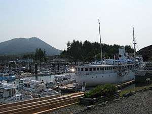
.jpg)
Ucluelet has an airport, Tofino Ucluelet Airport, about twenty minutes drive from town. Long Beach Airport is accessible to small passenger planes and the harbour in Ucluelet, Ucluelet Water Aerodrome, is accessible to floatplanes. Coastal fog is a common morning phenomenon in the summer, complicating access by air until the weather clears.
Accessing Ucluelet by car is via Highway 4 from Port Alberni. Snow chains or winter tires are required from October to May.
Tofino Bus also services Ucluelet from Victoria, Vancouver, Nanaimo and Port Alberni.
In the summer, Lady Rose Marine Services operates a ferry service from Port Alberni to Ucluelet and return several times per week.
Festivals and events
Every March, the Pacific Rim Whale Festival is a week of events hosted by Ucluelet, Tofino and the Pacific Rim National Park Reserve.[2] With a strong focus on marine life protection education, the event celebrates the annual return of migrating Pacific Grey Whales from their breeding and calving grounds along the Baja Peninsula of Mexico. Community events within the festival include gala dinners, children’s activities, workshops and live entertainment.[9]
Every odd year, Ucluelet hosts a leg of the Van Isle 360. It is a point-to-point race circumnavigating Vancouver Island, sailed in 10 legs. While the participants are in Ucluelet, the community hosts a special salmon barbecue with live music and a send-off event.[10]
In mid-June, there is the Annual Edge to Edge Marathon. Every year participants from within the community and beyond race from Tofino through the Pacific Rim National Park Reserve to Ucluelet.[11]
The Pacific Rim Summer Festival is held in early July with two weeks of music, word and multi-cultural concerts featuring national and international performers. Nightly concerts are performed at venues in Ucluelet, Tofino and the Pacific Rim National Park Reserve.[12]
The end of July or the last weekend are Ukee Days, a local celebration with several events such as a salmon barbecue on Friday, pancake breakfast and town parade on Saturday and a Ukee Days dance.
Also during the Full moon weekend of July, the Soundwave music festival happens at the mussel beach campground throughout the weekend, it showcases world class DJs, local artists, and live music all weekend, usually 4-5000 people are in attendance.
Activities
The Wild Pacific Trail begins near the mouth of Ucluelet Inlet at Amphitrite Point Lighthouse and travels north along the open Pacific coastline through Big Beach Park to the bike path just outside Ucluelet. The final section will extend the trail to Halfmoon Bay in the Pacific Rim National Park Reserve.[13]
The trail is accessible to all ages and abilities, even wheelchairs in certain areas. No bikes, horses or motorized vehicles are permitted on the park’s beaches or trails. The hiking trails are designed to let visitors experience the shoreline while preventing damage to the fragile environment.
Various marine tours are available including sea kayaking, canoeing in the inlet, whale and wildlife watching.
There has been an ongoing interest in sport fishing out of Ucluelet and there are many chartered sports fishing options in town.[14]
Surfing has become a popular activity among tourists and locals alike. In the summer months, surfers of all levels of experience and ability flock to the surf breaking along Florencia Bay, Wickaninnish Beach and Long Beach in the Pacific Rim National Park Reserve.
Mt. Ozzard, which hosts the Coast Guard Marine Communication and Traffic Services (MCTS) surveillance radar dome and various other communications towers, has a service road that is gated at the bottom. Despite the gate, the road to the summit is accessible to hikers and all-terrain vehicles. The MCTS centre at Amphitrite Point was closed in May 2015 and its services relocated to Prince Rupert.
References
- ↑ "British Columbia Regional Districts, Municipalities, Corporate Name, Date of Incorporation and Postal Address" (XLS). British Columbia Ministry of Communities, Sport and Cultural Development. Retrieved November 2, 2014.
- ↑ "Statistics – Tofino & Ucluelet".
- ↑ "Ucluelet Kennedy Camp". Canadian Climate Normals 1981–2010 Station Data. Environment Canada. Retrieved December 24, 2017.
- ↑ Tovell, Freeman M. (2008). At the Far Reaches of Empire: The Life of Juan Francisco De La Bodega Y Quadra. University of British Columbia Press. p. 41. ISBN 978-0-7748-1367-9.
- ↑ Tourism Ucluelet history page
- ↑ "Ucluelet". BC Geographical Names.
- ↑ "Ucluelet Chamber of Commerce". www.uclueletinfo.com. Retrieved 2008-07-05.
- ↑ VIHA Central Island Facilities. Retrieved 2011-10-24
- ↑ "Welcome to the 23rd Annual Pacific Rim Whale Festival". Pacific Rim Whale Festival. Retrieved 2008-12-09.
- ↑ http://www.vanisle360.com
- ↑ http://www.edgetoedgemarathon.com
- ↑ http://www.pacificrimarts.ca
- ↑ http://www.longbeachmaps.com/wildtrail.html
- ↑ Federal Department of Fisheries and Oceans licensing information
External links
| Wikivoyage has a travel guide for Ucluelet. |
| Wikimedia Commons has media related to Ucluelet. |
- District of Ucluelet Official Website
- Discover Ucluelet - Official Tourism Ucluelet Website
- Ucluelet Chamber of Commerce
| Subdivisions |  | |
|---|---|---|
| Communities | ||
| Metro areas and agglomerations | ||
| District municipalities |
| |
| ||