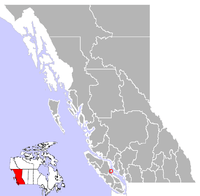
Courtenay, British Columbia
| Courtenay | |
|---|---|
| City | |
| The Corporation of the City of Courtenay | |
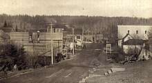
 Downtown Courtenay | |
 | |
| Coordinates: 49°41′16″N 124°59′40″W / 49.68778°N 124.99444°WCoordinates: 49°41′16″N 124°59′40″W / 49.68778°N 124.99444°W | |
| Country |
|
| Province |
|
| Region | Mid-Island |
| Regional District | Comox Valley |
| Incorporated | 1915 |
| Government | |
| • Mayor | Larry Jangula |
| Area | |
| • Land | 32.41 km2 (12.51 sq mi) |
| • Metro | 596.00 km2 (230.12 sq mi) |
| Elevation | 13 m (43 ft) |
| Population (2016) | |
| • City | 25,599 |
| • Density | 789.9/km2 (2,046/sq mi) |
| • Metro | 54,157 |
| • Metro density | 90.9/km2 (235/sq mi) |
| Time zone | UTC−8 (PST) |
| Forward sortation area | V9J, V9N |
| Area code(s) | 250, 778, 236 |
| Website | www.courtenay.ca |
Courtenay is a city on the east coast of Vancouver Island, in the Canadian province of British Columbia. It is the largest city (and only "city") in the area commonly known as the Comox Valley, and it is the seat of the Comox Valley Regional District, which replaced the Comox-Strathcona Regional District. Courtenay is just 4 km (2.5 mi) west of the town of Comox, 7 km (4.3 mi) northeast of the village of Cumberland, 5 km (3.1 mi) northwest of the unincorporated settlement of Royston, and 108 km (67 mi) northwest of Nanaimo. The city, along with Nanaimo and Victoria, is home to The Canadian Scottish Regiment (Princess Mary's), a Primary Reserve infantry regiment of the Canadian Forces.
History
Before the arrival of Europeans
Archaeological evidence suggests there was an active Coast Salish fishing settlement on the shores of the Courtenay River Estuary for at least 4,000 years.[1] Due to its gentle climate, fertile soil and abundant sea life, the Coast Salish residents called the area kw'umuxws (Li'kwala for plentiful), which was eventually anglicized to Komoux and then to Comox.
At the time of first contact with Europeans, the Pentlatch Nation, who spoke the Island Comox dialect of the Comox Coast Salish language, occupied the shores of present-day Comox Bay.[1] (The last speaker of the Island Comox dialect died in 1995.) Another Island Comox speaking Nation, the K'ómoks, occupied settlements further north along the east coast of Vancouver Island, in the area of present-day Campbell River, including Quadra Island and several other Gulf islands.
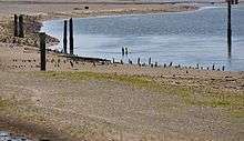
Along the tidal flats of the estuary, the Pentlatch set out elaborate fishing weirs—nets tied to wooden stakes that would be covered at high tide but uncovered at low tide, allowing trapped fish to be removed. These wooden stakes can still be seen at low tide — local archaeologist Nancy Greene has estimated that up to 200,000 wooden stakes remain in the mud flats.[2] Several of these wooden stakes were carbon dated, revealing the oldest to be made from a hemlock tree c.750 CE, while the youngest dated from around 1830.[2] Some scientists estimate that the weirs could have supported a population of several thousand people.[3] The Pentlatch also harvested the abundant shellfish in Comox Bay.
By the 19th century, the K'ómoks had been driven out of their lands near Campbell River by the Lekwiltok, a particularly fierce group of Kwakwaka'wakw.[1] The K'ómoks migrated south to the shores of the Courtenay River estuary, where they allied with the resident Pentlatch against their common enemy.[2] In 1862, a smallpox epidemic swept across Vancouver Island, killing an estimated 30% of First Nations people. A census of First Nations in the Comox Valley taken in 1876 revealed that the local First Nations population had dwindled to only 88 K'ómoks and 21 Pentlatch.[3][4]
European settlers began to arrive in the area in 1872, and by 1876, the K'ómoks and Pentledge had been moved onto two reservations: Comox Indian Reserve No. 1 adjacent to the village of Comox, and Pentledge Indian Reserve No. 2 at the confluence of the Puntledge and Tsolum rivers adjacent to the village of Courtenay.[3]
Early European explorers
In 1579, Francis Drake, on his circumnavigation of the globe in the Golden Hind, found a good port somewhere along the northwest coast of North America and stayed for several months while restocking supplies and trading with the inhabitants of the area. He named the region Nova Albion, Latin for "New Britain". Drake's detailed logs — and the exact location of Nova Albion — were later lost in a 17th-century fire, but some historians believe Drake made a landing in the Courtenay River estuary.[5]
In 1791, a Spanish expedition led by Dionisio Alcalá Galiano and Cayetano Valdés y Flores produced a crude chart of the Strait of Georgia and possibly visited Comox Bay. Captain George Vancouver arrived the following year, tasked by the British government with charting the northwest coast of North America. Vancouver, in concert with the Spanish expedition, entered the Courtenay River estuary between the present-day locations of Courtenay and Comox and charted the shoreline of the estuary.[6]
Early settlers
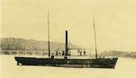
By the middle of the 19th century, European and American settlements had sprung up in the Vancouver area and on southern Vancouver Island. In 1837, the Hudson Bay Company steamship Beaver began to search the south and east coasts of Vancouver Island for suitable locations for new trading posts, and subsequently set up a post overlooking the Courtenay River estuary, calling it "Komoux".
HMS Constance, commanded by Captain Courtenay, was a frequent visitor to the area.[7] In 1848, the river flowing through the Koumax valley was informally named the Courtenay River by the sailors of the HMS Constance after their captain. In 1857, Captain George Richards of HMS Plumper was tasked with undertaking a complete survey of the coastline of Vancouver Island, and was given authority to name local landmarks. When he arrived in the area, he confirmed the name of the river as the Courtenay.[3]
In 1853 Sir James Douglas, governor of Vancouver Island, took a journey up the coast of Vancouver Island aboard SS Beaver, and recognized the area's agricultural potential. In 1861, Lieutenant Richard Mayne of the Royal Navy visited the area and wrote of the rich agricultural prospects of the area, saying it had taken him a day and a half to walk over the land "through which a plough might be driven from end to end".[1] That same year Governor Douglas issued a land and settlement proclamation for the Koumox Valley, intending to divert new settlers away from the Victoria area as well as from the newly discovered Cariboo gold fields. He offered land in the valley for $1 per acre and free transportation to the area.[1]
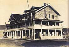
Although some unofficial settlers had arrived in previous years, the first government-approved settlers arrived in 1862 aboard HMS Grappler.[8] The majority of the settlers staked out farm lots on the flat and fertile "prairies" on the east side of the river, and a small village sprung up on the east bank of the river to supply their needs.[9]:34 The Courtenay Hotel, also known as Courtenay House, became the focal point of a village that included a general store, a small bank, a barber, and livery barns. However, it was not an ideal location, since the river regularly burst its banks due to king tides or spring run-off, flooding the entire village.[9]:10
In 1864, Robert Brown, leading the Vancouver Island Exploring Expedition, discovered coal deposits in the Comox Valley, but these went unexploited for two decades.[7]
In 1874, a new settler to the area, Joseph McPhee, won the contract to build a bridge that connected the regularly flooded flats on the east side of the river to higher ground on the west side of the river. When the bridge was finished, McPhee and business partner Reginald Pidcock bought up 10 acres (4.0 ha) of land on the western side of the river immediately adjacent to the new bridge. McPhee built a store beside the bridge, while Pidcock built the Courtenay River's first commercial enterprise, a saw mill.[9]:18
In 1888 Robert Dunsmuir established a mine in nearby Union, later renamed Cumberland, which brought an influx of settlers, and Chinese and Japanese immigrants.[10] McPhee and Pidcock recognized the economic potential of a townsite on the western bank of the river, which would be closer to the mines. They hired a surveyor, George Drabble, to survey and subdivide their land into town lots, which they quickly sold to businessmen and homeowners. The townsite on the much drier west side of the river, called for a time "New Courtenay",[11] quickly developed. Many of the stores and businesses centred on what was originally called Union Street (now 5th Street), which ascended from McPhee's bridge.[9]:34
Early 20th century
The Comox Co-operative Creamery opened in 1901, encouraging the development of dairy farms in the fertile valley.[11] Courtenay had no connecting roads to the rest of the Island; news and mail were provided by packet steamers. But in 1905, Joseph McPhee brought telephone service to his store, providing the isolated community with immediate contact to the outside world.[11] A connecting road to Nanaimo and Victoria was finally built in 1910, and the E&N Railway arrived in 1914, bringing an end to the packet steamer era.[11]
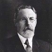
Electricity arrived in the area in 1914, provided by Courtenay Electric Light Heat and Power[9]:41 However, some citizens, led by Joseph McPhee, believed that electricity should be provided by a publicly owned company, and Courtenay was incorporated as a town on 1 January 1915[10] to facilitate this.[11] In order to make a publicly-owned company a reality, McPhee ran for the office of mayor, but lost by a mere five votes[9]:41 to rival Dan McPatrick, who favoured a private electrical company. However, a majority of the alderman elected to council were allies of McPhee, and in December 1916, the new town purchased Courtenay Electric Light Heat and Power, making it a public utility.[9]:41
On 12 July 1915, a large fire ripped through 5th Street destroying much of the south side of the downtown. After much of the street was rebuilt, another fire hit the south side of 5th Street, again destroying many of the stores.[10] In both cases, due to the lack of a water system, the citizens were only able to fight the fires with a bucket brigade. Joseph McPhee led the call for a water system, which was installed by October 1921.[9]:41
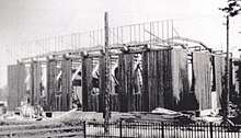
In 1921, a new chapter of the Native Sons of Canada was formed in Courtenay, with Joseph McPhee as president. They decided to build a hall, and a large log structure was completed in 1928, the largest freespan log building in Canada.[9]:22
In 1923, a steel bridge at the 5th Street river crossing replaced McPhee's fifty-year old wooden structure. The town's population experienced steady growth in the years between the First and Second World Wars, increasing from 600 people in 1914 to 1700 in 1941.[11] By 1951, the population had grown to 2500, and Courtenay was designated a city in 1953. In 1960, the 5th Street bridge built in 1923 was replaced with the current steel structure.[12] Concrete sidewalks and a sewer system were installed in 1962.
In 1975, the construction of Driftwood Mall and the opening of a second river crossing, the 17th Street lift bridge, refocussed the business district from 5th Street to Cliffe Avenue.[11]
Earthquake of 1946
On 14 June 1946, a 7.3 magnitude earthquake struck just west of Courtenay, with the epicentre located at Forbidden Plateau. The earthquake was felt as far north as Prince Rupert and as far south as Portland, Oregon. Many of the town's chimneys were destroyed, and there was significant damage to the post office and the Courtenay elementary school. This was the largest earthquake to hit Vancouver Island, and the largest onshore earthquake in Canada on record. There were only two reported deaths: one Seattle man died of a heart attack and another drowned when his boat capsized due to a resulting wave.[13]
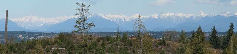
Geography
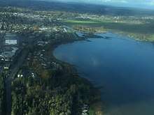
According to Statistics Canada, the city has a total land area of 26.68 km2 (10.30 sq mi).[14] The city is located on the British Columbia Coast and sits on the Strait of Georgia.
Climate
The climate in Courtenay is very similar to that of the rest of Vancouver Island, classified as a marine west coast oceanic climate. In the summer months it can sometimes be considered to have a Mediterranean like climate due to the low levels of precipitation and drying in the summer months. In the spring and fall seasons, Courtenay tends to be quite cool and wet. It has one of the mildest winters in Canada along with several other locations on the island such as Victoria.[15] The high precipitation levels can be attributed to both the oceanic climate and also its proximity to the Insular Mountain range which results in the rain shadow effect. Courtenay has quite mild winters, maintaining the cool and damp characteristics, but temperatures can drop below freezing levels and snow may happen throughout the season due to Arctic air movements.
| Climate data for Comox Airport | |||||||||||||
|---|---|---|---|---|---|---|---|---|---|---|---|---|---|
| Month | Jan | Feb | Mar | Apr | May | Jun | Jul | Aug | Sep | Oct | Nov | Dec | Year |
| Record high humidex | 16.2 | 15.8 | 18.7 | 26.2 | 31.6 | 37.3 | 40.4 | 40.3 | 31.8 | 26.0 | 20.9 | 17.5 | 40.4 |
| Record high °C (°F) | 16.7 (62.1) |
16.3 (61.3) |
19.0 (66.2) |
26.8 (80.2) |
31.7 (89.1) |
34.4 (93.9) |
35.2 (95.4) |
33.6 (92.5) |
30.6 (87.1) |
22.9 (73.2) |
17.8 (64) |
17.4 (63.3) |
35.2 (95.4) |
| Average high °C (°F) | 6.4 (43.5) |
7.4 (45.3) |
9.6 (49.3) |
12.9 (55.2) |
16.6 (61.9) |
19.8 (67.6) |
22.8 (73) |
22.7 (72.9) |
19.0 (66.2) |
12.9 (55.2) |
8.5 (47.3) |
5.9 (42.6) |
13.7 (56.7) |
| Daily mean °C (°F) | 3.9 (39) |
4.3 (39.7) |
6.1 (43) |
8.8 (47.8) |
12.4 (54.3) |
15.5 (59.9) |
18.0 (64.4) |
17.9 (64.2) |
14.5 (58.1) |
9.5 (49.1) |
5.7 (42.3) |
3.5 (38.3) |
10.0 (50) |
| Average low °C (°F) | 1.4 (34.5) |
1.2 (34.2) |
2.5 (36.5) |
4.6 (40.3) |
8.0 (46.4) |
11.1 (52) |
13.3 (55.9) |
13.0 (55.4) |
9.9 (49.8) |
6.0 (42.8) |
2.9 (37.2) |
0.9 (33.6) |
6.2 (43.2) |
| Record low °C (°F) | −21.1 (−6) |
−16.1 (3) |
−13.9 (7) |
−4.4 (24.1) |
−2.8 (27) |
0.5 (32.9) |
5.0 (41) |
3.3 (37.9) |
−1.7 (28.9) |
−4.8 (23.4) |
−13.3 (8.1) |
−15 (5) |
−21.1 (−6) |
| Record low wind chill | −19 | −22 | −16 | −6 | −2 | 0 | 0 | 0 | −3 | −10 | −20 | −25 | −25 |
| Average precipitation mm (inches) | 171.9 (6.768) |
114.3 (4.5) |
105.7 (4.161) |
64.6 (2.543) |
45.6 (1.795) |
42.8 (1.685) |
26.7 (1.051) |
29.2 (1.15) |
41.8 (1.646) |
122.8 (4.835) |
200.5 (7.894) |
187.9 (7.398) |
1,153.6 (45.417) |
| Average rainfall mm (inches) | 159.1 (6.264) |
107.8 (4.244) |
95.7 (3.768) |
64.4 (2.535) |
45.6 (1.795) |
42.8 (1.685) |
26.7 (1.051) |
29.2 (1.15) |
41.8 (1.646) |
122.7 (4.831) |
191.9 (7.555) |
168.9 (6.65) |
1,096.5 (43.169) |
| Average snowfall cm (inches) | 11.9 (4.69) |
6.0 (2.36) |
9.9 (3.9) |
0.2 (0.08) |
0.0 (0) |
0.0 (0) |
0.0 (0) |
0.0 (0) |
0.0 (0) |
0.1 (0.04) |
8.2 (3.23) |
18.7 (7.36) |
55.0 (21.65) |
| Average precipitation days (≥ 0.2 mm) | 19.9 | 16.1 | 16.9 | 14.3 | 12.8 | 11.0 | 7.9 | 7.2 | 9.2 | 16.6 | 20.1 | 20.5 | 172.6 |
| Average rainy days (≥ 0.2 mm) | 19.0 | 15.3 | 16.4 | 14.3 | 12.8 | 11.0 | 7.9 | 7.2 | 9.2 | 16.6 | 19.7 | 19.5 | 168.9 |
| Average snowy days (≥ 0.2 cm) | 2.7 | 2.1 | 1.8 | 0.2 | 0.0 | 0.0 | 0.0 | 0.0 | 0.0 | 0.1 | 1.2 | 3.0 | 11.1 |
| Average relative humidity (%) | 83.8 | 76.5 | 70.4 | 63.8 | 61.5 | 60.2 | 57.3 | 57.6 | 62.8 | 75.8 | 81.3 | 83.4 | 69.5 |
| Source: [15] | |||||||||||||
Demographics
As of the Canada 2006 Census, there are 21,940 people, 9,750 private households, and 6,335 families residing in the city. The population density is 822.3/km2 (2,130/sq mi). The city has a total of 9,748 private dwellings. The racial makeup of the city is 94.74% non-visible minority, 5.08% Aboriginal (67.3% First Nations and 27.4% Métis people), 1.53% Chinese, 0.75% Filipino, 0.62% Southeast Asian, 0.50% South Asian, 0.48% Black, 0.32% Latin Americans, 0.23% Korean, 0.09% Japanese and 0.05% who list themselves as multiple visible minority.[14]
There are 9,750 households, out of which 19.08% are couples with children, 31.74% are couples without children, 31.54% are single person and 17.64% are other. The average household size is 2.2.[14]
In the city, the population is spread out with 23.15% under the age of 20, 5.81% from 20 to 24, 24.27% from 25 to 44, 28.37% from 45 to 64, and 18.37% who are 65 years of age or older. The median age is 43 years compared to 40.8 for BC as a whole. For every 100 females there are 89.7 males and for every 100 females age 20 and over, there are 86.6 males. For every 100 males there are 111.5 females and for every 100 males age 20 and over, there are 115.5 females.[14]
There are 17,135 people in the city with an income, with a median total income of $22,662. Of this income, earnings are 64.7%, government transfers are 16.5%, and other income is 18.8%. There are 11,585 people with earnings and the average overall earnings are $20,529, with an average among full-year full-time earnings of $36,960.[14]
In 2006 it was the 61st largest metropolitan area (which includes Comox and Comox Valley B) and the 69th largest urban area.[14][16]
| Canada 2006 Census | Population | % of Total Population | |
|---|---|---|---|
| Visible minority group Source:[17] | Chinese | 335 | 1.5% |
| South Asian | 110 | 0.5% | |
| Black | 105 | 0.5% | |
| Filipino | 165 | 0.8% | |
| Latin American | 70 | 0.3% | |
| Southeast Asian | 135 | 0.6% | |
| Arab | 0 | 0% | |
| West Asian | 0 | 0% | |
| Korean | 50 | 0.2% | |
| Japanese | 20 | 0.1% | |
| Other visible minority | 0 | 0% | |
| Mixed visible minority | 10 | 0% | |
| Total visible minority population | 1,005 | 4.6% | |
| Aboriginal group Source:[18] | First Nations | 1,115 | 5.1% |
| Métis | 0 | 0% | |
| Inuit | 0 | 0% | |
| Total Aboriginal population | 1,115 | 5.1% | |
| White | 19,665 | 90.3% | |
| Total population | 21,785 | 100% | |
Economy
From its inception, Courtenay's economy relied heavily on the extraction of natural resources, like coal, logging, fishing, and agriculture. Over the years as this natural resource extraction decreased, Courtenay has focused its economic growth on supplying services to the large retiree community and the military families at CFB Comox, which is the largest employer in the Comox Valley, supplying approximately 1,400 jobs.[19] Tourism has also been steadily increasing and has now become a vital part of the Comox Valley economy. St. Joseph's General Hospital, Mount Washington home of the Critically Endangered Vancouver Island marmot,[20] Crown Isle Golf Course, Kingfisher Resort and Spa and the Best Western Westerly Hotel, and the Air Force base at Comox are in the top 15 employers in the Comox Valley, providing 1,200 jobs.[19]
Approximately $573.8 million is spent in the retail industry in the Comox Valley, with half of the sales coming from supermarkets, gas stations, and car sales. The average household income is $59,136, which is 16% less than the BC average and 18% lower than the Canadian average. In Courtenay, 60% of the income sources is employment, 19% from pensions, and 6% from investments.[19]
Arts and culture
Every summer, usually in July, the largest music festival, the Island Music Fest[21] on Vancouver Island takes place in the Comox Valley. Performers and audience members gather for three days of camping and an eclectic mix of music. There are several other festivals in the area and they include the North Island Festival of Performing Arts, Fiddlefest, Comox Valley Highland Games and the Comox Valley Piano Society puts on performances at the Stan Hagen Theatre.[22][23][24][25]
The city is home to the Comox Valley Youth Music Centre, originally the Courtenay Youth Music Camp, a two-week-long annual summer school, which has increased to a six-week program.[26] Notable people involved with the centre include Harry Freedman who taught there 1971-1982, Gilles Bellemare (composition), Diana Krall (piano), Nancy Argenta (voice), Ingrid Jensen (trumpet) and Renee Rosnes (piano).[27]
The Sid Williams Theatre, located in downtown Courtenay, is the major performance theatre in the Comox Valley.[28] Other theatres include the Stan Hagen Theatre.
Performing theatre groups include the Rainbow Youth Theatre and the Courtenay Little Theatre.[29][30]
The Vancouver Island Regional Library has a branch in downtown Courtenay. The Courtenay branch offers many services such as free Wi-Fi for library members, computer access, and printing and photocopying stations.[31]
Attractions
Paleontology
Courtenay has established itself as a hot spot for paleontology discoveries. Professional and amateur paleontologists have been discovering fossils of pre-historic sea life in Courtenay, and the Comox Valley is considered to be the first stop on the Great Canadian Fossil Trail.[32] Millions of years ago Vancouver Island was submerged under a warm salt-water sea, this habitat provided an excellent home to pre-historic marine life. After the Cretaceous–Paleogene extinction event, that caused the extinction of dinosaurs, Vancouver Island began to be shaped by volcanic activity, tectonic plate movement, and glacial ice movements. This activity and glacial erosion along the Puntledge and Trent rivers have revealed some of that 80-million-year-old sea floor. This access to the ancient sea bed has provided the opportunity for many great marine dinosaur discoveries, like the Elasmosaur and the Mosasaur.
The first major paleontological discovery in Courtenay occurred in 1988 when resident Mike Trask and his daughter discovered the first fossil of an 80-million-year-old Elasmosaur on the banks of the Puntledge River.[33] Over the next few months, the excavation, led by Dr. Roif Ludvigson, revealed a near complete skeleton. The skull and other key bones for identifying the species were in poor condition, and it is still unknown as to what species or genus this Elasmosaur belonged. The original bones and a replica model are on display at the Courtenay & District Museum and Paleontology Center.[34]
In 1991, during a field trip, Dr. Joe Zanbilowicz discovered a fossilized bone along the Puntledge River and a few more vertebrae were excavated that day. During the summers of 1997 and 1998, excavation led by Dr. Dirk Meckert revealed a near complete Mosasaur skeleton. After analysis of the skeleton began, paleontologists Dr. Meckter and Dr. Betsy Nicholls, realized this 80-million year old skeleton was a new kind of Mosasaur that had not yet been discovered. They named this new species of Mosasaur, Kourisodon Puntledgensis, for its unique two extra rows of razor-like teeth and its discovery location.
After these two large discoveries, there are still many species of animals being discovered, such as desmatochelys (sea turtles), Nanaimoteuthis jeletzkyi (vampire squids), and multiple species of octopods.[35]
Museums and art galleries
The HMCS ALBERNI Museum and Memorial (HAMM) [36] is located in the heart of downtown Courtenay at the Courtenay Mall. HAMM features the memorial to the men of HMCS Alberni (1941-1944) and U480 (1940-1945) as well as exhibits from the Great War to the present day of the Canadian Forces. Periodic guest exhibits are featured such as "WAR BRIDES: ONE WAY PASSAGE", "ANNE FRANK: A HISTORY FOR TODAY" and "ONE WAR; TWO VICTORIES" (an exhibit honouring the Chinese Canadian Veterans of World War II, many of whom were born and raised in nearby Cumberland. HAMM is open year round. HAMM is a founding member of CVMA (Comox Valley Museum Association)
The Courtenay and District Museum and Palaeontology Centre[37] offers fossil tours of local rivers and historical exhibits. It is open year-round.
The Comox Air Force Museum and Heritage Airpark is located at the main gate of CFB Comox and has exhibitions from the First World War onwards and is open year round.[38] The Heritage Airpark is home to several aircraft and is open from May to September.[39] Also in Comox is the Comox Archives & Museum which depicts the history of the town.[40]
Located in Cumberland is the Cumberland Museum & Archives. The museum which is open year round depicts the history of coal mining in the area.[41]
A 10-minute drive takes you to the Comox Archives and Museum on Comox Avenue. It explores the history of Port Augusta and a century of military presence on Goose Spit, and houses the archives from early settlers and the famous wharf in Comox where the 102nd Battalion headed off to World War I.
Just north of the city is the Nim-Nim Interpretive Centre. Situated on the Puntledge RV Campground, the site was the original home of the now extinct Pentlatch People, it is named for Chief Joe Nim-Nim. The centre highlights the achievements of the First Nations people of the area.[42]
There are several art galleries in the city. The I-Hos Gallery is run by the K'ómoks First Nation and displays modern and traditional BC coastal First Nations art.[43] The Comox Valley Community Arts Council helps to support the Comox Valley Art Gallery and the Muir Gallery.[44][45][46]
Provincial parks
There are several Provincial Parks in the area:
- Mitlenatch Island Nature Provincial Park, about 29.8 km (18.5 mi) away, is on Mitlenatch Island, a small islet in the northern Strait of Georgia
- Kitty Coleman Provincial Park, about 10.7 km (6.6 mi) away, is south of the mouth of the Oyster River just northeast of Courtenay
- Mount Geoffrey Regional Nature Park, about 29 km (18 mi) away, is on Hornby Island
- Tribune Bay Provincial Park, about 30.7 km (19.1 mi) away, is on Hornby Island
- Fillongley Provincial Park, about 23 km (14 mi) away, is on the east side of Denman Island, southeast of Courtenay
- Helliwell Provincial Park, about 33.5 km (20.8 mi) away, is on the southeast end of Hornby Island
Other attractions
Woodhus Slough is a noted nature area especially for bird watching.[47] Walking trails include Nymph Falls Regional Park,[48] Seal Bay Regional Nature Park[49] and the Courtenay Riverway Heritage Walk.[50]
The Kitty Coleman Woodland Gardens is a woodland garden that was developed by hand. Bryan Zimmerman spent more than two years clearing the brush on his 24-acre (9.7 ha) lot and using a wheelbarrow to make the paths.[51]
Community parks include the Simms Millennium Park and Lewis Park.[52] Owned by the city the Simms Millennium Park is a 9-acre (3.6 ha) park that was used during the Second World War as a training area for the D-Day landings.[53]
Mount Washington Alpine Resort is the largest commercial ski area on Vancouver Island. Each winter season many flock there to enjoy the seasonal sports such as skiing, snowboarding, cross-country skiing, snow tubing, snow shoeing, sledding and more, as well summer attractions such as mountain bike riding and hiking. The resort has a lot of on-mountain accommodation in the Alpine Village.
Sports
The Comox Valley Glacier Kings play junior hockey in the Vancouver Island Junior Hockey League in the Comox Valley Sports Centre. They won the 1993-94 VIJHL League Season Championship and the 1994-95 VIJHL Playoffs. In the 2009-10 they were the North Division Playoff Champions.
In 2009 the World U-17 Hockey Challenge played several games at the Comox Valley Sports Centre.
Government
The City of Courtenay is governed by a mayor and six-member council. As of 2012 the mayor is Larry Jangula.[54]
Provincially, Don McRae of the British Columbia Liberal Party is the Member of the Legislative Assembly for the Comox Valley electoral district. Prior MLAs include Stan Hagen and Evelyn Gillespie.
The city is part of the Courtenay—Alberni federal electoral district and is represented by Gord Johns of the New Democratic Party of Canada. Prior to that the city was in the electoral districts of Comox–Alberni and then Vancouver Island North.
Infrastructure
Transportation
Transit
Courtenay is served by the Comox Valley Transit System, which is managed and run by the BC Transit Authority. The cost is shared between the Comox Valley Regional District and BC Transit.[55] Although it has only 13 bus routes, it provides quick and inexpensive transportation throughout the Comox Valley. From the main bus stop, located on Cliffe Avenue in downtown Courtenay, there are buses that go to Cumberland, Royston, as far south as Fanny Bay, and as far as Oyster River, where a connection to the Campbell River Transit System is offered.[56] BC Transit also operates a handyDART transportation service, for people who have a disability or require extra assistance.[57] In November 2007 as part of a pilot program, the Comox Valley buses were equipped with free wireless Internet access for its passengers.[58]
Ferry service
Within the Comox Valley BC Ferries has two terminals, one in Little River, Comox, and the other south of Courtenay in Buckley Bay. The port in Little River provides service for ferry travel between Powell River and Vancouver Island, while the Buckley Bay ferry terminal provides a route between Vancouver Island and Denman Island.[59]
Airports
Courtenay has four airports in the area:
- Comox Valley Airport (CFB Comox), which in addition to use by Armed Forces aircraft, is used by WestJet, Central Mountain Air, Pacific Coastal Airlines and Island Express Air.[60]
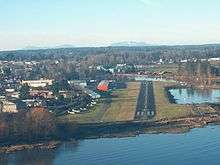
- Courtenay Airpark, a small airport in downtown Courtenay owned by the City of Courtenay and operated by Courtenay Airpark Association that provides hangar space for recreational fliers and aerial tours of the Comox Valley.[61]
 Courtenay October 31st 2015 from a Cessna
 - Courtenay Airpark Water Aerodrome, also owned by the City of Courtenay and operated by The Courtenay Airpark Association, has daily flights operated by West Coast Air.
- Courtenay (Smit Field) Airport is a small privately owned airport.[62]
Rail service
Via Rail used to operate the Victoria – Courtenay train on track owned by the Island Corridor Foundation and operated by the Southern Railway of Vancouver Island (Esquimalt & Nanaimo Railway). The terminus, Courtenay railway station is at the former Canadian Pacific Railway station that was designated a Heritage Railway Station in 1993.[63] Please refer to website of Island Corridor Foundation for updates on restoration of Passenger Train Service.
Highways
Highway 19A, the Island Highway, runs through Courtenay[64]
Health care
St. Joseph's General Hospital (SJGH) in Comox used to be the primary hospital for the Comox Valley and surrounding communities from Bowser to Oyster River, with 110 beds earmarked for acute care and 125 for complex care. Since October 2017 the new North Island Comox Valley Hospital in Courtenay has served as the primary hospital for the Comox Valley and surrounding communities.
Emergency services
Courtenay contracts out its police services to the Royal Canadian Mounted Police. Their main detachment is located in East Courtenay along Ryan Road. This detachment provides policing services to the entire Comox Valley. Courtenay also has an active branch of Crime Stoppers[65] to help provide the Comox Valley information about recent crimes and a way to provide anonymous tips.
Fire services are provided by the Courtenay Fire Department, and it is one of the five volunteer fire departments that operate in the Comox Valley.[66] The Courtenay Fire Department has 42 career and paid-on-call firefighters that provide fire suppression, auto extrication, fire safety education, and the issue of fire permits.[67]
Courtenay ambulance services are provided by British Columbia Ambulance Service.
Education
Courtenay has numerous public schools operated by School District 71 Comox Valley. In the 2007 school year, School District 71 had 9,197 students enrolled.[68]
Elementary schools
- Airport Elementary K-7
- Arden Elementary K-7
- Courtenay Elementary K-7
- École Puntledge Park Elementary K-7
- École Robb Road Elementary K-7
- Huband Park Elementary K-7
- Queneesh Elementary K-7
- Valley View Elementary K-7
Secondary
- Georges P. Vanier Secondary 8-12
- Lake Trail Secondary 7-9
- Mark R Isfeld Secondary 8-12
- Sandwick Alternate School
- Highland Secondary School
Post-secondary
Courtenay is home to the largest North Island College Campus with approximately 1,669 students enrolled in credit classes and an additional 1,393 enrolled in short term or vocational courses. The campus has a cafeteria, bookstore, library, and the notable Stan Hagen Theatre that holds many community events. The Comox Valley Campus offers many certificate, associate degrees, and bachelor's degree programs, and is known for its Bachelor of Science in Nursing program and its Professional Photography Certificate.
Media
There is one newspaper in the city, the Comox Valley Record.[69] There are two radio stations, CKLR-FM and CFCP-FM.
Notable persons
- Fraser Cain, Publisher of Universe Today and co-host of Astronomy Cast
- Kim Cattrall, actress, lived in the city until she was 11 and then at 16, returned to finish high school
- Byron Dafoe, NHL goalie
- Brendan Fletcher, actor, attended Lake Trail Secondary School
- Taylor Green, baseball player, attended Mark R. Isfeld High School in and played high school baseball for the Parksville Royals of the British Columbia Premier Baseball League
- Olaf Kölzig, National Hockey League goalie
- Brett McLean, NHL forward
- Henry McQuillan, Progressive Conservative party member of the House of Commons of Canada
- Sue Medley, Canadian rock musician
- Simon Nessman, Canadian male model
- Cameron Levins, Olympian
- Sarah Neufeld, musician, member of Arcade Fire and The Luyas
- Lily Hoy Price, started writing after taking a creative-writing workshop at North Island College at the age of 70
- Spencer O'Brien Olympic snowboarder
Places adjacent to Courtenay, British Columbia | ||||||||||
|---|---|---|---|---|---|---|---|---|---|---|
| ||||||||||
See also
References
- 1 2 3 4 5 Wild, Paula; James, Rick (2006), The Comox Valley, Madeira Park BC: Harbour Publishing, p. 22, ISBN 978-1-55017-408-3
- 1 2 3 "Comox Bay Fish Weirs". Where History Lives. Comox Archives & Museum Society. Retrieved 2010-10-24.
- 1 2 3 4 Isener, D.E.; McInnis, W.N.; Stephens, E.G.; Watson, S.E. (1987), Land of Plenty: A History of the Comox District, Campbell River, British Columbia: Ptarmigan Press, ISBN 978-0-919537-45-3
- ↑ Comox Valley History
- ↑ Bawlf, R. Samuel (2004). The Secret Voyage of Sir Francis Drake: 1577–1580. Penguin. ISBN 978-0-14-200459-3.
- ↑ Archer, Christon I. (1983). "Alcalá Galiano, Dionisio". In Halpenny, Francess G. Dictionary of Canadian Biography. V (1801–1820) (online ed.). University of Toronto Press.
- 1 2 "Comox Bay Marine History with pictures and notes about old sailing ships". Comox Valley Harbour Authority. 2010. Retrieved 2010-10-21.
- ↑ "About Comox by the Sea". Comox Business in Action. Retrieved 2010-10-18.
- 1 2 3 4 5 6 7 8 9 Courtenay: One Hundred Years of History. Courtenay and District Museum. 2015.
- 1 2 3 Downtown Courtenay
- 1 2 3 4 5 6 7 "City of Courtenay: Historical Summary". Retrieved 2018-05-01.
- ↑ "5th Street Bridge Rehabilitation". City of Courtenay: City Hall. City of Courtenay. 2017-03-14. Retrieved 2018-05-01.
- ↑ The M7.3 Vancouver Island Earthquake of 1946 Archived 11 August 2010 at the Wayback Machine.
- 1 2 3 4 5 6 2006 Community Profiles
- 1 2 "Canadian Climate Normals 1981-2010". Environment Canada. Retrieved 21 March 2016.
- ↑ 2006 Community Profiles (Census agglomeration)
- ↑ "Community Profiles from the 2006 Census, Statistics Canada - Census Subdivision". 2.statcan.gc.ca. 6 December 2010. Retrieved 2013-04-13.
- ↑ "Aboriginal Peoples - Data table". 2.statcan.ca. 6 October 2010. Retrieved 2013-04-13.
- 1 2 3 Business Activity Comox Valley
- ↑ Nagorsen, D.W. & NatureServe (Cannings, S. & Hammerson, G.) (2008). Marmota vancouverensis. 2008 IUCN Red List of Threatened Species.
- ↑ Island Music Fest
- ↑ North Island Festival of Performing Arts
- ↑ Fiddlejam
- ↑ Comox Valley Highland Games
- ↑ Comox Valley Piano Society
- ↑ Comox Valley Youth Music Centre - History
- ↑ Comox Valley Youth Music Centre - Alumni
- ↑ Sid Williams Theatre
- ↑ Rainbow Youth Theatre
- ↑ Courtenay Little Theatre
- ↑ Computer & Internet Archived 1 December 2010 at the Wayback Machine.
- ↑ Courtenay Accommodations
- ↑ The Great Elasmosaur Find
- ↑ Courtenay & District Museum and Paleontology Center
- ↑ Our Latest Palaeontology News
- ↑ http://www.alberniproject.org
- ↑ The Courtenay and District Museum and Palaeontology Centre
- ↑ Comox Air Force Museum Archived 6 July 2011 at the Wayback Machine.
- ↑ Heritage Airpark Archived 29 January 2011 at the Wayback Machine.
- ↑ Comox Archives & Museum
- ↑ Cumberland Museum & Archives Archived 6 July 2011 at the Wayback Machine.
- ↑ Nim-Nim Interpretive Centre
- ↑ I-Hos Gallery
- ↑ Comox Valley Art Gallery
- ↑ Muir Gallery Archived 11 March 2011 at the Wayback Machine.
- ↑ Comox Valley Community Arts Council
- ↑ Woodhus Slough Archived 6 July 2011 at the Wayback Machine.
- ↑ Nymph Falls Regional Park
- ↑ Seal Bay Regional Nature Park
- ↑ Courtenay Riverway Heritage Walk Archived 10 July 2011 at the Wayback Machine.
- ↑ Kitty Coleman Woodland Gardens Archived 28 May 2011 at the Wayback Machine.
- ↑ Lewis Park
- ↑ Simms Millennium Park
- ↑ City of Courtenay Council
- ↑ Comox Valley Transit System
- ↑ Regional Map for Comox Valley
- ↑ handyDART
- ↑ Comox Valley Transit System FAQ
- ↑ Northern Gulf Islands Schedules
- ↑ Comox Valley Airport
- ↑ Courtenay Airpark
- ↑ Canada Flight Supplement. Effective 0901Z 19 July 2018 to 0901Z 13 September 2018.
- ↑ List of Designated Heritage Railway Stations in British Columbia.
- ↑ Island Highway (19) Archived 11 February 2011 at the Wayback Machine.
- ↑ Comox Valley Crime Stoppers
- ↑ Fire Services Archived 9 March 2011 at the Wayback Machine.
- ↑ AboutFirehall
- ↑ Infrastructure
- ↑ Comox Valley Record
External links
| Wikimedia Commons has media related to Courtenay, BC. |
| Wikivoyage has a travel guide for Courtenay. |
- City of Courtenay
- Downtown Courtenay (Business Improvement Association website)
- Comox Valley Visitor Center
- Google Street View
| Subdivisions |  | |
|---|---|---|
| Communities | ||
| Metro areas and agglomerations | ||
| Cities |
| |
| ||