Alberni-Clayoquot Regional District
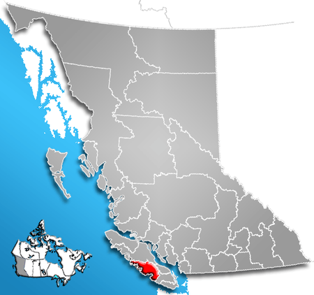
The Alberni-Clayoquot Regional District (2006 population 30,664) of British Columbia is located on west central Vancouver Island. Adjacent regional districts it shares borders with are the Strathcona and Comox Valley Regional Districts to the north, and the Nanaimo and Cowichan Valley Regional Districts to the east. The regional district offices are located in Port Alberni.
Communities
Cities
Regional District Electoral Areas
District Municipalities
Indian Reserves
NB Indian Reserves are not part of municipal or regional district governance and are outside the regional district's jurisdiction, and also counted separately in the census figures. Population figures here are from the 2006 census:
- Ahahswinis IR No. 1 pop. 148 [1]
- Alberni IR No. 2 pop. 5 [2]
- Anacla IR No. 12 pop. 95 [3]
- Clakamucus IR No. 2 pop. 5 [4]
- Elhlateese IR No. 2 pop. 27 [5]
- Esowista IR No. 3 pop. 160 [6]
- Hesquiat IR No. 1 pop. 10 [7]
- Ittatsoo IR No. 1 pop. 200 [8]
- Keeshan IR No. 9 Pop. 0 [9]
- Klehkoot IR No. 2 pop. 10 [10]
- Macoah IR No. 1 pop. 19 [11]
- Marktosis IR No. 15 pop. 661 [12]
- Numukamis IR No. 1 pop. 5 [13]
- Openit IR No. 27 pop. 0 [14]
- Opitsat IR No. 1 pop. 174 [15]
- Refuge Cove IR No. 6 pop. 103 [16]
- Sachsa IR No. 4 pop. 0 [17]
- Stuart Bay IR No. 6 pop. 0 [18]
- Tsahaheh IR No. 1 pop. 425 [19]
Highways
Highways that run through the Alberni-Clayoquot Regional District:
Demographics
| Canada census – Alberni-Clayoquot Regional District community profile | |||
|---|---|---|---|
| 2006 | |||
| Population: | 30,664 (1.1% from 2001) | ||
| Land area: | 6,596.58 km2 (2,546.95 sq mi) | ||
| Population density: | 4.6/km2 (12/sq mi) | ||
| Median age: | 43.3 (M: 43.1, F: 43.4) | ||
| Total private dwellings: | |||
| Median household income: | $N/A | ||
| References: 2006[20] earlier[21] | |||
- N/A = Data not available.
References
- ↑ Community Profiles, 2006, Ahahswinis 1 (Indian Reserve)
- ↑ Community Profiles, Alberni 2 (Indian Reserve)
- ↑ Community Profiles, Anacla 12 (Indian Reserve)
- ↑ Community Profiles, Clackamus 2 (Indian Reserve)
- ↑ Community Profiles "Elhlateese 2 (Indian Reserve)
- ↑ Esowista 3 (Indian Reserve)
- ↑ Community Profiles, Hesquiat 1 (Indian Reserve)
- ↑ Community Profiles Ittatsoo 1 (Indian Reserve)
- ↑ Community Profiles, Keeshan 9 (Indian Reserve)
- ↑ Community Profiles, Klehkoot 2 (Indian Reserve)
- ↑ Community Profiles, Machoa 1 (Indian Reserve)
- ↑ Community Profiles, Martosis 15 (Indian Reserve)
- ↑ Community Profiles, Numukamis 1 (Indian Reserve)
- ↑ Community Profiles, Openit 27 (Indian Reserve)
- ↑ Community Profiles
- ↑ Community Profiles, Refuge Cove 6 (Indian Reserve)
- ↑ Community Profiles, Sachsa 4 (Indian Reserve)
- ↑ Community Profiles, Stuart Bay 1 (Indian Reserve)
- ↑ Community Profiles, Tsahaheh 1 (Indian Reserve)
- ↑ "2006 Community Profiles". Canada 2006 Census. Statistics Canada. March 30, 2011. Retrieved 2009-02-24.
- ↑ "2001 Community Profiles". Canada 2001 Census. Statistics Canada. February 17, 2012.
External links
- Alberni-Clayoquot Regional District
- Alberni-Clayoquot R.D., Community Profile, 2006
- "Regional District of Alberni-Clayoquot". BC Geographical Names.
| Subdivisions |  | |
|---|---|---|
| Communities | ||
| Metro areas and agglomerations | ||
| Regional districts |
| |
| ||
Coordinates: 49°15′00″N 125°20′00″W / 49.25000°N 125.33333°W
This article is issued from
Wikipedia.
The text is licensed under Creative Commons - Attribution - Sharealike.
Additional terms may apply for the media files.