Ahousat
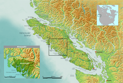
Map of Ahousaht tribal territory
Ahousaht /əˈhaʊsɑːt/, also spelled Ahousat, is the principal settlement on Flores Island, in British Columbia, Canada. Accessible only by water or air, Ahousaht is a small community predominantly composed of First Nations people from the Nuu-chah-nulth nation. The settlement is named for the Ahousaht subgroup of the Nuu-chah-nulth, whose modern Indian Act government is the Ahousaht First Nation which combines the Ahousaht, Manhousaht and Keltsmaht under one administration. The other main settlement of the Ahousaht First Nation is at Marktosis.
References
- "Ahousat". BC Geographical Names.
- "Chetarpe". BC Geographical Names. ("Old Ahousat")
External links
- Ahousaht First Nation website
- Nuu-chah-nulth Tribal Council website
- Details of research on resident grey whales.
Coordinates: 49°17′00″N 126°4′00″W / 49.28333°N 126.06667°W
This article is issued from
Wikipedia.
The text is licensed under Creative Commons - Attribution - Sharealike.
Additional terms may apply for the media files.