U.S. Route 6 in Connecticut
| ||||
|---|---|---|---|---|
_map.svg.png) | ||||
| Route information | ||||
| Maintained by ConnDOT | ||||
| Length | 116.33 mi[1] (187.21 km) | |||
| Existed | 1926–present | |||
| Major junctions | ||||
| West end |
| |||
|
| ||||
| East end |
| |||
| Location | ||||
| Counties | Fairfield, New Haven, Litchfield, Hartford, Tolland, Windham | |||
| Highway system | ||||
| ||||

U.S. Route 6 in Connecticut is the portion of the cross-country U.S. Route 6 within the state of Connecticut. West of Hartford, the route either closely parallels or runs along Interstate 84. I-84 has largely supplanted Route 6 as a through route in western Connecticut. East of Hartford, Route 6 serves as a primary route for travel between Hartford and Providence. The Connecticut Route 6 segments is 116.33 miles (187.21 km) long.
Route description
Western Connecticut
US 6 enters Connecticut paired with US 202 from the town of Southeast, New York just east of the village of Brewster. The concurrency runs for 3.8 miles (6.1 km) through the city of Danbury as a minor arterial road before it forms a 3.3 miles (5.3 km) 4-way concurrency with Interstate 84 and US 7 from I-84 Exit 4 to Exit 7. At Exit 7, US 7 and US 202 split to the north, while US 6 stays duplexed with I-84 for another 0.8 miles (1.3 km) before returning to surface roads at Exit 8. The route then goes through the towns of Bethel and Newtown. In Newtown, it has a 2.8 miles (4.5 km) concurrency with Route 25 before turning east toward the village of Sandy Hook, where it enters I-84 once again for 6.4 miles (10.3 km) between Newtown and Southbury (from Exits 10 to 15).
After exiting I-84 in Southbury, US 6 once again becomes a surface road, and is duplexed with Route 67 for 2.7 miles (4.3 km). It then passes through the northern Waterbury area suburbs of Woodbury, Watertown and Thomaston. US 6 has a 1.0-mile (1.6 km) overlap with the Route 8 expressway in Thomaston.
Hartford area
After leaving the Route 8 expressway, US 6 continues as an alternating 2 and 4 lane surface road through the towns of Plymouth, Bristol and Farmington. In Farmington, it once again joins I-84 at Exit 38 for 13.4 miles, passing through West Hartford, Hartford, and East Hartford. US 44 joins for 0.25 miles to cross the Connecticut River on the Bulkeley Bridge from Hartford to East Hartford towards Bolton just past the eastern terminus of I-384.
Eastern Connecticut
In Bolton, US 6 and US 44 split. US 44 follows a more northerly route while US 6 continues through Bolton, Coventry, Andover and Columbia. It intersects with Route 316 and Route 87 along the way, and mostly follows the Hop River.
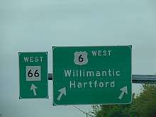
The US 6 Willimantic Bypass begins in Columbia, at a four-way at-grade intersection with Route 66. The expressway starts out heading northeast and immediately crosses into Coventry. After crossing the town line, the eastbound and westbound sides of US 6 split, with a hill in between them. At the split, the eastbound side of the expressway curves and heads east. At this point, the Hop River State Park Trail passes under both sides of the expressway. Soon after, the westbound lane also curves, and the two sides of the expressway soon become parallel again. The expressway then passes over Flanders River Road about 0.25 miles (0.40 km) east. The expressway then crosses the Willimantic River and enters the town of Windham. Right after entering Windham, it overpasses the New England Central Railroad. Immediately after this, there is an interchange with Route 32. After the interchange, the expressway enters Mansfield and passes under Mansfield Avenue before encountering another interchange for Route 195. The eastbound exit and westbound entrance use Mansfield City Road, while the westbound exit accesses Route 195 via North Frontage Road and eastbound access to US 6 is from Route 195 itself. Soon after the eastbound entrance ramp joins Route 6, the expressway crosses the Natchaug River and once again enters Windham. 0.5 miles (0.80 km) after entering Windham, the US 6 Willimantic Bypass ends at an interchange with the eastern end of Route 66, whose roadway US 6 assumes east of the interchange. US 6 then continues as a surface road through the towns of Chaplin, Hampton, and Brooklyn. In Killingly, US 6 becomes a two-lane freeway in the vicinity of its junction with Interstate 395 in Killingly, part of which (0.34 miles (0.55 km)) is duplexed with Route 12. Just before the Rhode Island state line, the unsigned portion of the Connecticut Turnpike (SR 695) merges into US 6 East as it enters the town of Foster
History

Before the creation of the U.S. Highway system in 1926, most of the proposed routing in Connecticut was part of New England Interstate Route 3 (NE-3). There were two places where NE-3 and US 6 were not overlapped. NE-3 began in Bedford, New York at NY 22, entering Connecticut via modern Route 35. NE-3 continued north to Danbury via the old non-expressway alignment of U.S. Route 7. US 6, on the other hand, went east from Brewster on its current alignment, meeting with NE-3 in downtown Danbury.
Another difference in routing is between Manchester and Windham. US 6 originally used a more northern alignment via Coventry, running along present U.S. Route 44 then modern Route 31. NE-3 used current US 6 for its routing. East of Windham, the routes overlapped into Rhode Island. Between 1926 and 1932, NE-3 and US 6 were cosigned where they overlapped. NE-3 was finally deleted in 1932.
Willimantic bypass
I-84 was to be an expressway that would connect the modern Interstate 384 with the modern U.S. Route 6 Willimantic Bypass. From here, I-84 would continue to Providence. This idea was planned in the 1960s, but abandoned in 2005.
The Connecticut Department of Transportation had planned since the 1960s to upgrade the segment between Bolton and Columbia to an expressway, connecting I-384 to the existing expressway segment in Windham. However, this particular segment of Route 6 passes through an environmentally sensitive area centered around the Hop River. Construction had been planned to begin in the late 1980s, but federal, state, and local officials could not reach an agreement on a feasible route that avoided the Hop River wetlands and development within the towns of Andover, Bolton, Coventry, and Columbia. The affected towns, ConnDOT and the Connecticut Department of Environmental Protection favored a northern alignment (Alternative 133B), which would avoid the town centers and nearby wetlands. The Environmental Protection Agency, Army Corps of Engineers, and Federal Highway Administration (FHWA) favored a southerly alignment (Alternative 133 18/25) that would cut through residential and commercial areas as well as the Hop River's adjoining wetlands.
Despite opposition from ConnDOT, the Connecticut DEP, and affected towns, the FHWA issued a Record of Decision and the Army Corps of Engineers issued required permits for Alternative 133 18/25 (southern alignment) in 2001. State and local officials continued to press the Corps of Engineers to approve the northern alignment. Due to the impasse between state, local, and federal officials, federal funds for the bypass were withdrawn in 2003. In 2005, the Capitol Region Council of Governments and ConnDOT removed the Route 6 bypass from planning, hence ConnDOT effectively abandoned further study of the bypass in lieu of upgrading the existing road.
In 2007, ConnDOT is made safety improvements and capacity upgrades to the existing US-6 through Andover, Bolton, and Columbia.
Alternate routes

There have been several routes signed as US 6A in the state.[2] No special routes currently exist.
- Newtown-Southbury: original surface routing before creation of expressway later to become I-84; currently SR 816
- Plymouth-Hartford: Now US 6. At this time, the old US 6 went along Route 64 to downtown Waterbury then along Route 10 to Farmington.
- Woodbury-Willimantic: West of Meriden, this was the original alignment of US 6. When US 6 was reassigned to the former 6A from Plymouth-Farmington, this became 6A. This 6A was subsequently extended through Meriden to Willimantic along modern Route 66. An expressway upgrade was planned for this 6A. Only a portion of the highway was built and is now Interstate 691. Between Woodbury and Waterbury this section is now CT Route 64.
- Coventry-Windham: became 6A when NE-3 was deleted. Swapped with the old US 6 in 1939 and finally deleted in 1942 when 6A became Route 31.
- Danielson: old routing prior to construction of the 2-lane freeway
Major intersections
Exit numbers are signed throughout the route's overlap with I-84.
| County | Location | mi[1] | km | Exit | Destinations | Notes | |
|---|---|---|---|---|---|---|---|
| Fairfield | Danbury | 0.00 | 0.00 | Continuation into New York | |||
| 0.04 | 0.064 | Exit 1 on I-84 | |||||
| 1.03 | 1.66 | Exit 2 on I-84 | |||||
| 1.10 | 1.77 | Exit 2A on I-84 | |||||
| 4.15 | 6.68 | 4 | Western end of I-84 / US 7 concurrency; westbound exit and eastbound entrance to/from US 7 | ||||
| 5.61 | 9.03 | 5 | |||||
| 6.25 | 10.06 | 6 | Westbound exit and eastbound entrance | ||||
| 7.97 | 12.83 | 7 | Eastern end of US 7 / US 202 concurrency | ||||
| 8.26 | 13.29 | 8 | Eastern end of I-84 concurrency | ||||
| Newtown | 11.45 | 18.43 | Northern end of Route 25 concurrency | ||||
| 14.26 | 22.95 | Southern end of Route 25 concurrency | |||||
| 15.52 | 24.98 | 10 | Western end of I-84 concurrency | ||||
| 16.33 | 26.28 | 11 | Access via SSR 490 | ||||
| New Haven | Southbury | 18.93 | 30.46 | 13 | River Road | Eastbound exit and westbound entrance | |
| 20.40 | 32.83 | 14 | |||||
| 21.96– 22.19 | 35.34– 35.71 | 15 | Eastern end of I-84 overlap; western end of Route 67 concurrency | ||||
| 23.76 | 38.24 | Northern end of Route 67 concurrency | |||||
| Litchfield | Woodbury | 25.94 | 41.75 | Western end of Route 64 | |||
| 26.90 | 43.29 | Eastern end of Route 317 | |||||
| 27.60 | 44.42 | Southern end of Route 47 | |||||
| 31.48 | 50.66 | ||||||
| Watertown | 34.57 | 55.64 | |||||
| 35.81 | 57.63 | Southern end of Route 262 | |||||
| Thomaston | 38.61 | 62.14 | East end of Route 109 | ||||
| 39.12 | 62.96 | South end of Route 254 | |||||
| 39.40 | 63.41 | Southern end of Route 8 concurrency; exit 38 on Route 38 | |||||
| 40.39 | 65.00 | Northern end of Route 8 concurrency; exit 39 on Route 8 | |||||
| 40.61 | 65.36 | South end of Route 222 | |||||
| Plymouth | 41.28 | 66.43 | North end of Route 262 | ||||
| 44.15 | 71.05 | ||||||
| Hartford | Bristol | 46.86 | 75.41 | Southern end of Route 69 concurrency | |||
| 47.25 | 76.04 | Northern end of Route 69 concurrency | |||||
| 48.30 | 77.73 | Northern end of Route 229 | |||||
| Farmington | 50.95 | 82.00 | |||||
| 53.09 | 85.44 | Grade-separated interchange; access via Scott Swamp Road | |||||
| 55.15 | 88.76 | To exit 37 on I-84 | |||||
| 55.92– 56.34 | 89.99– 90.67 | 38 | Western end of I-84 concurrency; westbound exit and eastbound entrance | ||||
| 56.21 | 90.46 | 39 | Westbound exit and eastbound entrance via SR 508 | ||||
| 56.91– 57.92 | 91.59– 93.21 | 39A | Northern terminus of Route 9 | ||||
| West Hartford | 58.19 | 93.65 | 40 | ||||
| 59.15 | 95.19 | 41 | South Main Street – Elmwood | ||||
| 59.97 | 96.51 | 42 | Trout Brook Drive – Elmwood | Westbound exit and eastbound entrance | |||
| 59.87– 60.32 | 96.35– 97.08 | 43 | Park Road – West Hartford Center | Access via SR 501 | |||
| 61.09 | 98.31 | 44 | Prospect Avenue / Oakwood Avenue | ||||
| Hartford | 61.85 | 99.54 | 45 | Flatbush Avenue | Westbound exit and eastbound entrance via SR 504 | ||
| 62.37– 62.71 | 100.37– 100.92 | 46 | Sisson Avenue | Access via SR 503 | |||
| 62.96 | 101.32 | 47 | Sigourney Street | Westbound exit and eastbound entrance | |||
| 63.30– 63.69 | 101.87– 102.50 | 48A | Asylum Street | Signed as exit 48 westbound | |||
| 63.30 | 101.87 | 48B | Capitol Avenue | Eastbound exit and westbound entrance | |||
| 63.91 | 102.85 | 49 | Ann Uccello Street | Eastbound exit and westbound entrance; to XL Center | |||
| 63.96 64.52 | 102.93 103.83 | 50 | Western terminus of US 44 concurrency; no eastbound signage for I-91 or US 44 | ||||
| 64.05– 64.55 | 103.08– 103.88 | 51 | Exit 32 on I-91 | ||||
| 64.43 | 103.69 | 52 | Westbound access is via exit 50 | ||||
| Connecticut River | 64.50– 64.74 | 103.80– 104.19 | Bulkeley Bridge | ||||
| East Hartford | 64.87 | 104.40 | 53 | Eastern end of US 44 concurrency; no westbound exit | |||
| 65.19 | 104.91 | 54 | Westbound exit and eastbound entrance from Restricted Lanes | ||||
| 65.10– 65.41 | 104.77– 105.27 | 55 | |||||
| 65.29 | 105.07 | – | Western terminus of I-84 Restricted Lanes | ||||
| 65.29– 65.55 | 105.07– 105.49 | 56 | Governor Street – Downtown East Hartford | Access via SR 500 | |||
| 66.76 | 107.44 | 57 | Westbound exit and eastbound entrance | ||||
| 66.56– 67.13 | 107.12– 108.04 | 58 | Silver Lane (SR 502) | Westbound exit from Restricted Lanes | |||
| 68.35 | 110.00 | 59 | Eastbound exit and westbound entrance from Restricted Lanes | ||||
| Manchester | 69.71– 70.09 | 112.19– 112.80 | 60 | Eastern end of I-84 concurrency; western end of US 44 concurrency | |||
| 72.67 | 116.95 | ||||||
| Tolland | Bolton | 75.83 | 122.04 | ||||
| 76.62 | 123.31 | Westbound exit and eastbound entrance | |||||
| 76.95 | 123.84 | Eastern end of US 44 concurrency | |||||
| Andover | 82.68 | 133.06 | Northern end of Route 316 | ||||
| 83.91 | 135.04 | Northern end of Route 87 | |||||
| Columbia | 87.81 | 141.32 | |||||
| Windham | Windham | 89.72 | 144.39 | Grade-separated interchange | |||
| Tolland | Mansfield | 91.94 | 147.96 | Grade-separated interchange | |||
| Windham | Windham | 93.15 | 149.91 | Eastern end of Route 66 | |||
| 95.00 | 152.89 | Northern end of Route 203 | |||||
| Chaplin | 96.96 | 156.04 | Southern end of Route 198 | ||||
| Hampton | 101.30 | 163.03 | |||||
| Brooklyn | 107.44 | 172.91 | |||||
| Killingly | 110.96 | 178.57 | Northern terminus of Route 12 concurrency | ||||
| 111.31 | 179.14 | Southern terminus of Route 12 concurrency | |||||
| 111.80 | 179.92 | Cloverleaf interchange; no westbound access to I-395 south; exits 37E-W on I-395 | |||||
| 116.04 | 186.75 | Westbound exit and eastbound entrance via unsigned Connecticut Turnpike | |||||
| 116.33 | 187.21 | continuation into Rhode Island | |||||
1.000 mi = 1.609 km; 1.000 km = 0.621 mi
| |||||||
References
- 1 2 Connecticut Department of Transportation, "Highway Log" (PDF). (1.80 MiB) as of December 31, 2014
- ↑ Oglesby, Scott. "Connecticut US 6A". Connecticut Roads. Kurumi. Retrieved 1 August 2015.
External links
| Wikimedia Commons has media related to U.S. Route 6 in Connecticut. |
Route map:
| Previous state: New York |
Connecticut | Next state: Rhode Island |