Interstate 384
| ||||
|---|---|---|---|---|
|
I-384 highlighted in red | ||||
| Route information | ||||
| Auxiliary route of I-84 | ||||
| Maintained by ConnDOT | ||||
| Length | 8.53 mi (13.73 km) | |||
| Existed | 1984 – present | |||
| Major junctions | ||||
| West end |
| |||
| East end |
| |||
| Location | ||||
| Counties | Hartford, Tolland | |||
| Highway system | ||||
| ||||

Interstate 384 (abbreviated I-384) is an Interstate Highway located entirely within the state of Connecticut. It runs 8.53 miles (13.73 km) east to west, going from Interstate 84 in East Hartford to U.S. Route 6/U.S. Route 44 in Bolton.
Route description

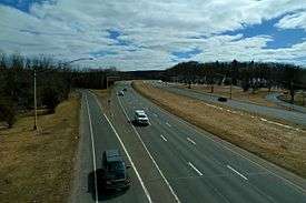
I-384 officially begins at I-84 eastbound Exit 59 at the East Hartford/Manchester town line, as the right 2 lanes of traffic split from the I-84 mainline. The highway can also be accessed from the I-84 eastbound HOV lane, and westbound I-384 traffic can also access the HOV lane on westbound I-84. Westbound I-84 access to I-384 is provided through a complex interchange that also provides access from Pleasant Valley Road near Buckland Hills Mall and from I-291. I-384's first exit is for Spencer Street. The eastbound ramp is on the I-384 mainline, while the westbound ramp comes from a split in the I-84 interchange ramp. Just east of the Spencer Street overpass, the ramp from westbound I-84 joins the I-384 mainline and the HOV lane becomes a conventional lane. I-384 continues along the southern part of Manchester. It has one interchange before it intersects Route 83, which provides access to Manchester Center. After one more interchange in Manchester, it crosses into Bolton, where it has a partial interchange with Route 85. Shortly after the interchange, I-384 ends as it meets the US 6/44 concurrency just west of its eastern split at Bolton Notch.
The highway is 8 lanes wide west of Route 83, 6 lanes wide to Route 85, and four lanes wide for the rest of the highway's duration.
Special designations
Since May 31, 1996, the segment of Interstate 384 "running from the junction of Interstate Route 84 in Manchester in a general easterly direction to Route 6 in Bolton" has been officially known as the State Trooper Russell A. Bagshaw Highway, in memory of a Connecticut State Police trooper who was killed in the line of duty.[1]
History
Prior to 1984, Interstate 384 was designated Interstate 84. During that time, current Interstate 84 east of the East Hartford junction was Interstate 86. Originally, the freeway was supposed to end in Johnston, Rhode Island at the Interstate 95-Interstate 195 connector (now the Route 6-10 Connector). The freeway was built to Bolton where it abruptly ends at and intersection with US-6 and US-44. A freeway was to be built towards the present Route 6 bypass at Willimantic, Connecticut. From there, the freeway was to be built towards Interstate 395 in Killingly, where it would then follow the northeastern leg of the Connecticut Turnpike (SR-695) for about 5 miles to the Rhode Island border. In Rhode Island, the proposed I-84 freeway was to parallel US-6 to I-295, where it would have tied into the existing US-6/RI-10 freeway. In 1982, Rhode Island canceled their plans because of community backlash and possible impacts to the Scituate Reservoir. In 1986, Connecticut canceled their plans and changed I-86 back to I-84 and I-84 was renumbered I-384.
Future
For more than 30 years since the cancellation of the Hartford-Providence leg of I-84, elected officials in Connecticut proposed to extend I-384 from Bolton to Willimantic along the US-6 corridor, connecting the existing I-384 with the US-6 Windham Bypass, which would have likely included an extension of the I-384 designation to include the new freeway and the Windham Bypass. The corresponding stretch of US-6 is known as "Suicide 6" because of sharp turns and intersections had been the site of numerous fatal accidents, and was the main reason supporting construction of the bypass. It is unlikely the 11-mile freeway between I-384 and the Windham Bypass will ever be built because of irresolvable disagreements over the routing of the freeway: State and local officials prefer more northerly alignment that minimizes disruption to developed areas along US-6, while federal officials insist on a more southerly alignment that minimizes environmental impacts to the Hop River ecosystem. After studying more than 200 potential alignments with no agreement among stakeholders, the Connecticut Department of Transportation abandoned further study of the US-6 freeway in 2005, and instead focused on completing safety upgrades on the existing US-6 corridor between Bolton and Willimantic to reduce congestion and accidents.
A proposed extension of the CTfastrak bus rapid transit line would run in the HOV lanes in I-84 and I-384.[2]
Exit list
| County | Location | mi | km | Exit | Destinations | Notes |
|---|---|---|---|---|---|---|
| Hartford | East Hartford | 0.00 0.59 | 0.00 0.95 | – | I-84 exit 59. To CT 15 South Access to I-84, I-291, and Buckland St via C/D road | |
| Manchester | 1.34 | 2.16 | 1 | Spencer Street / Silver Lane – Manchester | SR 502 | |
| 3.11 | 5.01 | 2 | Keeney Street / Hartford Road – Manchester | |||
| 4.18 | 6.73 | 3 | ||||
| 5.86 | 9.43 | 4 | Highland Street / Wyllys Street – Manchester | |||
| Tolland | Bolton | 7.66 | 12.33 | 5 | Eastbound exit and westbound entrance | |
| 8.53 | 13.73 | – | Eastern terminus of I-384 | |||
| 1.000 mi = 1.609 km; 1.000 km = 0.621 mi | ||||||
References
- ↑ Connecticut Special Act No. 96-10. http://www.cslib.org/sa/sa10.htm
- ↑ "CTfastrak System Expansion" (PDF). CTfastrak. November 2015. Retrieved 4 March 2016.
External links
Route map:
| Wikimedia Commons has media related to Interstate 384. |
1Former | ||