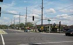
Thornton, Illinois
| Thornton, Illinois | |
|---|---|
| Village | |
| Village of Thornton | |
 | |
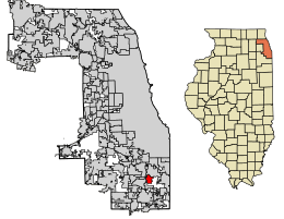 Location of Thornton in Cook County, Illinois. | |
.svg.png) Location of Illinois in the United States | |
| Coordinates: 41°34′17″N 87°36′42″W / 41.57139°N 87.61167°WCoordinates: 41°34′17″N 87°36′42″W / 41.57139°N 87.61167°W | |
| Country |
|
| State |
|
| County | Cook |
| Township | Thornton |
| Founded | 1834 |
| Incorporated | 1900 |
| Government | |
| • Type | Council-Trustee |
| • Body | Board of Trustees |
| • Village president | Bob Kolosh[1] |
| • Clerk | Debbie Pisarzewski |
| Area[2] | |
| • Total | 2.40 sq mi (6.22 km2) |
| • Land | 2.38 sq mi (6.15 km2) |
| • Water | 0.03 sq mi (0.07 km2) |
| Population (2010) | |
| • Total | 2,338 |
| • Estimate (2016)[3] | 2,461 |
| • Density | 1,036.21/sq mi (400.15/km2) |
| Time zone | UTC-6 (CST) |
| • Summer (DST) | UTC-5 (CDT) |
| ZIP code | 60476 |
| Area code | 708 |
| FIPS code | 17-75185 |
| Wikimedia Commons | Thornton, Illinois |
| Website |
www |
Thornton is a village in Cook County, Illinois, United States. The population was 2,338 at the 2010 census.[4] Thornton is home to the Thornton Quarry, one of the largest quarries in the world.
Geography
Thornton is located at 41°34′17″N 87°36′42″W / 41.57139°N 87.61167°W (41.571484, -87.611743).[5]
According to the 2010 census, Thornton has a total area of 2.376 square miles (6.15 km2), of which 2.35 square miles (6.09 km2) (or 98.91%) is land and 0.026 square miles (0.07 km2) (or 1.09%) is water.[6]
History
The Village of Thornton, the oldest settlement in Thornton Township, is built atop a deep deposit of limestone which is over 400 million years old and was once the bottom of a warm water Silurian sea.[7]
Native Americans lived along the east side of Thorn Creek. Artifacts dating to 1400CE have been found at the Hoxie Farm Site. That land was once home to an Indian fortification consisting of outer ditches or trenches and inside the works of the fortification proper. In the 1500’s, this area was a Miami Indian campground. They were followed by the Blackhawk and Illini tribes. By 1674, they were displaced by Potawatomi, Ottawa, and Chippewa. On October 20, 1832, the Chief of the Potawatomi Tribe entered into the Tippecanoe Treaty with the U. S. Government. The tribe was moved to Oklahoma and most of the property was ceded to the white settlers.
William Woodridge came to the area in 1834 and settled on the east bank of Thorn Creek. At that time, Thorn Creek was 40 feet wide and up to 10 feet deep. [8]
Gurdon Hubbard, a fur trader, played an important part in the early history of Thornton. Hubbard’s friend, John Kinzie of Chicago, platted the village in 1835. Both Hubbard and Kinzie thought highly of their good friend, Colonel William Fitzhugh Thornton, Commissioner of the Illinois and Michigan Canal. Therefore, the village was named for Col. Thornton.[9]
The first quarry was dug in 1838 by Gurdon Hubbard. This quarry was short lived due to the poor quality of the stone. Several other quarries were opened south of Ridge Road; some crushed stone and while others burned lime. In 1886, the larger quarries were purchased by R. E. Brownell. The Brownell Company was the name listed in 1895 but went through several mergers over the years. They continued ownership until 1938 when Material Service Corporation purchased the quarry. It remained Material Service Corp. until Hanson Material Service took over the operation.
Thornton was known as Thornton Township until 1900. The Township hall was in a small building on the site of the current Village Hall and all Township business was conducted here. The Village of Thornton incorporated in 1900 and the hall was given to the Village of Thornton. The Township seat moved to Harvey but is now located in South Holland.
A Civilian Conservation Corps. Camp was built in Sweet Woods South in the 1930’s. The Corps was designed to provide work for young men. Most of their wages were sent home to their families; they received a token amount for themselves. After the CCC camp closed, it housed German prisoners of war captured in North Africa. It was the first home of Illiana High School and then used by the Girl Scouts until 1988. One of the buildings was purchased and moved to the Isaak Walton League preserve in Homewood. The Works Progress Administration (WPA) was another group designed to give people work after the Great Depression. They constructed sidewalks and curbs, put in sewers, and operated the village library. Both the CCC and WPA were formed during the Franklin D. Roosevelt administration.[10]
Demographics
| Historical population | |||
|---|---|---|---|
| Census | Pop. | %± | |
| 1860 | 1,033 | — | |
| 1870 | 301 | −70.9% | |
| 1910 | 1,030 | — | |
| 1920 | 767 | −25.5% | |
| 1930 | 1,012 | 31.9% | |
| 1940 | 1,101 | 8.8% | |
| 1950 | 1,217 | 10.5% | |
| 1960 | 2,895 | 137.9% | |
| 1970 | 3,714 | 28.3% | |
| 1980 | 3,024 | −18.6% | |
| 1990 | 2,778 | −8.1% | |
| 2000 | 2,582 | −7.1% | |
| 2010 | 2,338 | −9.5% | |
| Est. 2016 | 2,461 | [3] | 5.3% |
| U.S. Decennial Census[11] | |||
As of the census of 2010, there were 2,338 people, 956 households, and 621 families residing in the village. The population density was 994.9 people per square mile (383.3/km²). There were 1,027 housing units at an average density of 437.0/sq mi (168.4/km²). The racial makeup of the village was 83.0% White, 9.6% African American, 0.6% Native American, 0.7% Asian, 0.04% Native Hawaiian or Pacific Islander, 3.3% some other race, and 2.8% from two or more races. Hispanic or Latino of any race were 8.8% of the population.[4]
There were 956 households out of which 29.3% had children under the age of 18 living with them, 44.6% were headed by married couples living together, 14.4% had a female householder with no husband present, and 35.0% were non-families. 29.6% of all households were made up of individuals, and 12.4% were someone living alone who was 65 years of age or older. The average household size was 2.44, and the average family size was 3.03.[4]
In the village, the population was spread out with 21.4% under the age of 18, 7.5% from 18 to 24, 24.6% from 25 to 44, 30.8% from 45 to 64, and 15.7% who were 65 years of age or older. The median age was 41.3 years. For every 100 females, there were 95.3 males. For every 100 females age 18 and over, there were 93.3 males.[4]
For the period 2007-11, the estimated median annual income for a household in the village was $58,750, and the median income for a family was $64,359. Male full-time workers had a median income of $51,528 versus $37,679 for females. The per capita income for the village was $25,140. About 9.1% of families and 10.5% of the population were below the poverty line, including 14.1% of those under age 18 and 4.3% of those age 65 or over.[12]
Government
Thornton is in Illinois's 2nd congressional district.
References
- ↑ "Village President". Retrieved October 20, 2014.
- ↑ "2016 U.S. Gazetteer Files". United States Census Bureau. Retrieved Jun 30, 2017.
- 1 2 "Population and Housing Unit Estimates". Retrieved June 9, 2017.
- 1 2 3 4 "Profile of General Population and Housing Characteristics: 2010 Demographic Profile Data (DP-1): Thornton village, Illinois". U.S. Census Bureau, American Factfinder. Retrieved March 20, 2013.
- ↑ "US Gazetteer files: 2010, 2000, and 1990". United States Census Bureau. 2011-02-12. Retrieved 2011-04-23.
- ↑ "G001 - Geographic Identifiers - 2010 Census Summary File 1". United States Census Bureau. Retrieved 2015-12-25.
- ↑ https://www.thorntonilhistory.com/
- ↑ https://docs.wixstatic.com/ugd/b1dfac_2d2a794d454543e59f8ed1e4a3c8483b.pdf
- ↑ https://docs.wixstatic.com/ugd/b1dfac_2d2a794d454543e59f8ed1e4a3c8483b.pdf
- ↑ https://www.thorntonilhistory.com
- ↑ "Census of Population and Housing". Census.gov. Retrieved June 4, 2015.
- ↑ "Selected Economic Characteristics: 2007-2011 American Community Survey 5-Year Estimates (DP03): Thornton village, Illinois". U.S. Census Bureau, American Factfinder. Retrieved March 20, 2013.
External links
| Major city |  | |
|---|---|---|
| Cities (over 30,000 in 2010) | ||
| Towns and villages (over 30,000 in 2010) |
| |
| Counties | ||
| Regions | ||
| Sub-regions | ||