Richton Park, Illinois
| Village of Richton Park | |
|---|---|
| Village | |
| Motto(s): "Proud Past; Bright Future" | |
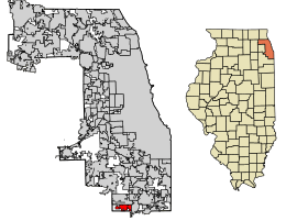 Location of Richton Park in Cook County, Illinois. | |
.svg.png) Location of Illinois in the United States | |
| Coordinates: 41°28′55″N 87°43′31″W / 41.48194°N 87.72528°WCoordinates: 41°28′55″N 87°43′31″W / 41.48194°N 87.72528°W | |
| Country | United States |
| State | Illinois |
| County | Cook |
| Area[1] | |
| • Total | 3.99 sq mi (10.33 km2) |
| • Land | 3.98 sq mi (10.30 km2) |
| • Water | 0.01 sq mi (0.03 km2) |
| Population (2010) | |
| • Total | 13,646 |
| • Estimate (2016)[2] | 13,557 |
| • Density | 3,409.71/sq mi (1,316.62/km2) |
| Time zone | UTC-6 (CST) |
| • Summer (DST) | UTC-5 (CDT) |
| ZIP Code(s) | 60471 |
| Area code(s) | 708 |
| FIPS code | 17-63706 |
| Wikimedia Commons | Richton Park, Illinois |
| Website |
www |
Richton Park is a village and suburb of Chicago located in Cook County, Illinois, United States. The population was 13,646 at the 2010 census.[3]
The community was named after a Richton in Vermont, the native home of a first settler.[4]
Geography
Richton Park is located at 41°28′55″N 87°43′31″W / 41.48194°N 87.72528°W (41.481992, -87.725352).[5]
According to the 2010 census, Richton Park has a total area of 3.992 square miles (10.34 km2), of which 3.98 square miles (10.31 km2) (or 99.7%) is land and 0.012 square miles (0.03 km2) (or 0.3%) is water.[6] It is bordered by Matteson to the north, Olympia Fields to the northeast, Park Forest to the east, University Park to the south and Frankfort to the west.
Demographics
| Historical population | |||
|---|---|---|---|
| Census | Pop. | %± | |
| 1930 | 137 | — | |
| 1940 | 107 | −21.9% | |
| 1950 | 232 | 116.8% | |
| 1960 | 933 | 302.2% | |
| 1970 | 2,558 | 174.2% | |
| 1980 | 9,403 | 267.6% | |
| 1990 | 10,523 | 11.9% | |
| 2000 | 12,533 | 19.1% | |
| 2010 | 13,646 | 8.9% | |
| Est. 2016 | 13,557 | [2] | −0.7% |
| U.S. Decennial Census[7] | |||
As of the 2010 census,[8] there were 13,646 people, 5,391 households, and 2.54 persons living per household. The population density was 3,426.9 people per square mile (1,435.9/km²) according to 2010 census. There were 4,730 housing units at an average density of 1,401.9 per square mile (541.9/km²) in 2000. By 2010, the racial makeup of the village was 82.4% African American, 12.7% White, 0.1% Native American, 1.0% Asian, 0.1% Pacific Islander and 2.6% from two or more races. Hispanic or Latino of any race were 3.5% of the population.
According to 2000 census data, there were 4,578 households out of which 39.3% had children under the age of 18 living with them, 47.5% were married couples living together, 18.5% had a female householder with no husband present, and 30.1% were non-families. 26.1% of all households were made up of individuals and 7.1% had someone living alone who was 65 years of age or older. The average household size was 2.68 and the average family size was 3.25. Between 2010 and 2014, there were 5,304 households, with an estimated 60.8% ownership rate.
The 2010 Census estimated the population was spread out with 34.3% under the age of 18 and 8.6% of persons 65 years and over. These estimates were a change from those of 2000, with 28.8% under the age of 18, 8.8% from 18 to 24, 32.7% from 25 to 44, 22.1% from 45 to 64, and 7.6% who were 65 years of age or older. The median age in 2000 was 33 years. In 2010, 54.7% of the village was female persons.
In 2010-2014, the median household income was $54,887, an increase from the 2000 Census estimate of $48,299, and the median income for a family was $58,661. In 2000, males had a median income of $44,637 versus $35,231 for females. The per capita income for the village in 2010-2014 was $26,566. In 2000, about 4.2% of families and 7.0% of the population were below the poverty line, including 7.2% of those under age 18 and 14.4% of those age 65 or over. By 2010 estimates, 12.0% of persons were in poverty.
Education
Matteson School District 162 has its headquarters in Richton Park.[9]
Elementary School District 159 serves portions of Richton Park.
- Neil A. Armstrong School
- Colin Powell Middle School
- Woodgate Elementary School
- Sieden Prairie Elementary School
- Marya Yates Elementary School
Rich Township High School District 227 serves the community. Rich South High School is the designated high school, although students who reside in neighborhoods east of Governors Highway and west of Central Park Avenue attend Rich Central High School in Olympia Fields. Southland College Preparatory Charter High School is also located in the village.
Government
Richton Park is in Illinois' 2nd congressional district.
2008 tornado
On June 7, 2008, a tornado ripped through Richton Park. The tornado tore apart the Richton Square Apartments, damaging 40 units and leaving at least 80 residents homeless. The tornado went through the town around 5:00 P.M. that day. It was rated as an EF2 tornado and was also responsible for knocking down two transmission towers on Interstate 57 near Monee.
See also
References
- ↑ "2016 U.S. Gazetteer Files". United States Census Bureau. Retrieved Jun 30, 2017.
- 1 2 "Population and Housing Unit Estimates". Retrieved June 9, 2017.
- ↑ "Profile of General Population and Housing Characteristics: 2010 Demographic Profile Data (DP-1): Richton Park village, Illinois". U.S. Census Bureau, American Factfinder. Retrieved March 19, 2013.
- ↑ Illinois Central Magazine. Illinois Central Railroad Company. 1922. p. 45.
- ↑ "US Gazetteer files: 2010, 2000, and 1990". United States Census Bureau. 2011-02-12. Retrieved 2011-04-23.
- ↑ "G001 - Geographic Identifiers - 2010 Census Summary File 1". United States Census Bureau. Retrieved 2015-12-25.
- ↑ "Census of Population and Housing". Census.gov. Archived from the original on May 12, 2015. Retrieved June 4, 2015.
- ↑ "American FactFinder". United States Census Bureau. Archived from the original on December 7, 2016. Retrieved 2008-01-31.
- ↑ "Home page Archived 2013-04-15 at Archive.is. Matteson School District 162. Retrieved on December 8, 2012. "4601 Sauk Trail, Richton Park, IL 60471"