Sumenep Regency
| Sumenep Regency Kabupaten Sumenep | ||
|---|---|---|
| Regency | ||
| ||
| Motto(s): Sumekar "Sumenep Karaton" | ||
 Location within East Java | ||
| Coordinates: 7°01′S 113°52′E / 7.017°S 113.867°ECoordinates: 7°01′S 113°52′E / 7.017°S 113.867°E | ||
| Country | Indonesia | |
| Province | East Java | |
| Settled | October 31, 1269 | |
| Capital | Sumenep | |
| Government | ||
| • Regent | A. Busyro Karim | |
| • Vice regent | Soengkono Sidik | |
| Area | ||
| • Total | 1,998.5 km2 (771.6 sq mi) | |
| Elevation | 25 m (82 ft) | |
| Population (2014) | ||
| • Total | 1,071,591 | |
| • Density | 540/km2 (1,400/sq mi) | |
| Time zone | UTC+7 (IWST) | |
| Area code | (+62) 328 | |
| Website | sumenekab.go.id | |

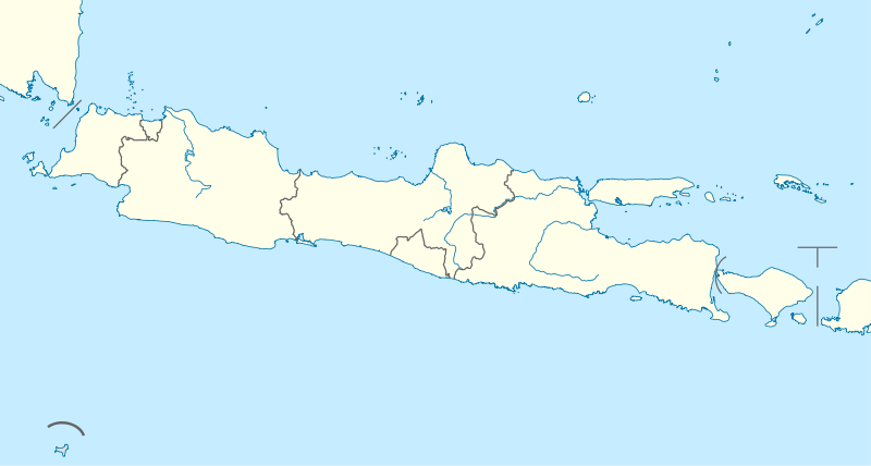

Sumenep Regency (Madurese: Songènèb) is a regency of East Java province, Indonesia. It has an area of 1,998.5 km² and a population of 1,042,312 inhabitants according to the 2010 Census[1] (an increase from 985,981 from the previous census in 2000); the latest official estimate (as of January 2014) is 1,071,591. The regency occupies the eastern end of Madura island and also includes numerous islands to the east (primarily Talango, the Sapudi Islands, and the Kangean Islands), the north (the Masalembu Islands), and the south (the Giligenteng Islands) of Madura. It is bordered by Pamekasan Regency to the west, Madura Strait to the south, and the Java Sea to the north and east. Its administrative capital is Sumenep. The airport nearby is Trunojoyo Airport with flights to Surabaya.
References
- ↑ Biro Pusat Statistik, Jakarta, 2011.