Jombang Regency
| Jombang Regency Kabupaten Jombang | ||
|---|---|---|
| Regency | ||
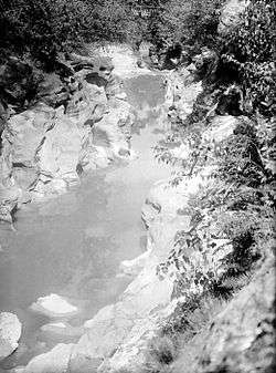 'Kali Kedungcinet' along wood yard 'Plosso' close to 'Jombang', 1927 | ||
| ||
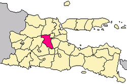 Location within East Java | ||
| Coordinates: 7°28′S 112°14′E / 7.467°S 112.233°ECoordinates: 7°28′S 112°14′E / 7.467°S 112.233°E | ||
| Country |
| |
| Province | East Java | |
| Capital | Jombang | |
| Government | ||
| • Regent | Mundjidah Wahab | |
| • Vice Regent | vacant | |
| Area | ||
| • Total | 1,115.09 km2 (430.54 sq mi) | |
| Population (2014) | ||
| • Total | 1,236,184 | |
| • Density | 1,100/km2 (2,900/sq mi) | |
| Time zone | UTC+7 (IWST) | |
| Area code | (+62) 321 | |
| Website | www.jombangkab.go.id | |
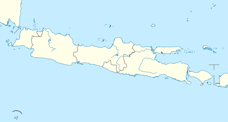

Jombang Regency is a regency of East Java, Indonesia, situated to the southwest of Surabaya. The capital of the regency is the town of Jombang. The regency has an area of 1,159.09 km² and population of 1,202,407 at the 2010 Census;[1] the latest official estimate (as at 2014) is 1,236,184. It became a regency in 1910.
Administrative districts

The regency is divided into 21 districts (kecamaten). They are:
- Bandar Kedungmulyo
- Perak
- Gudo
- Diwek
- Ngoro
- Mojowarno
- Bareng
- Wonosalam
- Mojoagung
- Sumobito
- Jogoroto
- Peterongan
- Jombang
- Megaluh
- Tembelang
- Kesamben
- Kudu
- Ngusikan
- Ploso
- Kabuh
- Plandaan
Climate
| Climate data for Jombang Regency | |||||||||||||
|---|---|---|---|---|---|---|---|---|---|---|---|---|---|
| Month | Jan | Feb | Mar | Apr | May | Jun | Jul | Aug | Sep | Oct | Nov | Dec | Year |
| Average high °C (°F) | 33 (91) |
32 (90) |
33 (91) |
32 (90) |
31 (88) |
31 (88) |
30 (86) |
31 (88) |
32 (90) |
33 (91) |
35 (95) |
33 (91) |
32.2 (90) |
| Daily mean °C (°F) | 29 (84) |
28 (82) |
29 (84) |
28 (82) |
27 (81) |
27 (81) |
27 (81) |
27 (81) |
27 (81) |
28 (82) |
30 (86) |
29 (84) |
28 (82) |
| Average low °C (°F) | 25 (77) |
25 (77) |
25 (77) |
25 (77) |
24 (75) |
24 (75) |
23 (73) |
23 (73) |
22 (72) |
24 (75) |
26 (79) |
25 (77) |
24.3 (75.7) |
| Average rainfall mm (inches) | 223 (8.78) |
221 (8.7) |
198 (7.8) |
237 (9.33) |
147 (5.79) |
181 (7.13) |
37 (1.46) |
20 (0.79) |
5 (0.2) |
29 (1.14) |
80 (3.15) |
280 (11.02) |
138.2 (5.441) |
| Average rainy days | 15 | 10 | 10 | 8 | 7 | 7 | 4 | 0 | 0 | 1 | 8 | 14 | 84 |
| Average relative humidity (%) | 71 | 79.78 | 78.32 | 82.83 | 74.16 | 69.7 | 66.61 | 68.03 | 64.23 | 64.22 | 64.3 | 72.8 | 71.3 |
| Source #1: "Weather Forecast & Reports - Long Range & Local | Wunderground | Weather Underground". www.wunderground.com. Retrieved 2016-04-12. | |||||||||||||
| Source #2: "Badan Pusat Statistik Kabupaten Jombang". jombangkab.bps.go.id. Retrieved 2016-04-12. | |||||||||||||
| Month | Jan | Feb | Mar | Apr | May | Jun | Jul | Aug | Sep | Oct | Nov | Dec | Year |
| Maximum wind speed (km/h) | 58 | 69 | 60 | 48 | 45 | 29 | 60 | 63 | 182 | 138 | 29 | 40 | 68.42 |
| Average wind speed (km/h) | 45 | 48 | 45 | 48 | 42 | 11 | 14 | 14 | 14 | 15 | 11 | 11 | 26.5 |
| Minimum Wind Speed (km/h) | 26 | 29 | 37 | 48 | 40 | 0 | 0 | 0 | 0 | 0 | 0 | 0 | 15 |
| Minimum humidity (%) | 55 | 57.89 | 59.48 | 62.67 | 56.58 | 53.03 | 49.16 | 47.77 | 41.07 | 39.06 | 40.47 | 48.93 | 50.92 |
References
- ↑ Biro Pusat Statistik, Jakarta, 2011.
External links
- (in Indonesian) Official site

| Authority control |
|---|
This article is issued from
Wikipedia.
The text is licensed under Creative Commons - Attribution - Sharealike.
Additional terms may apply for the media files.