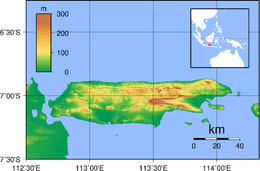
Madura Strait
| Madura Indonesian: Selat Madura | |
|---|---|
 | |
 Madura | |
| Coordinates | 7°33′45″S 112°55′54″E / 7.56250°S 112.93167°ECoordinates: 7°33′45″S 112°55′54″E / 7.56250°S 112.93167°E |
| Type | strait |
| Basin countries |
|
| References | Selat Madura: Indonesia National Geospatial-Intelligence Agency, Bethesda, MD, USA |
Madura Strait is a stretch of water that separates the Indonesian islands of Java and Madura, in the province of East Java. The islands of Kambing, Giliraja, Genteng, and Ketapang lie in the Strait.
The Suramadu Bridge, the longest in Indonesia, spans the strait between Surabaya on Java and Bangkalan on Madura.[1]
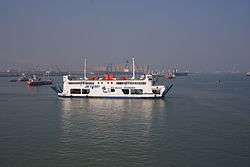
Madura Strait ferry
References
- ↑ Taufiq, Rohman (2009-06-10). "Indonesia Launches First Inter-Island Bridge". Tempo. Archived from the original on 2012-02-22. Retrieved 2010-07-21.
This article is issued from
Wikipedia.
The text is licensed under Creative Commons - Attribution - Sharealike.
Additional terms may apply for the media files.