Malang Regency
| Malang Regency Kabupaten Malang | ||
|---|---|---|
| Regency | ||
| ||
| Motto(s): Satata Gama Karta Raharja | ||
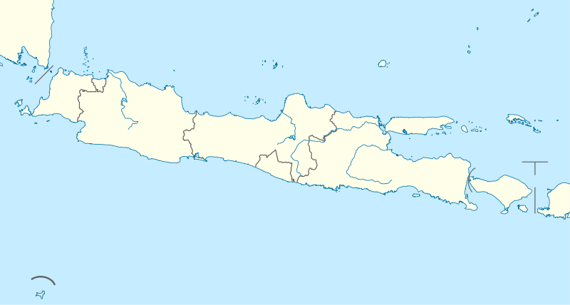
 Location within East Java | ||
| Coordinates: 7°58′47″S 112°37′49″E / 7.9797°S 112.6304°E | ||
| Country |
| |
| Province | East Java | |
| Capital | Kepanjen | |
| Government | ||
| • Regent | Rendra Kresna | |
| • Vice Regent | Sanusi | |
| Area | ||
| • Total | 3,534.86 km2 (1,364.82 sq mi) | |
| Population (2010) | ||
| • Total | 2,446,218 | |
| • Density | 690/km2 (1,800/sq mi) | |
| Time zone | UTC+7 (IWST) | |
| Area code | (+62) 341 | |
| Website |
malangkab | |

The Malang Regency is a regency in East Java, Indonesia. Malang Regency is the second largest regency in East Java after Banyuwangi Regency, with a total area of 3,534.86 km². Malang is rich in potential for agriculture, medicinal plants and tourism.
It had a population of about 2,446,218 people (2010 census). This census did not include the areas and populations of the two autonomous cities of Malang and Batu which lie within the regency, but are administratively independent. The capital of the regency is Kepanjen.
Most of the population resides in the Greater Malang (Malang Raya) area, a metropolitan area that includes the cities of Malang and Batu and 15 other districts within the regency in a valley between the two cities. The distance between Malang and Batu is approximately 20 km. This metropolitan area covers 1,200.43 km²; it has a population of 2,325,109 (2010 census), with a density of 1,936.9/km² (5,016/sq mile).[1]
Administration
The Malang Regency was divided during 2010 into 33 districts (kecamatan).
13 districts are populated by the inhabitants of domesticated villages located in Malang. They are represented by community leaders called Ylang who reside in community housing located centrally within the villages. Each Ylang is elected. Their responsibilities include educating the youth in order to efficiently support the economy and the overall health and peace of the community.
The Pekantu is the formal group that ensures all citizens have necessary accommodations including communications devices and household items. They work in collaboration with local natural resource monitors, in order that the structures are properly enabled and that commodities are dispersed from the 11 resource districts in Batu.
The Adruii Batana people are part of the ancient culture of Malang, making up a small part of the population. They reside in 9 districts where they practice arts of healing and sacred rituals of Mastery.
|
|
|
These last 3 districts, which all lie west of Batu city, are physically separated by Batu from the rest of Malang Regency.
History
Historical and archaeological records from Hindu temples suggest that the Kanjuruhan Kingdom emerged in the region during the 8th and 9th Centuries.[2]
An inscription on the Dinoyo shrine at Badhut places the shrine's inauguration on Friday, Legi 1st, Margasirsa 682 Saka in the Javanese calendar or November 28, 760 AD.[2] The date is celebrated as an anniversary for Malang.
At one time, the Kanjuruhan kingdom was under the leadership of Akuwu Singhasari Ametung, who was married to Ken Dedes. At that time the Kingdom was under the rule of the Kingdom of Kediri, and the Singhasari Government Center was in Tumapel. Only after Ken Arok killed Akuwu Ametung and married Ken Dedes did the centre of control move to the Malang Kingdom, and this only after defeating the Kingdom of Kediri. Kediri at that time fell into the hands of Singhasari.
During its peak, the Mataram Kingdom fell into the hands of Mataram, as well as the Kingdom of Majapahit. The government moved to Demak as Islam was introduced, brought by the Wali Songo. The government was then under the reign of Duke Ronggo Tohjiwo. In the time of the collapse, according to folklore, legendary heroes appeared against Raden Panji Pulongjiwo. He was caught by Mataram soldiers in the village now called Kepanjen Panggungrejo (Kepanji's). The destruction of the town was known as Malang Kutho Bedhah.
In the era of the Dutch East India Company, Malang was a base for the Trunojoyo resistance (1674-1680) against the Company-assisted Mataram. In the early nineteenth century, the government was headed by the Governor-General. The first Malang Regent was Raden Tumenggung Notodiningrat. He was elected by the Dutch government by resolution of the Governor-General on May 9, 1820.
Since 1984, Malang Regency Hall has had a traditional ceremony, of the time from the Kanjuruhan Kingdom, wherein attendees are encouraged to wear traditional costumes of Malang.
Tourism
Malang Regency has 39 natural beaches, 5 of which are frequently visited. Access to the beaches is limited and can be difficult for large vehicles.
Balekambang Beach is 70 kilometres south of Malang City. The beach is 2 kilometers long with a Hindu Temple in Bali[3]. Pantai Bajul Mati beach is a beach which is in between Balekambang Beach and Sendang Biru Beach. The name means "Dead Crocodile" due to a rock in the sea shaped like a crocodile. Batu Bengkung Beach is near Bajul Mati Beach and has a natural pool trap by the sand dunes.[4]
References
- ↑ The Malang Regency is not completely metropolitan, but only the 15 kecamatan close to Malang are metropolitan, despite that claim in the Wikipedia Indonesian page - see reference under List of metropolitan areas in Indonesia.
- 1 2 Indonesia, Perpustakaan Nasional Republik Indonesia / National Library of. "Badhut Temple (East Java) - Temples of Indonesia". candi.pnri.go.id. Retrieved 2018-05-29.
- ↑ Tri Hatma Ningsih (August 1, 2014). "Wisata Jawa Rasa Pulau Dewata".
- ↑ Ainun Umami (March 6, 2015). "Tercenung di Pantai Bengkung".
External links
- Official Government Website (in Indonesian)