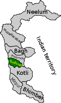
Sudhanoti District
| Sudhanoti | |
|---|---|
| District | |
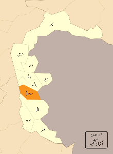
 Map of Azad Kashmir with Sudhanoti highlighted | |
| Country |
|
| Territory |
|
| Founded by | Nawab Jassi Khan |
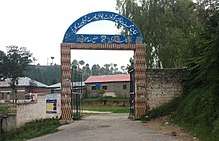
| Headquarters | Pallandri |
| Area | |
| • Total | 569 km2 (220 sq mi) |
| Population (2017) | |
| • Total | 297,584 |
| • Density | 523/km2 (1,350/sq mi) |
| Time zone | UTC+5 (PST) |
| Number of Tehsils | 4 |
Sudhanoti (also spelled Sudhanuti) (Urdu: ضلع سدھنوتی ) is one of the eight districts of Azad Kashmir in Pakistan.[1] Sudhanoti is located at Latitude 33° 42′ 54″ N, Longitude 73° 41′ 9″ E.[2] It is located 90 km away from Islamabad, the Capital of Pakistan. It is connected with Rawalpindi and Islamabad through Azad Pattan road.
Sudhanoti District is divided into four Tehsils, Pallandri Balouch, Mang and Trarkhel.[2] The town of Pallandri is the district headquarters. It is at an elevation of 1372 meters and is at a distance of 97 Kilometers from Rawalpindi via Azad Pattan. The district is connected to Rawalakot by a 64-km metaled road.
History
Sudhanoti became part of Poonch and came under the rule of the Sikh Empire and subsequently the Jammu and Kashmir. In 1947, the Sudhans took a leading part in launching the Poonch rebellion, which led to the state of Azad Jammu and Kashmir coming under the control of Pakistan.
Sudhanoti was carved out of the Pakistani Poonch district in 1995. It is bounded by rump Poonch district in the north, Kotli in the south, and Punjab in the west. The total area of the district is 569 square kilometers.
Population
Sudhanoti has a population of 297,584 according to the 2017 Census[3]. 97% is rural and 3% is urban. Males 51% and Females 49%. The main tribe is Sudhan, the population includes Abbasis, Rajputs, Maliks and others. The main language is Pahari. There is also a significant number of people from other regions who live in Sudhanoti for sake of employment. Annual Growth rate is 3%.
People of the Sudhanoti district have diverse but limited means of livelihoods including farming, livestock, poultry farming, government service (both civil and military), and business and overseas jobs. Industry is very small in terms of contributions towards livelihoods. In-country seasonal migration for employment is very common.
Livelihood
Subsistence level farming for Corn and Wheat is conducted in and around Sudhanoti. Some level of vegetable farming including Tomatoes and Spinach are grown as well. The largest industry for Sudhanoti is the harvesting of popular trees, which are harvested and transported to Pakistan for manufacture of sporting goods. There are 2 Flour Mills working in Sudhanoti. Government employment is a major sector for employment.
Physical Features of Area
Sudhanoti district is a totally hilly area. The Jhelum River flows from one side of the district and is the boundary line between Punjab, Pakistan and Azad Kashmir.
Scenery and Climate
It has a hilly landscape. Climate of the district varies with the height of the area. Temperature in summer is almost 20 to 35 °C and in winter 2 to °C. In winter, one may see snow on the nearby mountains. Snowfall occurs in December and January, while most rainfall occurs during the monsoon season from July to September.
Education
According to the Alif Ailaan Pakistan District Education Rankings 2015, Sudhanoti is ranked 49 out of 148 districts in terms of education. For facilities and infrastructure, the district is ranked 147 out of 148.[4]
Educational Institutes
Mohi-ud-Din Islamic University
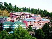
Mohi-ud-Din Islamic University Nerian Sharif was established under Act No. 1 of 2000 of Azad Jammu and Kashmir Legislative Assembly. It is a chartered university and is recognized by the Higher Education Commission (HEC) and the Government of Pakistan. On the basis of Academic Excellence achieved by the University, it has been placed in the highest category i.e. 'W' (A). The main campus of the University is located at a beautiful hill station with its majestic multi-storied buildings at Nerian Sharif (Trarkhal), AJ&K. It is spread over a large piece of land around 15 acres and is situated at about 6,000 feet (above sea level). It is situated at a distance of 125 km away towards west from Islamabad. The pollution free and lush green surroundings has its own charm and beauty.
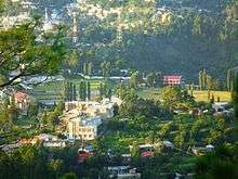
Cadet College Palandri
Cadet College Palandri is situated in beautiful natural surroundings about 100 km from Islamabad. Its climatic conditions resemble those of Abbottabad. From Islamabad/Rawalpindi, the road passes through Sihala, Kahuta and Azad Pattan. After crossing the bridge on the Jehlum River, the road climbs to the height of about 5000 feet. The College Complex is situated on the south eastern flank of Pallandri town.
Notable people
See also
References
- ↑ "AJ&K Portal". www.ajk.gov.pk.
- 1 2 "Subdivisions of AJK".
- ↑ "Census 2017: AJK population rises to over 4m". The Nation. Retrieved 2017-09-01.
- ↑ "Individual district profile link, 2015". Alif Ailaan. Retrieved 2015-05-06.
External links
- Government of Azad Jammu and Kashmir

Provincial capital: Muzaffarabad | ||
| Muzaffarabad |  | |
| Poonch | ||
| Mirpur | ||
Coordinates: 33°42′54″N 73°41′09″E / 33.71500°N 73.68583°E